FORECAST:
Tuesday (High 85, Low 70): Mostly cloudy. Numerous showers and thunderstorms are possible throughout the day and night.
Wednesday (High 86, Low 69): Gradually decreasing clouds. Isolated showers and thunderstorms are still possible, especially in the morning hours.
Thursday (High 88, Low 66): Sunny. Seasonably hot but with lower humidity.
EXTENDED OUTLOOK:
Independence Day (High 91, Low 68): Mostly sunny.
Saturday (High 90, Low 69): Partly cloudy with a 20% chance of showers/thunderstorms.
Sunday (High 90, Low 70): Partly cloudy with a 20% chance of showers/thunderstorms.
Monday (High 89, Low 71): Partly cloudy with a 30% chance of showers/thunderstorms.
READING TEA LEAVES:
Tuesday July 8 (High 88, Low 72): Partly cloudy with a 30% chance of showers/thunderstorms.
Wednesday July 9 (High 89, Low 71): Partly cloudy with a 30% chance of showers/thunderstorms.
Thursday July 10 (High 90, Low 70): Partly cloudy with a 20% chance of showers/thunderstorms.
BEACH FORECAST:
Tuesday (High 87, Low 73): Showers and thunderstorms likely.
Wednesday (High 90, Low 74): Mostly cloudy with a 50% chance of numerous showers and thunderstorms.
Thursday (High 92, Low 75): Partly cloudy with a 30% chance of widely scattered showers and thunderstorms.
Independence Day (High 94, Low 75): Mostly sunny with a 20% chance of isolated showers/thunderstorms.
Saturday/Sunday (High ~92, Low ~76): Partly cloudy with a 40% chance of scattered showers and thunderstorms.
PRONÓSTICO:
Martes (Máxima 85, Mínima 70): Mayormente nublado. Posibilidad de numerosas lluvias y tormentas durante el día y la noche.
Miércoles (Máxima 86, Mínima 69): Disminución gradual de la nubosidad. Posibilidad de lluvias y tormentas aisladas, especialmente por la mañana.
Jueves (Máxima 88, Mínima 66): Soleado. Caluroso, típico de la temporada, pero con menor humedad.
PERSPECTIVA EXTENDIDA:
Día de la Independencia (Máxima 91, Mínima 68): Mayormente soleado.
Sábado (Máxima 90, Mínima 69): Parcialmente nublado con un 20 % de probabilidad de lluvias/tormentas.
Domingo (Máxima 90, Mínima 70): Parcialmente nublado con un 20 % de probabilidad de lluvias/tormentas.
Lunes (Máxima 89, Mínima: 71): Parcialmente nublado con un 30 % de probabilidad de lluvias/tormentas.
LEYENDO LAS HOJAS DE TÉ:
Martes 8 de julio (Máxima 88 , Mínima 72): Parcialmente nublado con un 30 % de probabilidad de lluvias y tormentas.
Miércoles 9 de julio (Máxima 89, Mínima 71): Parcialmente nublado con un 30 % de probabilidad de lluvias y tormentas.
Jueves 10 de julio (Máxima 90, Mínima 70): Parcialmente nublado con un 20 % de probabilidad de lluvias y tormentas.
PRONÓSTICO DE LA PLAYA:
Martes (Máxima 87, Mínima 73): Probabilidad de lluvias y tormentas.
Miércoles (Máxima 90, Mínima 74): Mayormente nublado con un 50 % de probabilidad de numerosas lluvias y tormentas.
Jueves (Máxima 92, Mínima 75): Parcialmente nublado con un 30 % de probabilidad de lluvias y tormentas muy dispersas.
Día de la Independencia (Máxima 94, Mínima 75): Mayormente soleado con un 20 % de probabilidad de lluvias y tormentas aisladas.
Sábado/Domingo (Máxima ~92, Mínima ~96): Parcialmente nublado con un 40 % de probabilidad de lluvias y tormentas dispersas.
It's a little after 2 PM CDT, but our latest observations showing up are from about 1:35. So we'll use those. Skies are mostly cloudy in Cullman. The temperature is 82 degrees. The dewpoint is 77, making the relative humidity 84%. Winds are out of the South at 8 miles per hour. The pressure is 30.07 inches and falling slowly. Our Low temperature this morning was 70.
It is partly cloudy in Jasper. The temperature is 86 degrees. The dewpoint is 77, making the relative humidity 75%. Winds are calm. The pressure is 30.05 inches and falling slowly. The Low this morning was 70 degrees.
Haleyville's observations have not been available lately, so let's look at Huntsville. It is mostly cloudy with a temperature of 86 degrees. The dewpoint is 72 degrees, making the relative humidity 64%. Winds are West at 12 mph. The pressure is 30.04 inches and falling slowly. The Low this morning was 72.


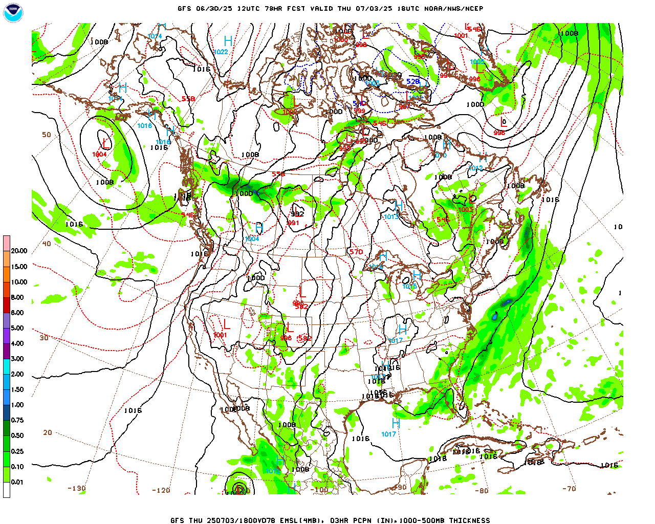
We've got some showers and thunderstorms, mainly up across the Tennessee border, and they are staying widely scattered for now. The little bit we've got on the Alabama side so far is really isolated, main storm along the Lawrence/Morgan county line.
There's a little better coverage of rain over Northern Mississippi, out in Arkansas, and down around Mobile, the Florida Panhandle, into the Gulf of Mexico.
We have surface High pressure in place over Alabama and Florida. And the winds aloft are going to allow a cold front to push into the Southeast this week, which is rare for this time of year, but can happen. They usually fizzle and die out, but it looks like this one may survive well enough to push through and bring us a couple days of drier air for the holiday actually.


The radiosonde soundings from 7 AM CDT show an airmass at Birmingham, Nashville, and Jackson about like you'd expect for this time of year, already some unstable air during the early morning hours, very little in the way of wind shear.
And that's how we get these random showers and thunderstorms amidst mainly muggy days that feature more sun than clouds overall in the summer months.


So we're about to have a cold front pushing into the region as we move into July, which is sort of an unusual event. It does look like it will stall out on Wednesday, or at least seriously slow down.
The rest of today, the coverage of rain will increase, and we'll have about a 40% chance, about 4 out of 10, of any one spot getting a shower or thunderstorm. The High should get up to about 86. The heat indices are already up into the 90's but are staying below heat advisory criteria, which I think is 105.


Tomorrow the rain from that front will push in here, but I'm still not convinced it's going to be one of those soaking, all-day sorts of rain. Will cap the rain chance off at 50%. More clouds than sun overall and more hours with rain for a lot of us than hours of the soupy summer air. High should be about 85, Low near 69-70.


Then on Wednesday it looks like we'll see a clearing trend, but will keep a low 20% chance of a shower or thunderstorm in there to account for at least the morning hours. Plus the front is going to slow down. It may not completely stall, but I think taking the rain chances out for Wednesday altogether would be a wrong move at this point. The High should be in the 86-88 range, Low about 67-69 range.

Now for Thursday, when the weakening front is pushing into far Southern Alabama, Georgia, and Florida, I will take the rain chances out for North Alabama.

We'll have high pressure moving in from the Northwest. And it just looks like a sunny, seasonably hot day with a High in the upper 80's, a Low actually down in the mid-60's thanks to a brief drop in our humidity levels.
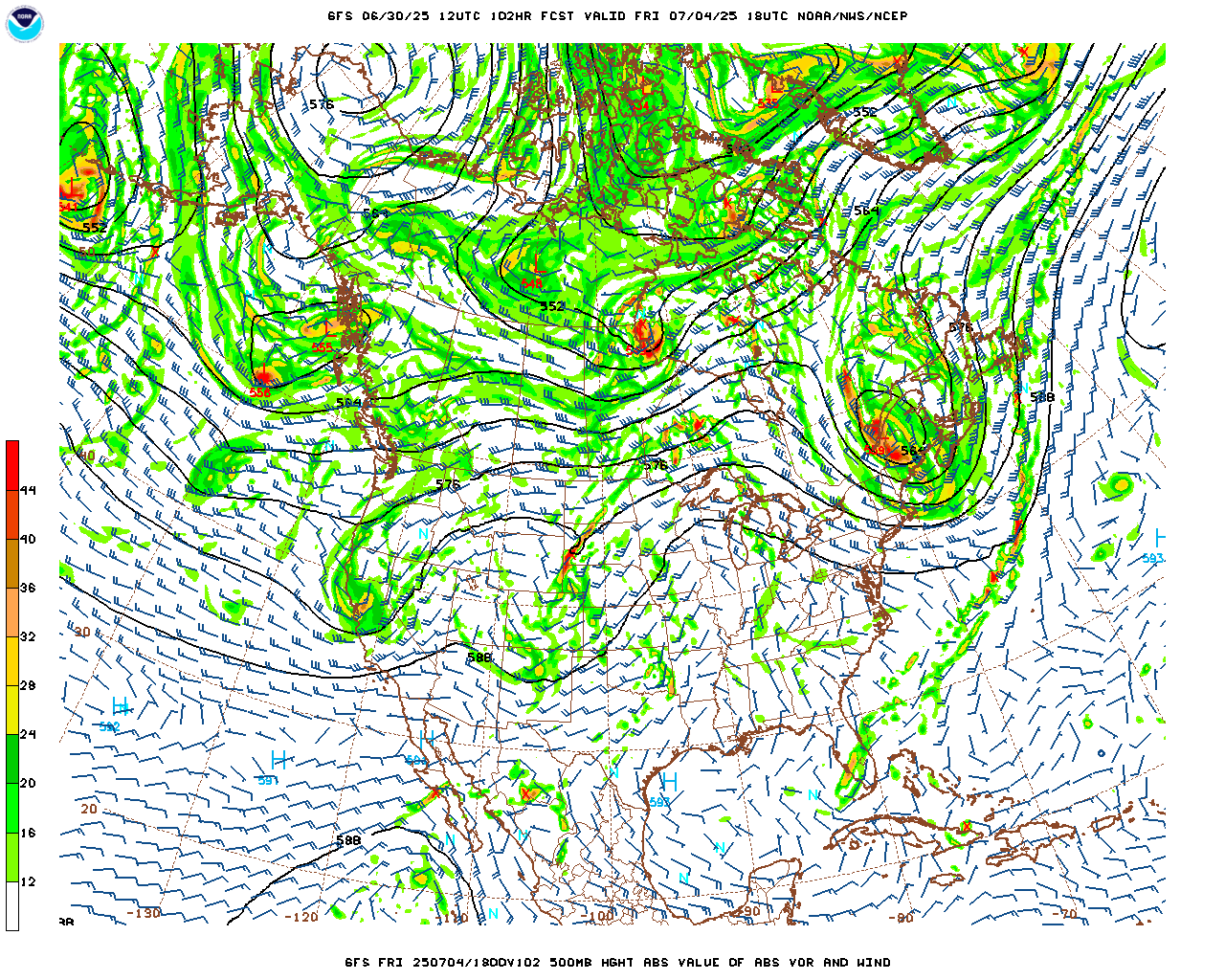

Then Friday, the 4th of July, also looks mostly sunny. Rain chances are so low, not worth worrying about. Look for a High near 90 and a Low in the upper 60's. Humidity doesn't look too bad for this time of year, but even so, it does look seasonably hot and muggy. Just a little less muggy than some 4th of July's you might remember.


Model guidance wants to keep us dry again for Saturday, but I don't think I buy into that. It's too much against our local climatology. So I'm bringing back a 20% chance of isolated rain for Saturday. Look for a High near 90 or so, Low near 70.


And Sunday looks about the same.


Looks like a little more Gulf moisture available Monday, enough to bump rain chance up to 30% but will keep temperatures near 90 for the High, 70 for the Low. Might adjust the High downward just a degree or two.


Then if you move into the land of reading tea leaves, days 8-10 (Tuesday through Thursday of next week), it looks like rain chances increase a little but still pretty scattered, an unsettled summer pattern, Highs close to 90, Lows close to 70. May not even include this in the forecast up top. But then again, I might, since it's summer and the weather is low-impact. It's okay to experiment at such times. And I hope to see the day when 10-day-forecasts are actually reliable. Even in the 1980's-90's, television stations typically did a 5-day forecast, not the 7-day forecast we take for granted now. So advances do happen. It's just jumping the gun for now, to do a 10-day-outlook and expect it to be as accurate as the first 3, 5, or 7 days. So I try to avoid those in the really dynamic weather patterns, like the Spring we just had.

The National Hurricane Center is monitoring what the remnants of that front may do once it gets into the Gulf of America, the Florida Peninsula, and perhaps the Atlantic Ocean. If anything develops, it will be this weekend or early next week. A tropical or subtropical Low could gradually develop, but the risk of that happening is estimated at only 20%. So if you've got plans for a trip to the beach for the weekend, I wouldn't lose any sleep over this. If you want to be on the safe side, keep an eye on future forecasts, but this is very speculative. It does not have the look or feel of something I would cancel holidays plans over, and frankly, it may turn out to be a big bunch of nothing. The NHC is required to call things straight down the middle, so they are noting this possibility and also noting that there is only a 20% chance of anything developing, and that even if it does, it may be "subtropical".


Tropical Storm Barry dissipated over Mexico last night and today. On the other hand, Tropical Storm Flossie is down on the other side of the waters and is expected to become a hurricane tomorrow. Tropical Storm Warnings have been issued for parts of Southwestern Mexico with a broader Tropical Storm Watch around it. The Mexican states most likely to deal with heavy rainfall (which could lead to flooding and mudslides) are Guerrero, Michoaca'n, Colima, and Jalisco.

The main rain over the next week is going to be down along the Gulf Coast, but we could still see an average of between half an inch and one inch of rain up in North Alabama/Southern Tennessee.
No comments:
Post a Comment