Thursday, August 29, 2024

Heat Advisory

 URGENT - WEATHER MESSAGE

National Weather Service Huntsville AL

135 AM CDT Thu Aug 29 2024


ALZ001>007-016-300200-

/O.NEW.KHUN.HT.Y.0012.240829T1700Z-240830T0200Z/

Lauderdale-Colbert-Franklin AL-Lawrence-Limestone-Madison-Morgan-

Cullman-

Including the cities of Tuscumbia, Muscle Shoals, Decatur,

Athens, Moulton, Florence, Russellville, Sheffield, Town Creek,

Red Bay, Cullman, and Huntsville

135 AM CDT Thu Aug 29 2024


...HEAT ADVISORY IN EFFECT FROM NOON TODAY TO 9 PM CDT THIS EVENING

AREAS IN AL ALONG AND WEST OF I-65...


* WHAT...Heat index values up to 108 expected for areas in AL along

  and west of I-65.


* WHERE...Cullman, Limestone, Madison, Morgan, Colbert, Franklin AL,

  Lauderdale, and Lawrence Counties.


* WHEN...From noon today to 9 PM CDT this evening.


* IMPACTS...Hot temperatures and high humidity may cause heat

  illnesses.


PRECAUTIONARY/PREPAREDNESS ACTIONS...


Drink plenty of fluids, stay in an air-conditioned room, stay out of

the sun, and check up on relatives and neighbors.


To reduce risk during outdoor work, the Occupational Safety and

Health Administration recommends scheduling frequent rest breaks in

shaded or air conditioned environments. Anyone overcome by heat

should be moved to a cool and shaded location. Heat stroke is an

emergency! Call 9 1 1.


&&


$$


GH

URGENT - WEATHER MESSAGE

National Weather Service Jackson MS

1001 AM CDT Thu Aug 29 2024


ARZ075-LAZ009-016-MSZ018-019-025>058-292300-

/O.CON.KJAN.HT.Y.0034.240829T1700Z-240829T2300Z/

Chicot-East Carroll-Madison LA-Bolivar-Sunflower-Leflore-Grenada-

Carroll-Montgomery-Webster-Clay-Lowndes-Choctaw-Oktibbeha-

Washington-Humphreys-Holmes-Attala-Winston-Noxubee-Issaquena-

Sharkey-Yazoo-Madison MS-Leake-Neshoba-Kemper-Warren-Hinds-Rankin-

Scott-Newton-Lauderdale-Claiborne-Copiah-Simpson-Smith-Jasper-

Clarke-

Including the cities of Anguilla, Greenwood, Bay Springs, Newton,

Magee, Rolling Fork, Isola, Quitman, Carthage, Eudora,

Philadelphia, Richland, Cleveland, Union, Yazoo City, Wesson,

Raleigh, Mathiston, Pearl, North Carrollton, Carrollton,

Mayersville, Brooksville, Ridgeland, Taylorsville, Pearl River,

Heidelberg, Crystal Springs, Durant, Lake Village, Madison,

Greenville, Grenada, Ackerman, Scooba, Vicksburg, Morton,

Decatur, Dermott, Jackson, Hazlehurst, Kosciusko, Winona, De

Kalb, Forest, Brandon, Lake Providence, Meridian, Port Gibson,

Tchula, Shubuta, Belzoni, Columbus, Eupora, Macon, Vaiden,

Canton, Stonewall, Louisville, Indianola, Weir, Mendenhall, West

Point, Lexington, Starkville, Pickens, Ruleville, Conehatta,

Tallulah, and Goodman

1001 AM CDT Thu Aug 29 2024


...HEAT ADVISORY REMAINS IN EFFECT UNTIL 6 PM CDT THIS EVENING...


* WHAT...Heat index values up to 105 to 110 expected.


* WHERE...Portions of southeast Arkansas, northeast Louisiana, and

  central Mississippi.


* WHEN...Until 6 PM CDT this evening.


* IMPACTS...Hot temperatures and high humidity may cause heat

  illnesses.


PRECAUTIONARY/PREPAREDNESS ACTIONS...


Drink plenty of fluids, stay in an air-conditioned room, stay out of

the sun, and check up on relatives and neighbors.


&&


$$


OAJ

URGENT - WEATHER MESSAGE

National Weather Service Birmingham AL

455 AM CDT Thu Aug 29 2024


ALZ011>015-017-022>027-030>032-034-300200-

/O.CON.KBMX.HT.Y.0020.240829T1500Z-240830T0200Z/

Marion-Lamar-Fayette-Winston-Walker-Blount-Pickens-Tuscaloosa-

Jefferson-Shelby-St. Clair-Talladega-Sumter-Greene-Hale-Bibb-

Including the cities of Livingston, Moundville, Sylacauga,

Carrollton, Pell City, Oneonta, Birmingham, Fayette, Double

Springs, Eutaw, Hamilton, Alabaster, Tuscaloosa, Talladega,

Jasper, Greensboro, Vernon, Sulligent, Columbiana, Pelham, Moody,

Centreville, and Hoover

455 AM CDT Thu Aug 29 2024


...HEAT ADVISORY REMAINS IN EFFECT FROM 10 AM THIS MORNING TO 9 PM

CDT THIS EVENING...


* WHAT...Heat index values up to 107 expected.


* WHERE...Bibb, Blount, Fayette, Greene, Hale, Jefferson, Lamar,

  Marion, Pickens, Shelby, St. Clair, Sumter, Talladega, Tuscaloosa,

  Walker, and Winston Counties.


* WHEN...From 10 AM this morning to 9 PM CDT this evening.


* IMPACTS...Hot temperatures and high humidity may cause heat

  illnesses.


PRECAUTIONARY/PREPAREDNESS ACTIONS...


Drink plenty of fluids, stay in an air-conditioned room, stay out of

the sun, and check up on relatives and neighbors. Young children and

pets should never be left unattended in vehicles under any

circumstances.


Take extra precautions if you work or spend time outside. When

possible, reschedule strenuous activities to early morning or

evening. Know the signs and symptoms of heat exhaustion and heat

stoke. Wear light weight and loose fitting clothing when possible

and drink plenty of water.


To reduce risk during outdoor work, the Occupational Safety and

Health Administration recommends scheduling frequent rest breaks in

shaded or air conditioned environments. Anyone overcome by heat

should be moved to a cool and shaded location. Heat stroke is an

emergency! Call 9 1 1.


&&


$$

URGENT - WEATHER MESSAGE

National Weather Service Memphis TN

252 AM CDT Thu Aug 29 2024


ARZ049-058-MSZ006-007-009>017-020>024-292100-

/O.NEW.KMEG.HT.Y.0026.240829T1600Z-240830T0100Z/

Lee AR-Phillips-Tishomingo-Tunica-Prentiss-Coahoma-Quitman-Panola-

Lafayette-Union-Pontotoc-Lee MS-Itawamba-Tallahatchie-Yalobusha-

Calhoun-Chickasaw-Monroe-

Including the cities of Marks, Batesville, Pontotoc, Charleston,

Marianna, Water Valley, Tupelo, Calhoun City, Amory, New Albany,

Houston, Okolona, Oxford, Tunica, Coffeeville, Fulton, Iuka,

Aberdeen, Booneville, Helena-West Helena, Clarksdale, and Bruce

252 AM CDT Thu Aug 29 2024


...HEAT ADVISORY IN EFFECT FROM 11 AM THIS MORNING TO 8 PM CDT THIS

EVENING...


* WHAT...Heat index values up to 106 degrees expected.


* WHERE...Portions of East Arkansas and North Mississippi.


* WHEN...From 11 AM this morning to 8 PM CDT this evening.


* IMPACTS...Hot temperatures and high humidity may cause heat

  illnesses.


PRECAUTIONARY/PREPAREDNESS ACTIONS...


Drink plenty of fluids, stay in an air-conditioned room, stay out of

the sun, and check up on relatives and neighbors.


&&


$$


CAD


Saturday, August 24, 2024

Hot Week Ahead

FORECAST:

Sunday (High 90, Low 61): Sunny. Cool in the morning, seasonably hot in the afternoon.

Monday (High 93, Low 63): Sunny. Cool in the morning, hot in the afternoon. 

Tuesday (High 96, Low 65): Mostly sunny. Hot. 

EXTENDED OUTLOOK:

Wednesday (High 99, Low 70): Mostly sunny and hot. 

Thursday (High 98, Low 72): Mostly sunny and hot. 

Friday (High 96, Low 73): Partly to mostly sunny with a 20% chance of a shower or thunderstorm. 

Saturday (High 93, Low 72): Partly cloudy with a 30% chance of showers/thunderstorms.

BEACH FORECAST:

Sunday (High 88, Low 79): Partly cloudy. Scattered showers and thunderstorms are possible. 

Monday (High 90, Low 78): Partly cloudy. Widely scattered showers and thunderstorms are possible. 

Tuesday (High 90, Low 78): Partly cloudy. Scattered showers and thunderstorms are possible. 

Rest of Week (Highs ~90, Lows ~80): Partly cloudy with a 40% chance of scattered showers and thunderstorms each day. 

PRONÓSTICO:

Domingo (Máxima de 90, Mínima de 61): Soleado. Fresco por la mañana, caluroso por la tarde, según la estación.

Lunes (Máxima de 93, Mínima de 63): Soleado. Fresco por la mañana, caluroso por la tarde.

Martes (Máxima de 96, Mínima de 65): Mayormente soleado. Caluroso.

PRONÓSTICO EXTENDIDO:

Miércoles (Máxima de 99, Mínima de 70): Mayormente soleado y caluroso.

Jueves (Máxima de 98, Mínima de 72): Mayormente soleado y caluroso.

Viernes (Máxima de 96, Mínima de 73): Parcialmente a mayormente soleado con un 20 % de probabilidad de lluvias o tormentas eléctricas.

Sábado (Máxima de 93, Mínima de 72): Parcialmente nublado con un 30 % de probabilidad de lluvias o tormentas eléctricas.

PRONÓSTICO DE LA PLAYA:

Domingo (Máxima de 88, Mínima de 79): Parcialmente nublado. Es posible que haya lluvias dispersas y tormentas eléctricas.

Lunes (Máxima de 90, Mínima de 78): Parcialmente nublado. Es posible que haya lluvias dispersas y tormentas eléctricas.

Martes (Máxima de 90, Mínima de 78): Parcialmente nublado. Es posible que haya lluvias dispersas y tormentas eléctricas.

Resto de la Semana (Máxima de ~90, Mínima de ~80): Parcialmente nublado con un 40 % de probabilidad de lluvias dispersas y tormentas eléctricas cada día.

NOTES:

Yesterday was the anniversary of Hurricane Katrina

And today was the anniversary of Hurricane Andrew

DISCUSSION:

It was a sunny day in Cullman with light winds. The High was 88 after a morning Low of 59. Jasper had a High of 93 and Low of 55. Haleyville had a High of 91 and Low of 57. 

Decatur saw a High of 90 and Low of 62. Huntsville had a High of 90 and Low of 63. 

Scottsboro appears to have had a High of 102 and a Low of 61. Naturally I question this observation and am going to see if I can double-check it. 

Wow, it appears to be technically correct. Went to a totally different site for getting NWS observations around the region, and it was the same. All I can say is that the Municipal Airport up that way must get a lot of good direct sunlight. 

Fort Payne had a High of 88 and a Low of 57. 

Then looking over on the other side of the local map, to Muscle Shoals, they had a High of 92 today, morning Low of 61. Tupelo saw a High of 93, Low of 66 there across the Mississippi border. Then looking up into the Volunteer State, or don't they call it the greenest state in the land of the free . . . where they kill bears when they're only three . . . Memphis saw a High of 93 and Low of 75 degrees. Nashville had a High of 93 and Low of 66, so drier air in place there this morning. Most of these places have had a cool morning, don't know if you noticed or anything. Memphis, the home of Elvis (or maybe Sam Phillips) was the outlier today. Winchester had a High of 88 and Low of 61. And Chattanooga had a High of 90, Low of 63. 


Our weather pattern is not looking too active for this forecast period. We're mainly going to stay hot without any rain, maybe the hottest week of the year coming up. Late in the period, we might see a few showers come back, but few and far between. 


The ridge of high pressure will assert itself over our region tomorrow making for another sunny day, High in the lower 90's, about 90-93 range. We'll start the morning down around 60 or so degrees again, not as many upper 50's as this morning. 


The heat bubble turns up the thermostat a little more for Monday, and it'll be more common to see lower 90's around region, maybe some mid-90's, morning Low edging toward the mid-60's but mostly staying in lower 60's for most of us. 


Skies stay mostly sunny on Tuesday with a High in the mid-90's, maybe upper 90's for a few places. Low should be in mid-60's. 


The heat may reach its peak on Wednesday, where we're in the upper 90's in the afternoon, a few places might break 100 degrees. Strangely I noticed Scottsboro already did that today, unless that report got jargled up somehow. So I bet their station will really be cooking by Wednesday there at the airport. Something tells me Jasper's observation out there at Bevill Field I think it is, will also be remarkable midweek. Expecting a Low near 70. 


Then Thursday looks like another scorcher with a High up close to 100 degrees, and that's not the heat index, that's the actual temperature in the afternoon, morning Low temperature of about 70 or so. 


Doesn't look like much relief even as clouds increase some on Friday, High still in the mid-to-upper-90's, Low in lower 70's. Chance of rain 20% at best. 


And I'm a little skeptical of the model data for next Saturday, showing a 20-30% rain chance and increase in clouds, High back in the lower 90's so soon and the Low near 70 or so. 


But if we get away from raw model data and look at more standard weather maps, it's obvious to everybody (who didn't sleep through science class) that we've got a cold front coming in here in the extended, Days 6-7. Given the time of year, about to get into the Fall season (technically . . . it usually takes a while for it to really feel like it), and how well the models have done so far this season . . . this is probably right. I'll give it the benefit of the doubt. 


While our tropics are quiet in the Atlantic and expected to remain that way this coming week, out in the Pacific, we do have Hurricane Gilma, a major hurricane, which is expected to weaken to a remnant Low pressure system later in the coming week, about Wednesday. Before it has a chance to hit any land. 


Then Tropical Storm Hone is expected to graze the Big Island of Hawaii tonight and tomorrow, maximum sustained winds of 51 knots, main threat being heavy rains/flash flooding issues but also some high winds possible. It is not expected to reach hurricane strength. And it's going to start moving a little more Southeast, so away from land, after tomorrow.  The swells and rip currents could still affect all the islands of Hawaii, so dangerous conditions to try to surf in. Usually there's one or two idiots who do it anyway, but I dunno, maybe folks in Hawaii have better sense, with the nice climate and distance from the lunacy of so much of the rest of the country. My last couple years of high school, there was this guy from Hawaii whose name escapes me now, but he was just the coolest guy, like when everybody else was a total jerk, I was still glad to see him in class or walking down the hall. I'll put it this way, there's a good reason, when David Copperfield used to still tour and come through Alabama, he made people disappear and sent them to Hawaii. Nobody ever asked to just go to Mobile. 


We'll see little to no rain for most of this forecast period, and then we'll see what we get, probably fairly isolated, light amounts Friday and Saturday. One silver lining for this week's heat is that the humidity doesn't look all that bad. If we get hot enough for a Heat Advisory, local NWS offices are saying it'll be from the air temperature alone, if it gets up to about 105 degrees. Some days, at least early in the week, the Heat Index may even be a degree or two below the air temperature through much of the day, because humidity levels will be relatively low. Any way you slice it though, it looks like a hot week with little hope of seeing any rain until next weekend. 

Friday, August 23, 2024

Hot and Dry Weather Returns

Saturday (High 90, Low 60): Mostly sunny. Cool in the morning, seasonably hot in the afternoon. 

Sunday (High 93, Low 63): Sunny. Cool in the morning, seasonably hot in the afternoon. 

Monday (High 95, Low 65): Sunny. Cool in the morning, hot in the afternoon. 

Tuesday (High 98, Low 67): Mostly sunny. 

Wednesday (High 99, Low 70): Mostly sunny. 

Thursday (High 97, Low 71): Partly cloudy with a 20% chance of showers/thunderstorms. 

Friday (High 96, Low 73): Partly cloudy with a 20% chance of showers/thunderstorms. 

Trivia note: This is actually the anniversary of Hurricane Katrina

While our tropics are quiet again for now, they usually ramp up in September. 

At 1 PM skies are fair (a.k.a "sunny) in Cullman. The temperature is 84 degrees. The dewpoint-temperature is 59, making the relative humidity 43%. Winds are light and variable at 6 miles per hour. The pressure is 30.25 inches and falling slowly. This morning's Low temperature was 68 degrees at about 6:30 or so this morning. 


And we're just not in a very exciting weather pattern. I thought I spied a lot of cirrocumulus clouds on the satellite imagery above, but the simple exercise of looking outside at the actual sky yielded a different result: Those are clearly cumulus clouds I can see without a satellite. With just my peepers. 


We have a stationary front down along the Gulf Coast, the focus for those showers and thunderstorms you saw above in Florida. 

Out West is a ridge of strong high pressure, sometimes called a heat bubble this time of the year, and that will affect us as we get into next week. Hey - don't shoot the messenger. I'm only in sales, not production. And really it's not even sales. More like just passing along the news of what it's gonna' do. 

Looks like today and tomorrow the High will get up to about 90 degrees with mostly sunny skies. Tonight into tomorrow morning, the air is still dry enough, our Low should be near 60. So if you walk a dog in the morning or anything like that, should be quite comfortable, maybe even a little nippy since we're not used to those kinds of mornings until this wave of them here lately. I can think of a lot of nights and mornings where a good walk felt really muggy this summer. 


Even going into Sunday, that high pressure is going to set up strongly over the Southeast, the Tennessee and Ohio River Valleys. High should rebound to the lower 90's and Low into the lower 60's. Not expecting much if any rain in the region, not even much in the way of clouds. 

Monday again looks mostly sunny and hot, the High perhaps edging into the mid-90's by then, Low in the mid-60's. 

Then Tuesday looks like a pretty good scorcher. The High should make it into the upper 90's, close to 100 degrees, the Low in the upper 60's. 

Then Wednesday again, close to 100 for the High, Low near 70. 

Thursday, might see a few more clouds, probably still no rain, High in upper 90's, Low around 70. 

By Friday the ridge should release its hold just enough to allow southerly flow from the Gulf of Mexico, enough to include a chance for isolated shower or thunderstorm again. Guess we could see something isolated Thursday too, but I'm not optimistic on rain chances for this forecast period. 


Our rainfall overall should be light and sporadic over the next seven days, pretty typical for this time of year. I sort of hope this coming week is our last heat wave, but I don't wanna' jinx it. Guess I just did. But the weather doesn't care, it just does its thing anyway. 

Saturday, August 17, 2024

Drier Air and Milder Temperatures on the Horizon for the New Week

FORECAST:

Sunday (High 92, Low 71): Mostly sunny and breezy. An isolated shower is still possible, mainly in the morning. 

Monday (High 86, Low 66): Mostly sunny. Milder with drier air.

Tuesday (High 85, Low 60): Sunny. Mild. 

EXTENDED OUTLOOK:

Wednesday (High 85, Low 57): Sunny. 

Thursday (High 86, Low 61): Sunny. 

Friday (High 88, Low 63): Sunny. 

Saturday (High 89, Low 65): Mostly sunny. 

BEACH FORECAST:

Sunday (High 92, Low 82): Mostly sunny with a 20% chance of an isolated shower or thunderstorm. Dangerous combination of heat and humidity likely. 

Monday (High 92, Low 80): Partly cloudy with a 40% chance of scattered showers and thunderstorms. 

Tuesday (High 91, Low 78): Sunny. 

Wednesday (High 90, Low 75): Sunny.

Rest of Week (Highs in upper 80's, Lows in upper 70's): Partly cloudy with a 40% chance of scattered showers and thunderstorms each day. 

PRONÓSTICO:

Domingo (Máxima 92, Mínima 71): Mayormente soleado y ventoso. Todavía es posible que se produzcan chubascos aislados, principalmente por la mañana.

Lunes (Máxima 86, Mínima 66): Mayormente soleado. Más suave con aire más seco.

Martes (Máxima 85, Mínima 60): Soleado. Leve.

PERSPECTIVA EXTENDIDA:

Miércoles (Maxima 85, Mínima 57): Soleado.

Jueves (Máxima 86, Mínima 61): Soleado.

Viernes (Máxima 88, Mínima 63): Soleado.

Sábado (Máxima 89, Mínima 65): Mayormente soleado.

PREVISIÓN DE LA PLAYA:

Domingo (Máxima 92, Mínima 82): Mayormente soleado con un 20 % de probabilidad de lluvia o tormenta eléctrica aislada. Es probable una combinación peligrosa de calor y humedad.

Lunes (Máxima 92, Mínima 80): Parcialmente nublado con un 40 % de probabilidad de lluvias y tormentas eléctricas dispersas.

Martes (Máxima 91, Mínima 78): Soleado.

Miércoles (Máxima 90, Mínima 75): Soleado.

Resto de la Semana (Máximas en los 80 grados superiores, Mínimas en los 70 grados superiores): Parcialmente nublado con un 40 % de probabilidad de lluvias y tormentas eléctricas dispersas cada día.

NOTES:

We had some thunderstorm wind damage to trees and power lines yesterday and today in North Alabama/Southern Middle Tennessee, mainly in Dekalb County, Alabama yesterday.

It's fortunate we didn't have any in Cullman County, because our NOAA Weather Radio transmitter is out of service at the moment. They are working hard to get it back online. In the meantime, people can try other nearby channels like the Arab one or revert back to regular radio or other sources. Severe thunderstorm warnings usually don't come over a cell phone. Weathercall is a good backup for weather radio. For those who can fit it into the budget. 

Today was the anniversary of Hurricane Camille, which hit in 1969, 55 years ago. That is still the worst hurricane we've had historically besides the 1935 Labor Day Hurricane (which was before they started giving them cutesy names. I don't mind names for hurricanes, has become a time-honored tradition, but this business of naming winter storms . . . please, people . . . just stop already. There's still time before next winter. Look at how goofy the weather folks are in the new Twister movie, and let it motivate you to do better.). By the way, for a great book on the science of hurricanes, a shameless plug for Divine Wind by Kerry Emanuel. Okay, so he paid me a big wad of money just to mention his book, I admit. A guy can use an extra quarter for laundry every now and then. And with extra quarter in pocket, I remind you all what a great read this is. And it is only a great read for those with shallow minds. For people who like to explore the depths, it is a reread, and a treasure to return to, again and again. 

And congratulations to Meaghan Thomas for being one of the new meteorologists at WBRC-6 in Birmingham atop Red Mountain. Glad to have her back on the air, but especially right in our backyard in Alabama. She worked in Nashville for quite a while there. 

DISCUSSION:


We had a mix of sun and clouds in the Tennessee Valley today with a few scattered showers and thunderstorms, some of which got strong, or a few even made it to severe limits, doing some wind damage to trees or power lines here and there. Today most of it was up across the Tennessee or Georgia border or back down into Central Alabama, where yesterday, almost all of it was in Dekalb County in Northeast Alabama. 

The High in Cullman actually made it up to 95 degrees before the thunderstorms arrived here. The Low this morning was 73. Jasper was one of the hot spots, High of 99 today with a morning Low of 72. Haleyville had a High of 93 and Low of 73. Then peeking up to the North, it appears that Huntsville also had a High of 97 (although their temperatures sure did spike quickly in an hour or two there) and a morning Low of 74. And it was just a hot day in the region, Nashville making it up to 98 degrees (wasn't that the name of a band . . . ?) with the morning Low at 75 in the music city. 


That cold front will continue to push through the region tonight into tomorrow. The rain has settled down for North Alabama at the moment. 

This forecast looks too simple and straightforward to waste a lot of overly detailed raw model output graphics on. 

Any more showers or thunderstorms tonight or into tomorrow should stay very widely spaced, just isolated activity in the region. And if we see any of it lasting into tomorrow, probably in the morning hours. It will be breezy tomorrow and more sun than clouds, winds turning back to the Northwest as the front moves to our South. High of about 92 after a Low near 70. 

Then light winds from the North on Monday, mostly sunny skies as high pressure moves into the region behind the front, and we get some milder and drier air in here. High in the mid-80's, Low in the mid-60's. 

Then the seriously drier air starts to filter in by Tuesday with a High in the mid-80's again, Low near 60, sunny skies. 

It continues to look more likely that many of us will actually start Wednesday in the upper 50's, been a while since we felt a morning like that. And then warm to the mid-80's in the afternoon for the High temperature. Sunny skies. 

Sunny skies continue for Thursday with a High in the upper 80's and Low in the lower 60's. 

Basically the same for Friday. 

And even by Saturday, I don't think most of us even break 90 degrees again. 

So I would enjoy this coming week and get some stuff done outside if you've been needing to. It looks great. 


Hurricane Ernesto continues to move through Bermuda. It will cause swells that affect the U.S. East Coast even though the core of the storm is far East of there with no direct impacts, just the usual dangerous surf conditions that a distant hurricane produces. And by Monday night, at least the Southeast parts of Newfoundland may be dealing with some wind, waves, and rainfall from this system. It may be down to tropical storm strength by then, but as we saw again recently with Puerto Rico, that can be significant for the areas most directly affected. 


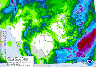
And we aren't going to see much in the way of rainfall around here for this forecast period. 

Hurricane Ernesto Update


980 

WTNT35 KNHC 172336

TCPAT5


BULLETIN

Hurricane Ernesto Intermediate Advisory Number 25A

NWS National Hurricane Center Miami FL       AL052024

800 PM AST Sat Aug 17 2024


...ERNESTO MOVING SLOWLY AWAY FROM BERMUDA BUT TROPICAL STORM 

CONDITIONS CONTINUE ON THE ISLAND...

...DANGEROUS BEACH CONDITIONS EXPECTED ALONG THE U.S. EAST COAST

THROUGH EARLY NEXT WEEK...


SUMMARY OF 800 PM AST...0000 UTC...INFORMATION

----------------------------------------------

LOCATION...33.5N 63.7W

ABOUT 100 MI...160 KM NE OF BERMUDA

ABOUT 1065 MI...1715 KM SW OF CAPE RACE NEWFOUNDLAND

MAXIMUM SUSTAINED WINDS...75 MPH...120 KM/H

PRESENT MOVEMENT...NNE OR 30 DEGREES AT 6 MPH...9 KM/H

MINIMUM CENTRAL PRESSURE...976 MB...28.82 INCHES


WATCHES AND WARNINGS

--------------------

CHANGES WITH THIS ADVISORY:


None.


SUMMARY OF WATCHES AND WARNINGS IN EFFECT:


A Tropical Storm Warning is in effect for...

* Bermuda


A Tropical Storm Warning means that tropical storm conditions are

expected somewhere within the warning area.


Interests in southeastern Newfoundland should monitor the progress

of Ernesto.  A watch may be required for a portion of this area

Sunday morning.


For storm information specific to your area, please monitor

products issued by your national meteorological service.


DISCUSSION AND OUTLOOK

----------------------

At 800 PM AST (0000 UTC), the center of Hurricane Ernesto was

located near latitude 33.5 North, longitude 63.7 West.  Ernesto is

moving toward the north-northeast near 6 mph (9 km/h), and this slow

motion is expected to continue through tonight.  An acceleration

toward the north-northeast is forecast to begin on Sunday, with a

turn toward the northeast and east-northeast occurring on Monday and

Tuesday.  On the forecast track, the center of Ernesto will slowly

move away from Bermuda through tonight and pass near southeastern

Newfoundland late Monday and Monday night.


Maximum sustained winds are near 75 mph (120 km/h) with higher

gusts.  No significant change in strength is forecast during the

next 48 hours, and Ernesto should remain near or at hurricane

strength through Monday.  The cyclone will likely become

post-tropical near southeastern Newfoundland by Monday night or

Tuesday morning.


Hurricane-force winds extend outward up to 60 miles (95 km) from

the center and tropical-storm-force winds extend outward up to 230

miles (370 km).


The estimated minimum central pressure is 976 mb (28.82 inches).


HAZARDS AFFECTING LAND

----------------------

Key messages for Ernesto can be found in the Tropical Cyclone

Discussion under AWIPS header MIATCDAT5 and WMO header WTNT45 KNHC

and on the web at hurricanes.gov/text/MIATCDAT5.shtml.


WIND:  Tropical storm conditions are likely to continue on Bermuda

for the next several hours.


STORM SURGE:  Coastal flooding is still possible on Bermuda in areas

of onshore winds.  Near the coast, the surge will be accompanied by

large and destructive waves.


RAINFALL:  Ernesto is expected to produce an additional 1 to 2

inches (25 to 50 mm) of rainfall through tonight across Bermuda,

with storm total amounts of 7 to 9 inches (175 to 225 mm). This

rainfall will likely result in considerable life-threatening flash

flooding to the island, especially in low-lying areas.


SURF:  Swells generated by Ernesto are affecting portions of the

Bahamas, Bermuda, the east coast of the United States, and Atlantic

Canada today.  Life-threatening surf and rip current conditions are

likely in these areas during the next couple of days.  Please

consult products from your local weather office, and stay out of the

water if advised by lifeguards.


NEXT ADVISORY

-------------

Next complete advisory at 1100 PM AST.


$$

Forecaster Beven


000

WTNT45 KNHC 172032

TCDAT5


Hurricane Ernesto Discussion Number  25

NWS National Hurricane Center Miami FL       AL052024

500 PM AST Sat Aug 17 2024


Recent infrared and microwave imagery indicate show that Ernesto's 

convective activity is a little thin, with the deepest convection 

located in a small band just north of the center.  Subjective and 

objective satellite intensity estimates have decreased through the 

day, and combined with the earlier data from the Hurricane Hunter 

aircraft--which only measured 700-mb wind of 74 kt--it is estimated 

that Ernesto's maximum sustained winds are near 65 kt.


Ernesto has slowed down during the day while moving away from 

Bermuda, and the initial motion is north-northeastward (030 

degrees) at 5 kt.  This slow motion is likely to continue for the 

next 12 hours or so, before the flow increases ahead of an 

approaching trough and causes Ernesto to accelerate toward the 

north-northeast on Sunday.  The cyclone is forecast to turn 

northeastward on Monday, and model guidance continues to show the 

center passing just to the southeast of Newfoundland late Monday or 

Monday night.  After passing Newfoundland, Ernesto is expected to 

accelerate further toward the east-northeast over the north 

Atlantic.  The track guidance is very tightly packed through 72 

hours, and no significant changes were required from the previous 

NHC forecast.


Despite Ernesto's recent weakening, the hurricane will move over 

warm waters of 28 degrees Celsius and within a light-shear 

environment for the next 24 hours or so.  The storm's current broad 

structure may not allow for significant strengthening within this 

otherwise favorable environment, but many of the dynamical 

hurricane models, global models, and consensus aids suggest that 

Ernesto could re-intensity by 5-10 kt over the next day or so.  

This is reflected in the official intensity forecast.  Weakening 

should begin by 48 hours due increasing shear and Ernesto moving 

over colder waters north of the Gulf Stream, and the cyclone is 

likely to become post-tropical by 60 hours while it is passing near 

southeastern Newfoundland.  The GFS and ECMWF models indicate that 

dissipation should occur by day 4 when the circulation opens up 

into a trough over the north Atlantic.


Key Messages:


1. Ernesto is moving slowly, and its impacts on Bermuda are

not over.  Strong winds, heavy rainfall, coastal flooding, and

battering waves should continue through tonight.  The heavy rains 

will likely result in considerable life-threatening flash flooding,

especially in low-lying areas on the island.


2. Even though Ernesto is forecast to remain well offshore the U.S.

East Coast, swells generated by the hurricane are expected to affect

the area through early next week.  Beach goers should be aware that

there is a significant risk of life-threatening surf and rip

currents, and should stay out of the water if advised by lifeguards.

Surf and rip currents are also possible on the Bahamas, Bermuda, and

Atlantic Canada during the next few days.


3. Ernesto could bring wind, wave, and rain impacts to portions of

southeastern Newfoundland late Monday and Monday night.


FORECAST POSITIONS AND MAX WINDS


INIT  17/2100Z 33.3N  64.0W   65 KT  75 MPH

 12H  18/0600Z 34.3N  63.6W   65 KT  75 MPH

 24H  18/1800Z 36.5N  62.6W   70 KT  80 MPH

 36H  19/0600Z 39.5N  60.9W   70 KT  80 MPH

 48H  19/1800Z 43.0N  57.2W   65 KT  75 MPH

 60H  20/0600Z 46.4N  50.9W   55 KT  65 MPH...POST-TROP/EXTRATROP

 72H  20/1800Z 48.9N  42.1W   45 KT  50 MPH...POST-TROP/EXTRATROP

 96H  21/1800Z...DISSIPATED


$$

Forecaster Berg


Warm, Dry Pattern

  NORTH ALABAMA: (Forecast) Friday (High 87, Low 62):  Sunny. Warm with low humidity levels. Saturday (High 88, Low 60):  Sunny. Warm with l...