


So looking at trends regarding today's severe thunderstorm threat, looks like an update is called for. The basic Level 2 risk of severe thunderstorms now covers about the Western 2/3 of North Alabama and about the Western third of Southern Middle Tennessee. Even as you move farther East, most of our area is outlooked for a marginal Level 1 risk. Down in South Alabama, they actually have an enhanced Level 3 risk.


So most of us have the basic 15% threat for damaging winds and large hail with some storms today. And they are expected to be more organized than the typical "pulse" summer storms that happen at random and quickly rain themselves out. Localized flooding issues could also occur today through tomorrow from storms producing heavy rainfall.
Never cross water that covers a roadway, or especially a bridge - turn around, don't drown.
If you get a Severe Thunderstorm Warning today or tonight, the best place to be is in a sturdy house properly anchored to the ground, in a central room or hallway on the lowest floor, away from any windows or anything that is likely to attract lightning. You don't have to shelter as much as you would during tornado season, but please use good sense. Especially if you've got trees around your house.


6:36 AM - A watch is not being issued across the Alabama line, because the air is not as unstable this early in the morning as it is back in Mississippi. Some isolated damaging wind gusts could still happen within this line. Our main threat for severe weather still looks to come later tonight. And even then, it's not like a severe weather event in the spring time. It's basically a more organized version of summer storms where maybe some places see some larger hail. We've had a good bit of this in the region lately.

8:01 AM - Doesn't look like this early morning round will get severe in North Alabama. We'll get a break during the day and then this evening or tonight may deal with a separate cluster of storms, a Mesoscale Convective System moving in from Northwest. It may have some damaging wind gusts and hail as well as heavy rainfall, good bit of lightning.

8:36 - Storms may produce wind gusts over 40 mph as they move through Walker and Winston Counties, but it has to be up to 58 mph (50 knots) to be severe.


6:49 PM - Looks like a Tornado Watch will be coming out for Mississippi soon. Wind shear is strong enough at low levels that it looks like particularly in any supercell thunderstorms that form, there will be a tornado potential along with the potential for large hail and damaging winds.


The really large hail (golfball-sized instead of closer to quarter-sized) will probably stay back over Mississippi in or near that hatched area. But an isolated tornado is possible for basically any of us tonight, even if the risk of it is low. In far West Alabama, the probability is the basic 5% risk closer to what you might see in the Spring. Not a big outbreak, but enough of a tornado threat to respect.
If you get a Tornado Warning:
* Stay away from windows.
* Be in a sturdy house, not a mobile home.
* Get to the lowest floor.
* Try for a smaller room like a bathroom, closet, or hallway.
* Make that room near the center of the building, putting as many walls between you and the outside as you can.
* If you have time, cover your body in case of debris, especially your head.
So we'll see how it plays out. Most places will probably be dealing with large hail or damaging straight-line winds, but any time we see a tornado threat trying to organize out of season, need to let people know.

6:59 PM - And the watch has been issued for Mississippi. We'll have to see how these storms evolve as they get closer to Alabama and further into Tennessee, but for this area, there is concern for supercell thunderstorms.

7:01 PM - And a few storms are already getting organized back there. Around sundown after a muggy day is a great time for storms to fire up.
7:33 - National Weather Service in Huntsville reminds everyone to have your cell phone set to a mode that you'll get the Wireless Emergency Alert if you need it, also to make sure your weather radio is working (preferably with battery backup). Because our severe weather, if we get it tonight, will probably come around midnight, give or take an hour or two, but roughly around midnight for the I-65 corridor of North Central Alabama and adjacent parts of Tennessee. Might want to remind a few family and friends too, because it is sort of unusual for this time of year. And in case we do have any problems, you have to remember, it is a holiday weekend, and if somebody is up that late, they are probably partying, not thinking about bad weather. So "be the hero" as the Birmingham NWS office likes to say. Let folks know. And they can still party or go to bed as they wish, but just have a shelter area nearby. And if going to sleep, need to have a way to get alerts that will wake them up - which is NOT an outdoor siren.
This may not be quite like the storm systems of Spring, but we should still respect it and take reasonable precautions.


7:41 - And we have our first storm trying to produce a tornado near the town of Sharon in Mississippi. This is a supercell thunderstorm that is also capable of producing ping-pong-ball sized hail, 1.5 inches in diameter.

8:07 PM - Storms really starting to get organized back in Mississippi. Some are producing signs of damaging winds, the hail looks really large like up to 2 inches in diameter, and even some signs of tornadic rotation, a couple tornadoes trying to develop there in Southern Mississippi. So we will probably see a watch including at least part of our area in North Alabama/Southern Middle Tennessee later tonight, between now and Midnight, and I would guess it will be a Tornado Watch.
8:17 - The Storm Prediction Center has issued a new severe weather outlook for the rest of tonight.


While most of us just have the basic risk for damaging winds and large hail, the hail threat is more pronounced back in Mississippi into far West Alabama, where you see the hatching. That is where golfball-sized hail events may be fairly common in some supercell thunderstorms.


8:45 - And SPC is now coordinating a Watch to include Western Alabama. I am almost sure this will be a Tornado Watch rather than a Severe Thunderstorm Watch based on mesoscale trends. Kind of weird for this time of year, but here we are.

8:52 - One thing SPC mentioned in that discussion is that the overturned atmosphere from earlier convection here today has contributed to a lot of mid-level convective inhibition compared to what they have in Mississippi. So it remains to be seen how much the severe weather threat will continue as storms move this way and the night goes on. A few showers and storms are trying to get going in our area but staying well under severe limits for now. The atmosphere is not right for storms to go severe or form rotating updrafts here yet. We'll see if that changes in next hour or two.
9:03 PM - On a lighter note, I'm glad the James Taylor concert at Oak Mountain Amphitheater was able to go ahead before things turned stormy. Saw some pictures from there, that old guy has some great songs. And the sky was lovely this evening.
We are all just going to be watching radar trends and changing conditions. The dewpoints are coming down some with the cooler night air over the past hour or two, but even in the cooler spots around here, still well up in the 60's. Looks like we will have some potential by midnight of large hail, damaging winds, or an isolated tornado - main threat probably along and West of Interstate 65. That's my best estimate for now.
.png)
9:05 - Hey, we really do have to watch this carefully though, because we already have a storm in Tennessee trying to produce a tornado, affecting Fayette and Hardeman counties up that way near Somerville and Grand Junction.
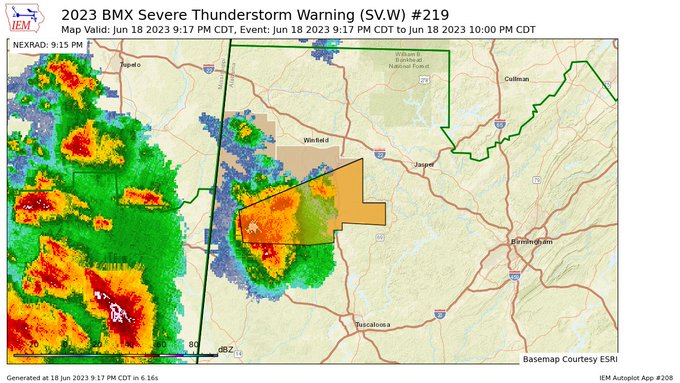
9:20 - All right, just got a Severe Thunderstorm Warning for Lamar and Fayette Counties.
This is for 60 mph wind gusts and hail up to quarter size. Affecting areas like Millport, Fayette, also the Bevill Campus in Fayette.


No comments:
Post a Comment