(Forecast)
Sunday (High 85, Low 68): Partly to mostly cloudy. Numerous rounds of showers and thunderstorms are possible, and a few storms could be strong, with potential for damaging winds.
Monday (High 86, Low 66): Isolated lingering rain possible in the morning. Then becoming mostly sunny.
Tuesday (High 89, Low 64): Sunny. Seasonably hot but with low humidity levels.
(Extended Outlook)
Wednesday (High 90, Low 65): Partly to mostly sunny with a 20% chance of a shower or thunderstorm.
Thursday (High 91, Low 69): Partly cloudy with a 30% chance of showers/thunderstorms.
Friday (High 92, Low 71): Partly cloudy with a 30% chance of showers/thunderstorms.
Saturday (High 91, Low 71): Partly cloudy with a 30% chance of showers/thunderstorms.
(Beach Forecast)
Sunday (High 89, Low 79): Showers and thunderstorms likely. Windy at times.
Monday (High 87, Low 78): Showers and thunderstorms likely. Windy at times.
Tuesday (High 88, Low 77): Partly to mostly cloudy. Scattered to numerous showers and thunderstorms are possible at times.
Wednesday/Thursday (High 88-89, Low 78-80): Partly cloudy with a 40% chance of showers/thunderstorms.
Friday/Saturday (High ~90, Low ~80): Partly cloudy with a 30% chance of showers/thunderstorms.
(Discussion)
At 3:15 PM skies have cleared up in Cullman, had some rain and thunder a while ago. The temperature is 81 degrees. The dewpoint is 75, making the relative humidity 84%. Winds are Southwest at 3 mph. The pressure is 1011.88 millibars, or 29.93 inches, and steady. I think we have already reached our High today, which was 84. The Low this morning was 68. It is 79 with scattered clouds in Jasper, 75 degrees with also a few clouds around in Haleyville.
Fort Payne has sunshine and 85. Huntsville is mostly sunny and 84. Sunny and 84 in Decatur. Mostly sunny and 79 in Muscle Shoals.
Elsewhere around the region, Birmingham has sunny skies and 82 degrees. Atlanta has a few clouds and 91. Nashville has sunshine and 90. Overcast with some rain in Memphis, visibility down to 7 miles, 75 degrees there. Visibility is down to 1.5 miles in Tupelo, where heavy rain is falling, and they are all the way down to 73 degrees with that activity.
We definitely have some rain and thunderstorms moving in from the West/Northwest. Notice a heavier shower has prompted a Flash Flood Warning over there that includes Columbus, Mississippi. Home of one of our most useful radar sites in this region.
There was another flash flood warning that I believe included Corinth, but it looks like that one may have already expired. These storms of summer can randomly pulse up and become locally strong. Some in Tennessee have prompted severe thunderstorm warnings for the potential of winds strong enough to do damage to trees and power lines. And you can see some stuff like that going on over in the Carolinas as well. These are just the storms of summer though, nothing like our severe weather season.
I just saw that one of those severe thunderstorms is moving South through Nashville. They've dealt with many worse storms over time though.
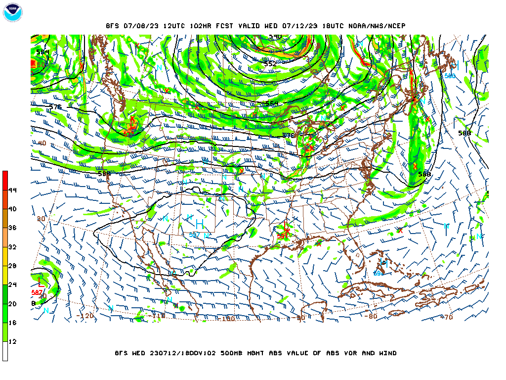
We have a series of shortwave troughs moving through the area. And we've got that front draped from the Great Lakes through the Ohio Valley back through the Plains and even the Rockies. High pressure dominates our weather, but then we get some rain and storms to balance it out, carried along by those westerly winds aloft.
Tomorrow we'll be watching a shortwave that could produce a Mesoscale Convective System in Oklahoma and Arkansas and then affect us later tomorrow afternoon.
The NAM is not as aggressive with the moisture available in our region tomorrow as the GFS is.
The Storm Prediction Center has outlooked a marginal 5% risk of winds strong enough to do minor damage (usually to trees and power lines, these types of storms this time of year) tomorrow for the Tennessee Valley. Notice the more basic 15% risk is outlooked for Central and South Alabama, back into Mississippi and parts of Southern Arkansas and Northern Louisiana. Looks like the Carolinas and Eastern Virginia could also see some damaging wind risk tomorrow. It's good to have a healthy respect for these risks even with summer storms, but please don't get bent out of shape over this if you hear "severe storms". This is not anything new for summertime around these parts. We did have a really rocky start to the summer this year though.
So tomorrow looks like about a 50/50 shot of any one spot getting some rain and thunderstorms, probably more periods of clouds than sun overall for a lot of us, High in the mid-80's, so about 85, and a Low in the upper 60's, going with 68 taking everything into account.
And I'm surprised to see that we now have the GFS and the NAM agreeing on a passage of a weak cold front (the one you saw above draped through Southeastern Missouri) through the area on Monday. Should see a High in mid-80's again, Low more toward mid-60's because the rain and moisture will be on the decrease after we've already had rain-cooled air. Chance of rain about 20-30%, and I think that will all be in the morning. Most of the day should feature a lot more sunshine than clouds.
And Tuesday actually does look dry. Glanced at the ECMWF, and it is showing the same as the GFS and the NAM, as unusual as it is to get such days like this in early to mid July. The Low may actually dip into the lower 60's in the morning, and then the abundant sunshine will warm us right back up into the upper 80's in the afternoon.


Then on Wednesday, it looks like an upper-level ridge establishes over the Ohio Valley, with a strong High pressure system out in the Desert Southwest stretching into Texas. So that'll crank up the heat again. Closer to home we'll have mostly the influence of High pressure but also a weak Low pressure system down close to the Gulf Coast that will bring us back a chance for at least isolated rain. Should see a High near 90, Low in mid-60's.
Looks like the rain will stay pretty widely scattered on Thursday, High again of about 90 or so, Low rebounding to about 70 as the air becomes more humid again, more what we'd expect this time of the year.
Doesn't look like the rain chances increase much by Friday, but does look like the heat/humidity will continue to get established again, might warm by a degree or two from Thursday's weather.
Might bump the rain chance up a notch for Saturday, but after glancing at the European model and thinking how random the rain chances tend to be from day to day this time of year, probably will just hold it at 30%. Keeping the temperatures similar, lower 90's for the High, Low of 70 or so.
Looking into the land of tea leaves, the GFS and ECMWF do ramp up the rain chances a little by Sunday of the following week. And also on Monday. Then looks like things calm down a little for that Tuesday. And even that trend is worth being skeptical of. We may not see an increase in rain chances at all, that far out. These models can be pathetic enough handling summer convection 3-7 days in advance for the Southeast.
There is a large area of Low pressure located a few hundred miles Southwest of Manzanillo, Mexico, that is becoming better organized with the thunderstorms it is producing. It will probably become some sort of tropical cyclone, perhaps as early as tonight. It is moving West/Northwest, away from the Mexican mainland.
There is also a trough of Low pressure a few hundred miles due South of Mexico that is producing rain and thunderstorms, but the activity is staying disorganized. It is also expected to move West/Northwest and move parallel to the Mexican coast without affecting the mainland. Of course it is a little early to say, but these are the trends the National Hurricane Center is making note of for now. It will probably form a tropical cyclone by about the middle of this coming week.
Rainfall totals are random and variable this time of year, but on average, most of us will probably see about an additional inch over the next week.
I lost a cat and felt a personal betrayal this week, so needed to do something requiring cold hard logic. Which predicting the weather does. Still using one site that could loosely be described as social media, but for the most part, I'm just going to keep this alive to practice what chops I developed in college days, regardless of how few readers happen by here. Elon Musk and Mark Zuckerberg should consider a romance, and I'll just say no to their buffoonery. If I ever do get back into meteorology, I think I'd rather teach it and do some storm chases than forecast it. Although I'd have second thoughts about the storm chasing, since a lot of times now, the reckless chasers appear to be more a hazard on the roads than the tornadoes. I've seen tornadoes before without having to chase them. They really are awe-inspiring. But so are the sunset and sunrise, if you can slow down and appreciate 'em.
Usually I just repost whatever the National Weather Service says for Gulf Shores for the Beach Forecast, but this time I tweaked it a little, thinking the rain chances were overdone as the week progressed.


No comments:
Post a Comment