Today (High 84): Partly to mostly cloudy, breezy and muggy with widely scattered thunderstorms possible during the day - some could become severe. Thunderstorms are likely in the evening and night hours and may be severe.
Thursday (High 80, Low 69): Rain and thunderstorms likely. A few storms could still be on the strong side, and it will be breezy at times.
Friday (High 74, Low 59): Mostly sunny. Cooler.
Saturday (High 76, Low 50): Sunny.
Sunday (High 80, Low 51): Sunny.
Monday (High 77, Low 56): Partly cloudy with a 30% chance of showers.
Tuesday (High 76, Low 60): Mostly cloudy with a 40% chance of rain.
Wednesday (High 78, Low 61): Partly cloudy with a 30% chance of rain.
Hoy (Máxima 84): Parcialmente a mayormente nublado, ventoso y bochornoso, con tormentas eléctricas muy dispersas posibles durante el día; algunas podrían volverse severas. Es probable que se produzcan tormentas eléctricas en las horas de la tarde y la noche y pueden ser severas.
Jueves (Máxima 80, Mínima 69): Lluvia y tormentas eléctricas probables. Algunas tormentas aún podrían ser fuertes y, a veces, habrá brisa.
Viernes (Máxima 74, Mínima 59): Mayormente soleado. Enfriador.
Sábado (Máxima 76, Mínima 50): Soleado.
Domingo (Máxima 80, Mínima 51): Soleado.
Lunes (Máxima 77, Mínima 56): Parcialmente nublado con un 30 % de probabilidad de lluvias.
Martes (Máxima 76, Mínima 60): Mayormente nublado con un 40 % de probabilidad de lluvia.
Miércoles (Máxima 78, Mínima 61): Parcialmente nublado con un 30% de probabilidad de lluvia.
At 5:41 AM, latest observations show overcast skies in Cullman with a balmy temperature of 72 degrees. The dewpoint is also 72, making the relative humidity 100%. But no rain is falling at this hour. Opening a window reveals the Southwest breeze at 10 miles per hour that the observations show, along with the sound of birds singing. Visibility is down to 9 miles. The pressure is 29.82 inches and holding pretty steady for now, but has shown a general falling trend over the next 6-12 hours.
It is overcast in Jasper. The temperature is 74, same dewpoint, 100% relative humidity. Winds are calm. The pressure is 29.81 inches and holding fairly steady. Actually one could make a case for both these sites waffling up and down. But we all know looking at the big picture that pressure will be generally falling today. Visibility in Jasper is 8 miles.
Haleyville is overcast and 72, 100% relative humidity there too. Winds are from the South at 12 mph. The pressure is 29.82 inches/1008.3 millibars (kudos to them for using millibars) and falling. The visibility is 8 miles.
Huntsville is mostly cloudy and 73 degrees. Nashville is partly cloudy and 74.
At least some of our region may be in for a stormy day. And we already have one round of thunderstorms that are staying below severe limits, but are still pretty strong, up there along the TN/KY border.
Some Special Weather Statements have been issued up that way, because wind gusts up to about 40 miles per hour and nickel sized hail are possible in these storms, but that is below what is considered severe, i.e. a direct threat to life and property. So no warnings are in effect. Fair amount of cloud-to-ground lightning with some of those storms.
There is one storm just West of Memphis, back in Arkansas, that has reached severe limits. Gusts up to 60 mph and quarter-sized hail are expected with it. They have been under a Tornado Watch there, which is about to expire.
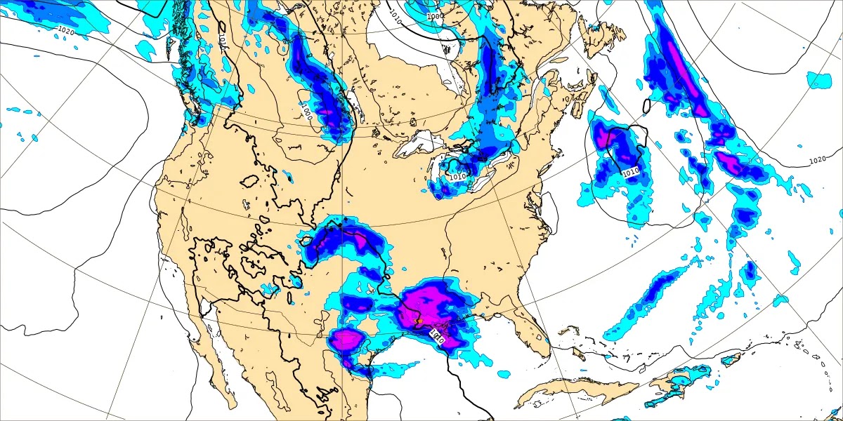
Satellite imagery reveals that the lightning has gotten pretty fierce with some of these storms in the pre-dawn hours. You can see it flaring up along those thunderheads seen from outer space.
That frontal system that has caused so much "fun" lately out in the Plains and Midwest, and I think more in the Ohio Valley yesterday, is finally getting ready to bring some fun to the Tennessee Valley and Southeast region.
So let's take a look at the details of how much fun it is shaping up to be.
First we'll run through the forecast before focusing in on the severe thunderstorm potential today and tonight.
Even just looking at the GFS, the timing of rain and storms today is going to be tricky. The GFS is now showing a good chance of organized thunderstorms at least in our Tennessee counties by early afternoon. And those storms from this morning up near the Kentucky line can lay down boundaries that storms later in the day (when it's warmer) can tap into.
The NAM is actually showing a chance for storms stretching down into North Alabama at that same time. This is a messy setup where definitely more than one round of storms will be possible. This is valid at 1 PM.
Before the storms get here today, we'll probably see a High in about the 83-85 range. It will be muggy with a pretty good southerly breeze, but not expecting the kinds of high winds we have ahead of some of the really major severe weather days. These winds should stay in the 10-20 mph range instead of like 30-40 mph. There are no wind advisories out for this one.
We'll look more at timing when looking specifically at the severe thunderstorm threat. For now we're just going to brush over each day to get a basic forecast. But the threat for rain and storms does last into the night hours, including potential for some to become severe.


Tomorrow it looks like we'll still have rain and thunderstorms going on as the front continues to push through. The overnight Low should be in the 67-70 range, and I remain skeptical as to how the models want to project more than 80 degrees for the High tomorrow. But they've been pretty consistent in it. So I guess some places could see a High up to 81, 82, maybe 83. But with so much rain ongoing from the previous night over much of the region, it's hard for me to see temperatures climbing too much, but definitely another muggy day. 80 degrees feel like a lot when you've got that much humidity. And we can't rule out a few storms still reaching severe limits. But again, with that much rain already going on, I kind of doubt we'll have a really organized problem with severe thunderstorms tomorrow. Most of that should be over with at some point tonight, or maybe very early tomorrow morning. And it'll be breezy again, but outside of thunderstorms, not expecting the kinds of winds that can really cause any problems.


By Friday the rain all moves down to the Gulf Coast. Tomorrow and Friday, they may have some stronger storms as well, doesn't look as organized as what we're likely to see in Tennessee and perhaps into North and Central Alabama today/tonight.
Since raw model data can look confusing to people who aren't "weather geeks", this map is easier to pick out what's going on. It is pretty straightforward: The cold front by this time has moved into Southern Georgia back through the Florida Panhandle.
Which means we'll see mostly sunny skies up this way and cooler, drier air. Sometimes the guidance wants to keep an isolated shower in there early Friday, but I don't think that's right, based on my own experience with patterns like this, sort of seems unlikely. Probably not going to include it in my official forecast up top.
Should start the day near 60 degrees, maybe upper 50's for a few of us, and then only warm to about the mid-70's, some places only lower 70's.
On Saturday high pressure is moving in from the West. The latest guidance shows temperatures a little more seasonal than what we were seeing a couple days ago. The High should get up into the mid-70's under sunny skies. And the morning Low probably won't dip into the 40's for most of us, but close call, should be around 50 or so.
High pressure in place over the region for Sunday too, Northwest wind flow at 500 millibars (about 18,000 feet in the air), so expecting another sunny day, could see a few fair weather clouds here and there, the High rebounding to the upper 70's, perhaps a few spots reaching 80, especially places like Jasper, Oneonta, Gadsden, on the fringes of North Alabama. The Low will probably stay in the lower 50's for most of us, pretty dry air here allowing great radiational cooling at night.
And this is a new development: The GFS wants to rush a mass of rain in here again next Monday. I doubt this will verify, but let's look at the ECMWF.
It has the same basic idea but keeps the rain back in mainly Louisiana and Southern Mississippi at 1 PM Monday.
So will respect the basic idea while keeping in mind that a lot of the GFS scenarios turn out to be overblown when other global models are not seeing the same thing. Which means bringing back a 30% chance of rain for Monday, a High in the mid/upper 70's and Low in the mid/upper 50's.
On Tuesday it is the ECMWF that has us covered up in rain, more than I'd expect all of a sudden in this pattern this time of the year.
The GFS is a little more conservative this time. It did get an upgrade a few years ago, and sometimes it actually shows.
The best approach may be to blanket both days with a 40% rain chance. Tuesday expecting the High more toward the mid-70's and the Low closer to 60.
The GFS has us clearing out swiftly on Wednesday of next week, a week from today, with high pressure moving back over the region.
That seems too fast for a mass of stratiform rain to move out of here in mid-May in this sort of pattern, and the ECMWF is not sold on it, keeps rain chances over the region Wednesday.
And my best estimate for Wednesday in this messy unsettled pattern is a 30% rain chance, a High in the upper 70's and Low near 60 or so.
Definitely not farting around with a 10-day-outlook this time. Especially not with a severe weather threat coming right up on us.
The best way to divvy up rain chances looks like 30% for Monday, 40% for Tuesday, and 30% again for Wednesday. That seems like the best balance between the two global models and personal experience/common sense.
Now, let's take a look at the severe weather potential. Because this does look more organized than we've seen in a while. It at least looks that way for Tennessee, but we need to keep an eye on things in Alabama too.
At 1 PM today the NAM is showing a respectable amount of unstable air and wind shear combining over the Mid-South into Northern Mississippi and Middle Tennessee to support organized severe thunderstorms.

The instability is forecast by the NAM to be crazy-high, taking a point near Corinth, MS. That's the kind of instability you'd see on a really hot summer afternoon. The wind shear is relatively weak, but with that much instability, it may not matter. So this would support a threat for large hail (maybe very large hail, like golfball-sized or greater), damaging thunderstorm winds, and a few tornadoes. The Significant Tornado Parameter is expected to be 1-2 range. And in this setup that favors supercells forming in Northern Mississippi and then tracking Northeast this afternoon, couldn't rule out the possibility of a longer-track tornado that ends up doing fairly significant damage. They've had some of those lately in mainly the Midwest, Nebraska, and this is reflected in the SPC outlook, which we'll get to shortly.

The more concerning time looks like this evening, here we have the NAM at 7 PM, the Energy-Helicity-Index, and it looks really concerning, especially up along and North of the Tennessee state line, and especially close to the Shoals.

Closer to home, taking a forecast sounding along the place where Cullman, Winston, Morgan, and Lawrence Counties meet, the instability and wind shear are very supportive of organized severe thunderstorms, including supercells. The parameters are a little lower than up around Waynesboro, but they are still plenty sufficient to support some problems brewing in our neck of the woods. A supercell composite of about 12 and a STP value of 2-3 is still well worth respecting. That kind of instability is what you normally see in the summer rather than spring months, and with this setup, it could produce some really large hail in any storms that can become discrete supercells or even break off briefly from any clusters or line segments.
Going to take a look at the HRRR for this too. Here you see a simulated image of what the radar could look like at 1 PM, then 7 PM, then 10 PM.
We start off with basically a Mesoscale Convective System, clusters of storms mainly in Northern and Middle Tennessee (maybe an isolated supercell or two up there), then by later in the evening, all that activity moving farther to the South and some supercell development trying to happen in Northeast Mississippi, perhaps affecting Northwest Alabama too, and up into those places in TN discussed earlier like especially around Wayne and Hardin Counties, I'd really watch things.
And then going into the night hours, the storm mode looks messier with a lower chance for the semi-discrete or discrete supercells but not really looking like a squall line/QLCS setup either. Looking more like a MCS setup of storm clusters like we'd see in the summer months, but with enough wind shear that we have to watch for more of a tornado threat, where usually in the summer, it is a damaging straight-line wind threat.
Probably the worst time for a tornado threat if this guidance is right would be late this evening into the early night hours.
One interesting thing is that the HRRR is not as aggressive as the NAM with the Significant Tornado Parameter values this evening and tonight as the NAM, not around here. Taking the two together, I'm left with the idea that tornadoes are part of this equation along with large hail (perhaps very large in some storms) and damaging winds. As far as a really long-tracker or more significant tornado damage, this suggests to me there might be isolated instances of that across the region.
It's probably better not to play guessing games with that. Even when a tornado is going on, sometimes you can't tell how strong it is. Any tornado is dangerous and potentially a life-threatening event. Even people who do survive without taking any shelter can suffer injuries. So the best thing to do is if you get a Tornado Warning later today or tonight, go ahead and take cover the best you can within your means. If you are close to a storm shelter or basement, of course you should take advantage of that. Most people are probably closer to just a sturdy house or other normal building . . . some will have to leave mobile homes to get there.
But just keep the basic guidelines in mind:
* Stay away from windows.
* Get to the lowest floor.
* Try for a small room like a bathroom, closet, or hallway.
* Make that as near the center of the building as you can - walls between you and outside.
* Cover your body from falling or flying debris, especially protect your head.
Wearing something like a helmet has saved people's lives in a tornado. If all you've got is a good pillow, use that. Or in a basement, especially if some of it is not under the ground, then you might consider getting under something sturdy like a set of stairs, a desk, table, or workbench, just in case of debris falling in there or trying to blow in there. Remember even in a basement that it is a good idea to stay away from windows. Tornado winds are lowest down at the ground level, but an awful lot of injuries in tornadoes happen from very simple things, like a window blowing out. And the injuries that are the most life-threatening happen from blunt force hits to the head and neck.
If you get a Severe Thunderstorm Warning, especially if it carries a "Tornado Possible" tag, you might want to go ahead and shelter anyway. Definitely do not stay in a mobile home if you have a pretty good idea that a tornado is coming at you. It's about the worst place to be. Some people say that getting into a car or van might be a little better, but if I was down to an absolute last resort, no sturdy house or even a gas station nearby, if there was a confirmed tornado coming at me, I'd probably hedge my bets in the nearest culvert, ditch, or other low spot on the ground and cover my head and neck the best I could. That was the traditional advice for many years, and some people have survived tornadoes that way, sometimes even tornadoes that did a lot of damage.
It's very important to have a reliable way to get the warning, like a NOAA Weather Radio or Weathercall.
If you don't have either of those, make sure you go to bed with Wireless Emergency Alerts enabled on your cell phone. You'll at least get Tornado Warnings that way. They only send out Severe Thunderstorm Warnings if it is marked a "Particularly Dangerous Situation". But that is better than nothing.
And you might tune the radio, if you like to sleep to music, to a station that will cut in if there is severe weather. Or you could do the same with your TV. For radio, the classical NPR stations are the most reliable for cutting in for severe weather. Unless they've changed things lately, Live 95.5 FM in Cullman is also really good. They cut in with that abrasive WEA tone and broadcast the warning. Sometimes they put a police scanner on if it's organized or even provide some updates of their own.
This situation is looking more concerning, at least for Tennessee, than it did a day or two ago. And I wouldn't downplay the threat for North Alabama either. We definitely need to keep an eye on it.
And it is only 20 minutes before the new SPC outlook is issued. So I think I will go up top and write the official forecast while waiting on that. So I can give you the most updated outlook. This other one was issued at 1 AM this morning.
All right, managed to get the forecast written and even translate it into Spanish, hope the translation is smooth reading for any native speakers that might stumble across this. I was always sharp with Spanish in school, and actually before that used to try to talk to Mexicans at restaurants or at a church my family went to at the time. So when I hear meteorologists talking about the need to serve that community better, I think it's a shame to put that knack for a language to waste. Even if fewer burritos might be good for my waistline . . . heh . . .
The new outlook really has not changed much. The hot zone today is from Southern Missouri into much of Northern and Middle Tennessee, clipping the Kentucky counties too, especially Western Kentucky, where a Moderate Level 4/5 Risk level for severe thunderstorms has been issued.
A much larger area all the way from Northeast Texas, through Arkansas and parts of Missouri into again Kentucky but most importantly for us to watch here, including just about all of Tennessee, is an Enhanced Level 3/5 Risk level. And then on the Alabama side, North Alabama is under the Level 2/5 Slight Risk level.
There are people who like to complain about the names of these categories, like "slight" isn't taken seriously enough and maybe "moderate" doesn't sound ominous enough either. That's why I'm making note of how it's 2 out of 5 here, 3 out of 5 level for most of Tennessee, and then around Nashville and points North, they have a Level 4 out of 5 risk. That way if anybody does nitpick and find the verbal labels confusing, the numerical values should clear it up.
There used to be only three risk levels: 1. Slight 2. Moderate and 3. High.
Now it's like you see on the graphic above, with Marginal being a very low, isolated severe threat and Enhanced being somewhere in between Slight and Moderate.
The real thing to pay attention to the day of an event though are the specific probabilities for different severe threats.
Here on the Alabama side, we are only outlooked for the standard 15% risk for large hail today. But on the Tennessee side, the vast majority of the state, including the counties that hug the AL state line, are outlooked for a 30% risk of unusually large hail, golfball-sized or greater. Notice there is even a smaller area in Southern Missouri into Northwest TN outlooked for a 45% chance of this knock-a-hole-in-your-head kind of hail. In all seriousness, while the main priority today should be protecting your life from a dangerous thunderstorm or a tornado, if you have the chance to park your cark in a garage or parking deck, that might be a great idea. I had a car completely ruined by hail damage one time, and that could be an issue with this system. Notice that wide hatched area for large hail, covers most of the Mid-South and even stretches back into Texas. This is where supercells are most likely to form today and track through, today and tonight.
One thing I skipped over, and should have remembered, is that it looks like for much of the day, at least North Alabama but perhaps also parts of Southern Tennessee will have a capping inversion. I guess the reason I forgot to mention it is that the CAPE values are forecast to be so strong. That kind of instability seems like it could erode a cap fairly efficiently. That remains to be seen. But a lot of the guidance shows the rising warm air struggling to get past that capping inversion layer of warm air today. That's why even in Tennessee, not everybody is going to see storms today. But where they do form, they could be severe. And some could even be supercells. Which is why we have the enhanced threat for very large hail.
I'm reading the SPC discussion now. They agree with local forecasters that this setup is complicated. I definitely had already picked up on that. This forecast discussion I'm writing has taken a long time.
I was out of commission yesterday, saw where there were some severe thunderstorm warnings in Tennessee and even in Northeast Alabama, also a tornado warning in Jackson/Dekalb Counties in Alabama yesterday evening. I don't think any tornado damage was confirmed. But there was at least one confirmed tornado in Tennessee the day before, so that was Monday evening. It was way up there though, not close to the AL state line. But some people did post some great pictures and video of it. It was rated E/F-1 with no fatalities or injuries, last I saw.
It sure does look bad for the potential of hail damage with this event, especially in the hatched areas (which includes just about all of Tennessee), with hail of 3 inches in diameter or greater possible. Don't be surprised if a lot of places see reports of baseball or tennis ball sized hail with some of these storms, at least the ones that can be at least semi-discrete supercells.
There is also a threat for widespread damaging winds outlooked with this system, maximized from about Southern Missouri down to about Nashville, Tennessee.
But again, notice the hatching. Only far Eastern Tennessee is not included in that hatched area for especially damaging thunderstorm winds. When you've got that kind of large hail in this kind of setup, the downdrafts of winds can be really strong too. And the winds could get up to 75-80 mph or greater in some of these thunderstorms, especially in Central back through Northwest Tennessee.
Down on the Alabama side, we're in the standard 15% risk bracket, which means we're more likely to see winds like 60-70 mph in the worst storms. Just like our hail is more likely to be measured in coin sizes instead of ball sizes like they're likely to have on the TN side today/tonight.
The best chance of seeing tornadoes with a longer track and more significant damage today/tonight is to our North in that 10% hatched area from roughly Nashville, TN back through Northern TN and KY, clipping Indiana and Illinois, back into Southern Missouri. That's not to say we couldn't see a long-tracker somewhere outside of that general area. That's just where it is most likely that tornadoes will form from discrete supercells today, maybe into tonight, and have the best chance of staying on the ground (supercells can last a long time, even cross state lines sometimes) and doing fairly substantial damage.
The counties that border us in Southern Middle Tennessee are under the more standard 5% tornado risk, just your usual isolated tornado risk with a severe thunderstorm event. And actually here in North Alabama, we are under the minimal 2% threat for an isolated tornado or two.
Please remember that these are only general guidelines and that this is a complex, messy setup. Anybody in North Alabama and Southern Middle Tennessee today and more so tonight needs to be prepared for a thunderstorm that could produce wind damage, large hail, or a tornado. If you are in Tennessee and think you might want to use a public storm shelter rather than sheltering in your home (or if you live in a mobile home, which you can't shelter from a tornado in), check out this page from one of the Nashville TV stations, Channel 5 up there. One of their meteorologists put a lot of effort into getting more shelters and letting people know where they are, it seems. I don't know that much about it, but just off the top of my head, I tip my hat to her and thank her for it.
If you have a lot of nerves about severe weather (and sometimes I do . . . other times I've been way too cocky and taken stupid chances with storms . . . now is not the time for such stories), please remember that even on a higher-risk severe weather day, the odds of sheltering safely in a sturdy house or other strong building are in your favor. About 9 times out of 10, you'll survive even a direct hit from a tornado, and usually without serious injury. An awful lot of the time, you'll be just fine. The odds of being hit directly by the worst winds of a tornado are very, very low. But since it does happen, and since you can be injured from even being closely grazed by a tornado (doesn't even have to be a "stronger" one), the best thing to do is be prepared. And if you fall under a Tornado Warning polygon, get yourself and your loved ones to a safe place right away.
And for an event like today/tonight, I would go ahead and shelter from Severe Thunderstorm Warnings basically the same as from a Tornado Warning. I don't trust this setup. It has thrown many curves over many days in different parts of the country, this system. And there is potential, at least in Tennessee, for the kinds of winds that could do similar damage to a tornado, even if they are straight-line winds in the downdraft of these powerful thunderstorms. Some people might not know unless reminded, hurricane force winds start at 74 miles per hour. And we could see winds like that with some of these storms, especially up on the Tennessee side. In light of that, I'd rather see people go beyond the usual just getting away from windows and figuring it'll be okay if they don't have any trees outside. I would take a Severe Thunderstorm Warning seriously with this event, even if you normally don't.
Plus if large hail goes blowing around in those kinds of winds, it makes it easier for windows to break, even in well-built houses. Not trying to scare anyone, but we do have to consider this stuff, and just advise people to kind of err on the side of caution with this event. Don't let it scare the crap out of you, but please do use a reasonable amount of caution. If you don't feel sure, then do that extra thing to keep yourself safe, like putting on an old bike helmet or football helmet in your place of shelter.
And try to get to that safe place within five minutes of getting the warning.
If you're on the Tennessee side of this and brave enough to read my discussions that have so much weather jargon, you might want to check out this very well-written discussion by Krissy Hurley, the MIC of the NWS Nashville. I met her briefly when she was still at the Huntsville office, and then she moved out to somewhere in Texas (I think) and has done very well for herself since. Some of these forecasters could write a meteorology textbook that more people could actually understand. If that lady wrote one, I'd buy it and read it.
I've been double-checking myself by reading local forecast discussions, and that one really stood out.
The chance for supercells on the Alabama side this afternoon/evening is probably going to be limited by the capping inversion. Things feel like one of those events where the ingredients are all there, but they are out of phase for a really bad outbreak. The best instability, wind shear, and lifting mechanisms for storms may not all come together at the right times for a more widespread, significant event. There is a chance of seeing supercells in North Alabama, but it is low. As you get farther into Tennessee, the chance does increase. And certainly as you get around and North of Nashville, that is where the highest threat for supercell thunderstorms capable of producing tornadoes will be. But as Ms. Hurley noted in that excellent discussion, it depends on where the boundary sets up. Along and North of that boundary is going to be the focus for the worst weather this afternoon and evening.
For most of us, this looks like an overnight event.
I know I did a lot of hem-hawing and talking things out above, but unless you are in Central or Northern Tennessee, you probably will get by without seeing a supercell thunderstorm as a first round or two this afternoon or evening. It is not impossible for us to see a supercell fire up South of there near the state line or even somewhere in North Alabama. We'll especially have to watch anything that were to develop in the warm sector in Mississippi this afternoon and evening. But the chance of that around here is low.
The chance is fairly significant as you get up around Nashville and points North.
It's interesting, the local offices seem to think we'll see a squall line/QLCS tonight, where it looked more like an MCS to me, Mesoscale Convective System, messy clusters of severe thunderstorms. And that's what the SPC was saying, best I recall. But sometimes these local forecasters with a lot of experience know what they're talking about. Either way, the threat for large hail, damaging winds, and isolated tornadoes is expected to be somewhat lower on the Alabama side. And in Southern Middle Tennessee, it's sort of in between the two. Could still see an isolated supercell there, but even if storms are in clusters or in a squall line, there could be embedded supercells capable of the really large hail and some pretty stout wind damage. None of us are exempt from the tornado threat, but it is highest in Central/Northern Tennessee and back into those other places like Western Kentucky and Southern Missouri. But we could still see isolated tornadoes in Southern Middle Tennessee along the state line. And we could even see a couple on the Alabama side of this.
This is a messy setup where we just have to accept that a lot of the details can't be nailed down. It will come down to watching the radars and the skies and other mesoscale details.
After about 7 AM tomorrow the threat of any more storms reaching severe limits is marginal around here, we only have that Level 1/5 Marginal Risk in effect.
We will have to watch for some flash flooding, though that too is most likely to happen in Central and Northern Tennessee. I notice Marion County, TN is included in the Flash Flood Watch though. And it borders Alabama.
The WPC keeps the risk for any flooding issues on the Alabama side of this pretty low today and tomorrow.
And as an average rainfall amount, we should see about one inch for the region (North Alabama into Southern Middle Tennessee) between now and next Wednesday.
Spent a lot of time on this, hope it is readable.
Wishing you safety tonight, or if you're extra unlucky, later during the daylight hours today.
9:36 AM - Adding a footnote. I forgot to explain that part of the reason I think the supercell threat is low for North AL into Southern TN this afternoon/evening is that the NAM can have a tendency to overdo things. The HRRR did not look nearly as threatening this time, and it has been known to go on some wild goose chases (as well as sometimes nailing things the other mesoscale models miss . . . that's kind of a crap shoot) itself. So I think the SPC forecasts are on track more than my wild speculations on if a few supercells could organize this afternoon or evening, in the discussion. And the local offices are probably right about this mainly being an overnight event. I tend to think it may start before Midnight for at least the Western counties though. Just from looking at everything. And I think we might see more storm clusters instead of just a typical squall line. The storm mode may be mixed for this.
9:44 - Another footnote, here is Craig Ceecee's
tornado shelter map for the entire country. I think it's awesome that he put this together, and I tend to forget about it between severe weather events. I'm going to go ahead and put it in the site's links (which you see on the desktop version, might have to specially enable that if viewing on a cell phone). So anybody who drops by can have it as a handy reference all the time. Whenever I see people trying to give people more access to shelter in places where it can be scarce (like around here where so many people live in trailers), they have my utmost respect. And I appreciate their efforts.


.png)


No comments:
Post a Comment