

FORECAST:
Tuesday (High 80, Low 55): Sunny. Mild.
Wednesday (High 84, Low 57): Sunny. Cool in the morning, warm in the afternoon.
Thursday (High 89, Low 60): Sunny. Turning hot.
Friday (High 92, Low 65): Sunny. Hot.
Saturday (High 95, Low 69): Sunny. Hot.
EXTENDED OUTLOOK:
Sunday (High 93, Low 71): Mostly sunny with a 20% chance of showers/thunderstorms.
Monday (High 91, Low 72): Partly cloudy with a 30% chance of showers/thunderstorms.
Tuesday (High 92, Low 72): Partly cloudy with a 20% chance of showers/thunderstorms.
Wednesday (High 91, Low 71): Partly cloudy with a 30% chance of showers/thunderstorms.
Thursday (High 92, Low 73): Partly cloudy with a 20% chance of showers/thunderstorms.
BEACH FORECAST:
Tuesday (High 88, Low 75): Sunny.
Wednesday (High 88, Low 74): Sunny.
Thursday (High 88, Low 75): Mostly sunny with a 20% chance of an isolated shower or thunderstorm.
Friday/Saturday (Highs in upper 80's, Lows in upper 70's): Partly cloudy with a 40% chance of scattered showers and thunderstorms.
Sunday/Monday (Highs in mid-to-upper-80's, Lows in upper 70's): Rain and thunderstorms likely.
PRONÓSTICO:
Martes (Máxima 80, Mínima 55): Soleado. Suave.
Miércoles (Máxima 84, Mínima 57): Soleado. Fresco por la mañana, cálido por la tarde.
Jueves (Máxima 89, Mínima 60): Soleado. Poniéndose caliente.
Viernes (Máxima 92, Mínima 65): Soleado. Caliente.
Sábado (Máxima 95, Mínima 69): Soleado. Caliente.
PERSPECTIVA EXTENDIDA:
Domingo (Máxima 93, Mínima 71): Mayormente soleado con un 20 % de probabilidad de lluvias/tormentas eléctricas.
Lunes (Máxima 91, Mínima 72): Parcialmente nublado con un 30% de probabilidad de lluvias/tormentas eléctricas.
Martes (Máxima 92, Mínima 72): Parcialmente nublado con un 20 % de probabilidad de lluvias/tormentas eléctricas.
Miércoles (Máxima 91, Mínima 71): Parcialmente nublado con un 30% de probabilidad de lluvias/tormentas eléctricas.
Jueves (Máxima 92, Mínima 73): Parcialmente nublado con un 20 % de probabilidad de lluvias/tormentas eléctricas.
PRONÓSTICO DE LA PLAYA:
Martes (Máxima 88, Mínima 75): Soleado.
Miércoles (Máxima 88, Mínima 74): Soleado.
Jueves (Máxima 88, Mínima 75): Mayormente soleado con un 20 % de probabilidad de lluvia o tormenta eléctrica aislada.
Viernes/Sábado (Máximas en los 80 grados superiores, Mínimas en los 70 grados superiores): parcialmente nublado con un 40 % de probabilidad de lluvias y tormentas eléctricas dispersas.
Domingo/Lunes (Máximas en los mediados de los 80 hasta los 80 grados superiores, Mínimas en 70 grados superiores): lluvia y tormentas eléctricas probables.
At 3 PM it is sunny in Cullman. The temperature is 81 degrees. The dewpoint is 54 degrees, making the relative humidity 39%. Winds are out of the North, sustained at 8 miles per hour, with higher gusts up to 16 mph. The pressure is 29.90 inches and falling slowly at the moment, but if you look at the pattern over about the past day, holding fairly steady. In a weather pattern like this, it waffles up and down a little each day but holds fairly steady.


Or maybe I should quit acting like this is a typical summer pattern. Because it's sort of an odd one at the moment. We usually don't get cold fronts coming all the way through the region this time of year, like we have now. And then a ridge is expected to build from out West later in this forecast period bringing us some fairly serious summer heat sort of early in the season. In fact by the terms of the Summer Solstice, it isn't even technically summer yet. Meteorologists consider summer to start on June 1st though.


As hard as it is to believe, it looks like all that model guidance is going to verify after all, for the drier airmass behind this cold front. Expecting a Low tonight about 55 degrees and a High tomorrow of only about 80 with sunny skies.
By the way, the Low in Cullman this morning was 63, actually 62.6 if you want to get technical, but I round up. So we already had a pretty cool morning. But the air is going to really dry tomorrow morning.


Then Wednesday the dry pattern holds, sunny skies, High about 83-84 and the Low about 57-56.


Then on Thursday notice that heat bubble starting out West. Around here we'll jump into the upper 80's for the High, stay around 60 degrees for the Low, air still pretty dry.

Then on Friday the strong high pressure system expands further into the Southeast. And we're looking at mostly sunshine, rain chances so low they're not worth worrying about. You can always get a stray shower or thunderstorm in the summer months, but most of us are getting nothing for the next several days. High will get up to 90 or so, Low rebound to about the mid-60's.


Another hot day Saturday, we may actually see mid-90's here, the Low rebounding to near 70.
Notice the GFS continues to show a subtropical Low in the Gulf of Mexico like it has on many runs now. Please note that nothing is going on in the tropics as far as anything that might become a hurricane, and nothing is expected to for this forecast period. This Low is expected to stay subtropical.


Latest guidance shows it taking more of a westerly track than some of the earlier runs. Still looks like a pretty good rainmaker for Florida, especially the Peninsula.
Around here, can reintroduce a minimal 20% chance for isolated rain with this Gulf moisture in the vicinity. Probably still have Highs in the lower 90's and Lows of 70 or so.


The GFS wants to bring that moisture up into our region with plenty of rain on Monday of next week.

Usually I wouldn't split hairs about such details in June, but this pattern is a little out of the ordinary. And the ECMWF is not on board with this wild goose chase. So will maintain rain chances on the low end, though may increase to 30% to account for whatever the GFS is picking up on. Usually none of the models get it exactly right, at least in summer months. But you can think about their bias and where the actual truth might lie.


Then if you want to peek at Days 8-10, it looks to stay unsettled. I think rain chances will be lower than what the GFS shows, so Highs staying in 90's, Lows of 70 or so. Rain chances probably stay in 20-30% bracket the whole period. The European model was more conservative just like for the first seven days as far as rain chances coming back.

And we aren't going to see a whole lot of rain around here any time soon. They will in Florida, heavy rainfall likely there late in the week, especially in the Peninsula.

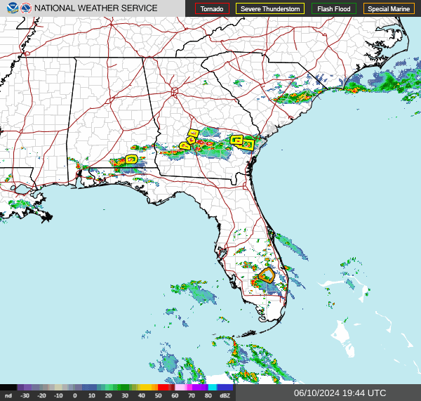
Sometimes those isolated storms of summer can pack a punch before they rain themselves out, and yesterday they had some help from a cold front. We went under a severe thunderstorm watch for a while. You might remember Blount County was under a severe thunderstorm warning, and that verified. Golfball sized hail was reported with pictures on social media. And it dented up a vehicle and busted the glass out. (I've had that happen in the past. It is not a pleasant experience. Granted mine happened during a springtime event that busted as far as the major tornado threat, but ended up being a crazy hail event.) That was around Allgood and Oneonta. Trees were blown down along County Road 11 in Blount County in Necar as well. So that's why they'll issue Severe Thunderstorm Warnings sometimes for these isolated summer storms when they look like they could produce severe hail or damaging winds. It's not like in our tornado season, but still, if a storm is getting that bad, anybody would appreciate a heads-up. And that can happen randomly in the heat and humidity. Even though usually it's just going to be a regular thunderstorm. Like I say, yesterday we got some help from the cold front. We don't get a lot of cold fronts this time of year. And it may be until September before we see another one, the way this next pattern is setting up soon.
And while it is not directly related to weather, in the interest of public safety, I'd like to remind people that the cops are still looking for a fugitive escaped from Georgia, who was recently seen in Cullman County. If you see him, please call 911 as soon as you can safely and discreetly do so.
In a few past posts, I let out too many of my personal opinions and speculations about this case, and I wish I hadn't. People a lot better-informed and wiser than me are handling this. But let's help them do it. The situation does strike me as a serious one, when you've got U.S. Marshals looking for somebody who's crossed state lines. Keep an eye out for this person.
The cats were alarmed last night by how much I was cleaning up the place. Which makes me think I should probably do it more often. Also the other night when I was doing pushups and such, it scared Salem. So there are several things I should do more often. Stormy still lives up to her name and goes back and forth between hissing and swatting and rolling over and acting as sweet as can be. They both tried to explore some cabinets as I opened them last night to rearrange things. They are not getting along great though. The saga continues where he's trying to be friendly and she's mostly snarling at him and telling him that she has become death, destroyer of worlds.
On a serious note, hope you enjoy these cool mornings. A lot of people don't like the kind of heat that is coming in a few days, but we all face things every day we don't particularly care for . . . we get over 'em. But since we're not used to this kind of heat this year, it really could become dangerous in situations where people get in too big a hurry and forget to use common sense. It made me think about it, talking about these crazy cats I had donated to me both within the past year. Some people even leave their kids in cars alone without the air conditioner running while they make a quick shopping trip. And I wouldn't do that. As John Gordon from Louisville (used to work in Huntsville) puts it: "Beat the heat - check the back seat!"
And if you think that's corny, wait until you hear my version. Even the National Weather Service can't compete with me for being unforgivably cheesy and cringey.
(DRUMROLL)
If you thought it was bad when Grandma got run over by a reindeer, just wait till you see what she looks like havin' a heatstroke.
Eh, on that note, hasta luego.
Hey, I like ketchup, but that many tomatoes at once is excessive, doncha' think . . . ?
Hasta . . . luego.
Well while I'm hiding behind the curtain to avoid any more free ketchup . . .
This weekend was the anniversary of Tropical Storm Cristobal four years ago.
And here is some advice on staying safe in rip currents, since it is a great time of year to go to the beach. Not this coming weekend so much, but in general.
And I still am not sure if 10-Day-Outlooks are a good idea even in the summer. Just giving them a try along with the Spanish versions of forecasts.
And I just heard a DJ relate a story about a presidential "code brown" on Live 95.5 FM (a station with great music) that made me want to share this link debunking such foolishness. Sort of like I'm gonna' tell you there is no hurricane coming in the Gulf this week. Most of the outlandish stuff you hear . . . there's a reason it sounds unlikely.
Now I want to throw a tomato at somebody for a cringe joke. It's fine not to like somebody who's in office, but how about, if you have to take a jab, at least stick to the truth?
And I feel that way about it both ways. Not that I don't have a bias, I just try to defer to my better sense every once in a while.
But I know . . . that's not the style now . . . buncha' shit, ain't it?
I prefer ketchup.
Sometimes I think I'm southern after all, just living in denial of it . . .
Hasta luego.
P.S. To that DJ's credit, he did show his better sense with another joke a few songs later: That he felt this election was going to be like a choice between Emperor Palpatine from Star Wars and Lord Voldemort from Harry Potter. And that he wishes there was a candidate he could really support. I agree with that. I'd like to see an Independent get in office . . . like Jesse Ventura did as Governor of Minnesota. But that would make too much sense. So it ain't gonna' happen. The tabloid style will continue and escalate . . . and we're all doomed. And ya' know what . . . I'd love to be wrong about that forecast.
P.P.S. If I was that DJ, I might have said it was like a choice between relying on Yokozuna (think he was even fatter than Rakishi?) the wrestler or Jabba the Hut for a weight-watchers deal. All hate mail should be directed here.


No comments:
Post a Comment