

(Forecast)
Saturday (High 70, Low 47): Warm and windy with isolated showers and thunderstorms possible throughout the day. Thunderstorms are likely at night and may become severe.
Sunday (High 55, Low 49): Partly to mostly cloudy. Cold and breezy.
George Washington's Birthday (High 46, Low 23): Sunny. Cold.
(Extended Outlook)
Tuesday (High 54, Low 26): Mostly sunny.
Wednesday (High 43, Low 30): Mostly cloudy with a 40% chance of showers - wintry mix possible.
Thursday (High 33, Low 17): Mostly sunny.
Friday (High 39, Low 15): Sunny.
(Pronóstico)
Sábado (Máxima 70, Mínima 47): Cálido y ventoso con posibles lluvias y tormentas eléctricas aisladas durante el día. Es probable que haya tormentas eléctricas por la noche y que se vuelvan severas.
Domingo (Máxima 55, Mínima 49): Parcialmente nublado a mayormente nublado. Frío y ventoso.
Cumpleaños de George Washington (Máxima 46, Mínima 23): Soleado. Frío.
(Pronóstico Extendido)
Martes (Máxima 54, Mínima 26): Mayormente soleado.
Miércoles (Máxima 43, Mínima 30): Mayormente nublado con un 40 % de probabilidad de lluvias; posible mezcla invernal.
Jueves (Máxima 33, Mínima 17): Mayormente soleado.
Viernes (Máxima 39, Mínima 15): Soleado.
(Note)
If you haven't already, please review your severe weather safety plans, before we have any problems tomorrow night.
(Forecast Discussion)
Our High today was 55 (technically 55.4 - I'm being a nitpicker today - but deny currently having head lice), and our Low was 23. And that's right on the money, 23.0 degrees. For anybody who's really slow, it's really, really easy to "round" that one. You just take the zero off. If you couldn't figure this out on your own . . . I will pretend that I don't know you.
All right, but seriously, we do have some stormy weather on the way tomorrow, maybe more tomorrow night, so let's take a look at the high points of the forecast and focus on that severe weather potential. We can have that in February around here, but it's fairly rare. For North Alabama into Southern Middle Tennessee, the main months are March, April, and May - late March through April usually being worst. November can also be a bear some years, or sometimes that secondary season comes more in December. But we can really have tornadoes any time of the year. Even the summer months, even without a hurricane coming inland, sometimes we get the right ingredients. It's a little more common in the cold months, if we get some warmer, unstable air at just the right time. And that may be about to happen. It's not like it's unprecedented, but this is not when we typically expect organized severe weather, so it's more important to make sure people know about it and have a reasonable safety plan in place.

Rain is scarce at the moment, even there in East Tennessee, only seeing light showers. That stuff in Georgia is probably just virga that evaporates before it reaches the ground.

The really organized rain right now is in Louisiana and Southern Mississippi, also some in Northeast Texas, sporadic through Arkansas. And there are some light showers here and there in Oklahoma, Missouri, Kentucky.

Looking at the satellite imagery with lightning overlay, you can see that some of those showers in Louisiana and Southern Miss are actually thunderbumpers (old-fashioned southern slang for thunderstorms, for those who don't know). But these are just general thunderstorms. We don't yet have the ingredients in place for severe thunderstorms to develop.


And I'm trying something a little bit different than usual today. Usually for upper-air maps, I only show the 500 millibar (about 18,000 feet) map. This time I'm showing all levels of the atmosphere down to the surface map. I'm still learning about some of this stuff as I go, but you can see that generally our winds aloft have shifted to the West/Southwest. Which is going to steer this next weather system.


And here's a look at how weather systems across the country have been moving today. These are all surface maps with analysis. Areas of high and low pressure are highlighted where the isobars (areas of similar pressure) show they are located. Fronts are drawn where there's a sharp temperature gradient. You can see the front we just got through with the other night (that brought all the flooding issues) continuing to move down into the Gulf (of Mexico . . . and America) and through the Florida Peninsula. At times it is still stalling out and moving slowly. You can also see that strong High pressure system moving through the Ohio Valley and then up into New England. These maps are valid for the past 24 hours. And you can see another Low pressure system and associated front (actually more than one) East of the Rocky Mountains.
Before we get to the colorful weather maps, let's take a look at something else I should show more often if I really want to promote the science instead of just having a cutesy weather reference blog here.

Here is this evening's forecast sounding from Birmingham, technically down by the Shelby County Airport, Calera. They launch these balloons twice a day, and they help us a lot in forecasting severe weather. You don't have to understand everything about them; after all, the temperatures here are in Celsius, which we don't use when reporting temperatures or forecasting them from day to day. And there is a lot of information here. But do notice that there is a lot of wind shear. Wind speeds increase as you go further up in the atmosphere, and there is a good bit of turning of the winds with height as well. If you don't know how to read wind barbs, I guess I'll let you "Google" that one. Nah, actually, here you go.

And here is the sounding from Nashville. We're in between those places, so I think it's a good idea to look at both of them. That box second from the left has something that's labelled SRH (m2s2), which stands for Storm Relative Helicity in meters squared per second squared. We see values up in the 300's already, way before we're getting any unstable air to work with as fuel. (And that's probably the main question of this forecast, is who gets the unstable air - where and when.) If you see that at 3 kilometers up, it's more than enough to support some rotating updrafts. (Generally you only need about 200 m^2/s^2 for that.) But values of 300 or more in the lowest kilometer of the atmosphere are unusually high.
I will say though, that in the cool or cold season, it's typical to have a lot of wind shear and not very much unstable air. We would not expect the unstable air right now, and these are current observations from what the balloon launches sent back as of 6 PM this evening (that's what the 0000 beside the day's date stands for near the top, that's 00:00 hours in Zulu time, at the prime meridian - subtract six hours to get Central Standard Time here in North Alabama and into Tennessee). These are not forecasts I'm showing. These are current (or at least very recent conditions) that we'll use to get a sense of what the atmosphere's doing. This data is also fed into the computer models that try to simulate how these conditions will all change over the next several days. I've shown forecast soundings many times, but tonight I decided to show actual current soundings. That's really the baseline that gets overlooked too much now in the hustle and bustle of numerical weather prediction, seeing what the atmosphere is doing right now.
That box in the upper right corner is what's called a hodograph. To keep things simple, just understand that curved hodographs are generally associated with a threat for severe thunderstorms that can rotate, and if the other ingredients are present, produce tornadoes.
By the way, before we move on, for anybody who doesn't take storm spotter training this season, the three ingredients you need for organized severe weather are: 1. Unstable Air 2. Wind Shear 3. A Lifting Mechanism, which usually means a front.
We've got a front coming in tomorrow, probably tomorrow night. And you can see that the wind shear is already getting going in this pattern. So if we get some unstable air tomorrow that coincides with these other things in the right timing, then some of us are going to see some severe weather.


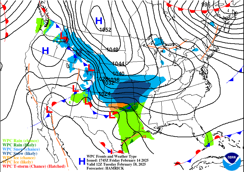
Now for some more usual, colorful weather maps that are easier to understand. Basically another front is going to move through here tomorrow/tomorrow night, bringing a threat for more flash flooding/river flooding issues as well as a threat for severe thunderstorms. And then behind it on Sunday, we'll start turning cooler, we'll stay breezy, and probably at least isolated rain showers will linger. Sometimes that's called "wraparound moisture", on the back side of a cold front. And I might talk about the snow and ice in other parts of the country if our weather was calm here. But it's not for this immediate forecast period. So let's worry about our own junk going on.


Here's the GFS model prediction for tomorrow. The top graphic is a forecast for what the 500 millibar map will look like, about 18,000 feet off the ground. And the "heights" (complicated to explain here, but similar to isobars on a surface map) show a trough digging through the Plains, that pronounced dip in the lines. Troughs are usually associated with rain/storms, while ridges (upward curves) are usually associated with high pressure and so calmer weather.
This is valid at Noon tomorrow, 1800Z. And the bottom graphic is basically a surface map, but you have to look at the moisture and the overall shape of things and sort of figure out where the front is. It comes to you if you study weather maps for a while.
The NAM looks similar enough to the GFS that I don't feel the need to show it here. The NAM is a mesoscale model focused on North America and only good out to about 2-3 days. The GFS is one of the main global models that takes into account weather observations all over the planet.
This is starting to feel like a meteorology lesson.

And I will show the other major global model, the ECMWF, since it shows a slower timing of the front than the GFS. This is common. If you work with them a while, you notice that certain models have certain habits. Usually the GFS American model wants to move systems along more quickly than the ECMWF European model. A lot of times, the slower timing turns out to be right, but not always. Since the NAM (I'll go ahead and show it below after all) is closer to the GFS, I'm more inclined to buy into the GFS/NAM timing this time. The European model is known for being really advanced, but even it doesn't get everything right. This graphic above is the rain/mean sea level pressure at Noon tomorrow, the forecast for that.

And here is the NAM, which is usually better than global models for short-term forecasts in North America. It agrees more-or-less with the timing and placement of this system shown by the GFS.


In a setup like this, minor differences in the models can make a big difference as to who gets the worst weather. And here between 6 PM and Midnight, the GFS shows a very favorable track of the surface Low for us to have severe weather in the Tennessee Valley.


The track of the NAM would make the hot spot more like Northwest Alabama, Northern Mississippi, Western Tennessee. Other places nearby could still see severe thunderstorms, but there is a zone near where the surface Low is tracking that ends up getting the worst of it. After a while you get a feel for that zone. I forget what the textbook version of it is.
Anyway, before we move on to looking at some of the mesoscale details of model predictions and analyzing our severe weather threat tomorrow, let's quickly gloss over the basic forecast.
And let's just start with broad brushstrokes for tomorrow. Based on what we've already looked at, at some point tomorrow or tomorrow night, thunderstorms are going to become likely around here. And some may become severe. Our Low tonight based on Model Output Statistics (see the resources list on left side of webpage - need to enable desktop phone if viewing on a phone) should be in the mid-to-upper-40's. We've already got that low-level jet from the GUFF (my silly way of saying the Gulf lately, since I heard someone from Louisiana pronounce it that way), like we saw on the upper-air maps. Those temperatures will rebound quickly. And tomorrow's High looks to be about 69-70. I think the GFS was actually showing 68, but just based on watching this for several days and past experience with similar setups, I think we'll get up to about 70.


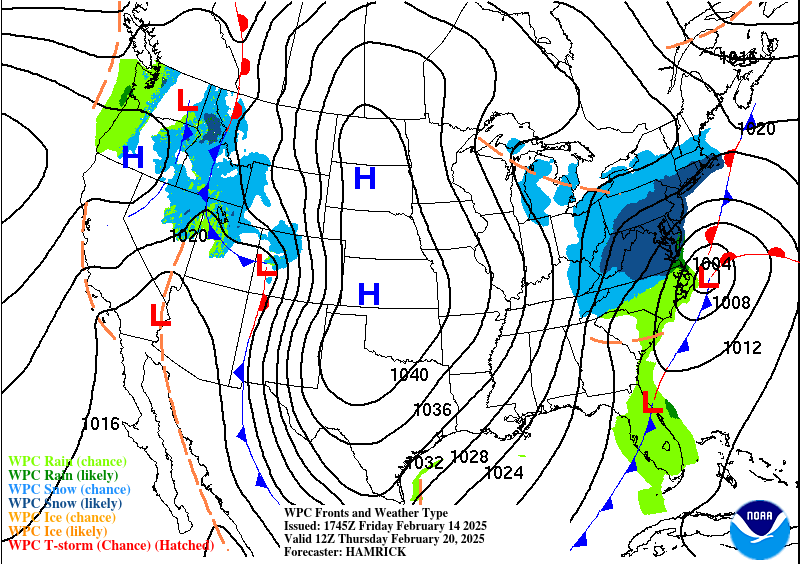
For Sunday, the GFS is no longer showing that wrap-around moisture like we saw on the maps from the Weather Prediction Center. I'm not sure if it was before, seems like it was another model that was showing it yesterday.

The NAM does not show wraparound moisture at Noon Sunday either.

The ECMWF does a little bit. But even it has backed off from what it was showing yesterday, moving most of the rain out of here by Noon. I remember now, this was the model that was dragging it through here slower.
Most likely we'll see only a little rain Sunday morning or no rain left over at all, but a lot of clouds will probably hang around. A lot of places may not see the sun peek out all day. Cold air will be rushing in behind the front, so we'll say the Low is in the 40's (probably upper 40's) in the morning, and the High in the 50's, also pretty early in the day, but during the afternoon, temperatures will plummet. It's one of those raw days that are tough to define a High/Low temperature for without confusing people. Sometimes I've seen broadcast meteorologists put the Low temperature (like what's expected way late at night, close to Midnight) up top for such days, and put the High temperature expected earlier in the day on bottom. I guess I'm doing it the old-fashioned way, a morning Low, midday or afternoon High, with just a note that the High won't last long and temperatures will be falling rapidly.
Also behind the front, winds will turn back to the Northwest and stay pretty breezy while the airmass/pressure changes in the region. We could see gusts up to about 20-25 mph.


On Monday our upper-level winds will become more zonal from the West. And at the surface, we're not under super-strong high pressure, but we're a couple states West of that High pressure system just off the coast of Georgia. And our air will be cold and stable, really dry. Expecting sunny skies with a High in the mid-40's, Low in the lower-to-mid-20's. This is also George Washington's Birthday, the father of our country, people often call him.


And we'll just get through the rest of the forecast without looking into major details, just standard analyzed weather map predictions here from WPC.
Tuesday will be mostly sunny with a High in the lower 50's, the Low in the mid-to-upper-20's.
Looks like about a 40% chance of showers on Wednesday, and some of that could start Tuesday night. It's going to be a closer call as to whether some of our region (especially Northwest Alabama into Tennessee) could see at least a mix of wintry precipitation if not all snow for some places. We'll burn that bridge and try to focus on specifics of that after tomorrow's storm system is over. High in lower 40's Wednesday, Low of about 30 or so. So we will have to watch at least the early morning hours Wednesday for a wintry mix.
And we also have to think about Wednesday night.
Now that's going to be a GUFF (ok, Gulf) Low bringing us the rain and maybe snow (or maybe even ice for some places), but we're still going to feel some cold air behind this system. How much of that is related to a snowpack for some of us remains to be seen, but for Cullman, a good estimate for Thursday is a High in the lower 30's and a Low in the 15-20 degree range.
Then Friday looks sunny but really dry air, really cold, the High only getting up to about 40 and the Low staying well down in the Teens.
And now we can look at the severe weather threat.


Well first, average rainfall totals over the next seven days should be about 1-2 inches over the region. We do have a slight risk for additional flooding issues though, especially in Western and Central Tennessee. But even the Alabama side needs to keep that in mind.

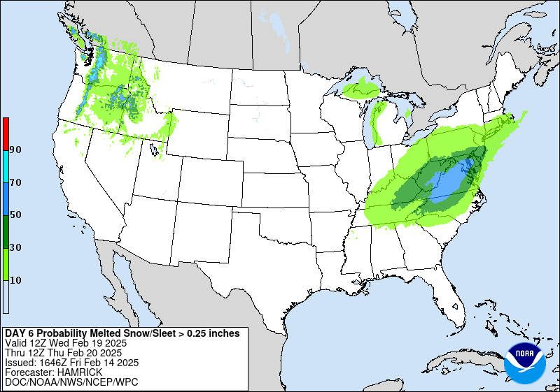
And we will have that low risk for some snow, mainly Tuesday night through Wednesday night.
If you can believe it, I originally planned to do a more laid-back, scientific-textbook style discussion this evening. I thought it would take less time and energy. And it's actually taking more than if I did it in more the style the broadcast meteorologists do.
Anyway, time for the mesoscale discussion.
(Mesoscale Discussion)

.png)
I'm going to use the 18Z run of the NAM since the 00Z run is still coming in, and frankly, I don't feel like waiting on it.
First thing we're looking at is a composite index. Sometimes I use the Energy-Helicity Index, a combination of the best unstable air and wind shear. But tonight I'm using Pivotal Weather rather than the College of DuPage, for a specific reason: The College of Dupage, great as their products are, cuts out Helicity from their graphics if there is no instability to work with. They don't just show it and let users figure out that without fuel, those wind fields are not likely to do much. They just cut it out of the picture. So when instability looks lacking, I use Pivotal Weather. It doesn't censor the wind energy graphics.
And since I don't use them as often, I didn't see the EHI tab until I'd already clicked on and gotten the graphics for the STP, Significant Tornado Parameter. And you can see, it is struggling to come up with minimal values anywhere in North and Central Alabama between 9 PM tomorrow night and Midnight.
The EHI looks fairly similar.
I use the composite indices to figure out the best times to compare different parameters.
But this looks fairly straightforward: The main severe weather threat may stay to our West in Mississippi. At least beyond damaging wind gusts and a low risk of an isolated tornado. If the current NAM data was all we had, that's what I'd say.

.png)
And here's our problem: Little to no unstable air. This is CAPE - Convective Available Potential Energy. You may have seen it on the soundings above. You really need about 500 joules per kilogram (or close to it) to fuel severe thunderstorms, even with a ton of wind shear.

.png)
But here's where you have to second-guess the models sometimes. It is the cold season still, we're not into March yet. And it's forecasting little to no CAPE. But it's also forecasting dewpoint-temperatures, even in Southern Tennessee, getting up to 60 degrees or slightly higher at this same time range. When the more standard parameters of unstable air like CAPE or Lifted Index look suspiciously low for the synoptic setup (where the fronts, Low pressure centers are, et cetera), it's good to look at the dewpoints. And this would be marginal but sufficient to support severe thunderstorms. With strong enough wind shear, you really don't need more than marginal instability.
So I think the NAM is underestimating the CAPE values here. And its dewpoint forecasts are closer to being right.

.png)
And the wind shear would be just about ideal for tornado development if we did have fairly strong instability with this system. Storm Relative Helicity at the lowest kilometer of the atmosphere (basically how much spin is forecast to be in the atmosphere) is showing about 300 units between 9 PM and Midnight for most of us, and actually 400 units or slightly more for parts of Northwest Alabama. So even with meager instability, if we have any instability at all, storms can easily rotate. And with the rotation this close to the ground, tornadoes are definitely a possibility.
Another model, the HRRR, is a newer Convection Allowing Model that a lot of people swear by these days, especially popular with storm chasers. My opinion on it is that when it gets things right, it is often amazing, but just as often, it goes on wild goose chases that are never going to verify.
.png)
.png)
.png)
Since the severe chance looks highest for us at 9 PM let's take a look at its forecasts for CAPE and 1 km Helicity.
.png)
.png)
It is showing only about 300-400 j/kg of surface-based CAPE but also even more alarming/screaming 1 km Helicity values than what the NAM was showing. And it too shows stronger rotating winds in Northwest Alabama. And with a setup like this, even though we might not realize the baseline of 500 j/kg of CAPE, you can still get a tornado out of a setup like this, definitely can.
A lot of these very low instability/super-high wind shear setups don't produce a whole lot of severe weather. So if that's the way it plays out, we might only have a few problems. Once in a while we get really lucky and only have a few damaging wind gusts along a squall line (or QLCS is the modern term for a squall line).
.png)


.png)
But once again, look at those dewpoints. If dewpoints can come up into the lower 60's, usually in my experience, the CAPE values are more likely to be about 500-750 j/kg than 300-400 j/kg or lower.
In fact, let's look at another parameter called Lifted Index. It's where you theoretically take a parcel of air, lift it to 500 millibars, and then subtract the difference. Usually that value should be positive, because air cools as it rises. If the value is negative, it means the air is getting warmer as it rises. So it's a good indicator of when the air is getting unstable.

Aha, and the HRRR shows LI values of between -1 and -3 for North Alabama up into Middle Tennessee. The higher (well technically lower, but more unstable) values are in Northwest Alabama into Tennessee. So this confirms my suspicion that we're going to see more unstable air than what first meets the eye with the short-term models here. This instability would usually be considered marginal for severe weather, but with these kinds of wind fields, I think they'll be plenty sufficient to sustain some severe thunderstorms, some of which may produce tornadoes. And based on what we're seeing so far, I'd think around here, the greatest tornado threat would be for Northwest Alabama, maybe stretching into parts of Southern/Middle Tennessee. And as you get farther East in Alabama especially, it becomes more of a general or even marginal tornado threat. Far Northeast Alabama may end up with a very low chance of seeing a tornado, based on this.
For Cullman, Jasper, Double Springs, I'd say we're in the general threat zone, with Winston and Walker Counties flirting with that hotter zone for an enhanced tornado threat. Just based on what we've looked at so far. Huntsville has about the same risk as Cullman IMHO.
And a lot of people don't like this last model I'm going to look at, the SREF. A SKYWARN instructor told me one time it was outdated and explained how it was just an ensemble based off the NAM anyway, but that it wasn't used much anymore. I only know that from my personal experience, it has gotten a lot of scenarios right when the NAM and other models were out to lunch. It's the one I turn to when I'm not quite buying what the other models are showing me. I've found it to often be the most balanced. And I've found it helpful even for things like snowstorms, which we rarely have around here. It's an in-house model at the Storm Prediction Center, and even if it's not the latest fashion, I have a really high opinion of it. All I can tell you is that I've seen it perform well.


The STP values on the SREF are interesting. You start to see values of 1 or even 2 getting into Northwest Alabama or nearby parts of Tennessee between 6 PM and Midnight, and then by 3 AM as the system pushes farther East into Alabama, looks like the tornado risk shifts down to around Tuscaloosa (roughly) and points South. So this model is expecting the unstable air to be choked off or out of phase with the wind shear by 3 AM I would guess. But let's take a look.

But really it's showing less than 500 j/kg of CAPE for us even when they are pretty unstable over in Mississippi at 6 PM.

If not for the really high wind shear values this front/low pressure system is bringing, we would not be worried about severe thunderstorms around here at all. And the instability might be a limiting factor after all.


But again, check out those dewpoints. They are getting up to 60 degrees or so by all three of these models. So I think the models are all underestimating the other measures of instability like surface-based CAPE, maybe even the HRRR is a little bit.


The Lifted Index on the SREF is barely getting down to -1 all through when this squall line is expected to arrive. At least the models do seem to agree on the basic timing of the storms coming in, roughly between 6 PM tomorrow and 3 AM Sunday.
So after all this overanalyzing and trying to practically give a meteorology lecture, this basically looks like a typical cold season squall line, where we're mainly just going to see strong wind gusts in thunderstorms, that could do some minor damage (usually just trees and power lines). And like with a lot of these squall lines, we do have a tornado risk, but it's looking on the lower end.
The only thing that makes me want to second-guess that tornado threat being low is the way the models all show dewpoints getting up to 60-63 range tomorrow night. That could make it a more "standard" tornado risk, and in places where the best wind shear is going on (probably Northwest Alabama up into Tennessee), the tornado threat could be a little enhanced above the average or standard, routine risk for isolated tornadoes.

The Storm Prediction Center has all of the TN Valley under the Basic ("Slight") Level 2/5 Risk of severe thunderstorms tomorrow/tomorrow night, except that the Enhanced Level 3/5 Risk clips part of Northwest Alabama as well as West-Central Alabama. The bulk of that Enhanced Risk is over Mississippi (where we saw some decent instability values, remember?) and clips parts of Louisiana and Arkansas.

In this setup, they are being very specific with the tornado risk. Notice it's not perfectly aligned with the Enhanced Level 3 Risk. Instead we've got a hatched area of a 10% chance of tornadoes mainly over Northern and Central MS stretching back into parts of Arkansas and Louisiana. That hatching means that there's a pretty decent chance of a tornado staying down a fairly long time and being able to do fairly significant damage. And over here in North Alabama and Southern Middle Tennessee, we are all under the standard 5% risk for isolated tornadoes. Some of our neighbors are only under a 2% marginal risk for tornadoes.
Notice that the main tornado risk is just East/Southeast of where the surface Low is expected to track. While lower tornado probabilities extend a lot farther East and North where the parameters, especially unstable air, won't be as strong as in that region that's hatched with the 10% chance.
And you know, a 10% chance of rain, you probably wouldn't worry about. But a 10% chance of a tornado is fairly significant. So those folks may have a rough time; some of their storms may be supercells that form out ahead of the main squall line while it is still daylight. When they say a "strong" tornado, it means it does enough damage to be rated at least E/F-2. So it could take all the roofing off even a well-built frame house, and it is likely to completely destroy a mobile home or throw it across the road . . . if a tornado gets that strong. Of course the higher ratings like E/F-3, F-4, F-5, are more rare. About 99% of tornadoes are between E/F0-F3. But when they do those hatched areas, it lets you know that there's a good chance of having more damage than the average tornado, at least F-2 level damage.

I probably should have shown this first, before the tornado probabilities. But here's the damaging wind potential from thunderstorms. And it does mirror the basic outline (Marginal, Slight, Enhanced Risk levels), where most of us are under the 15% standard risk for damaging winds, the kinds that usually can bring down trees and power lines. And then over in mainly West-Central Alabama, there is an enhanced 30% risk for wind damage. But notice it is not hatched like the tornado risk in Mississippi. And this damaging wind 30% risk does affect most of Mississippi. If this was hatched, it would mean a chance for really damaging, hurricane-force winds in thunderstorms. But this is more like 60-70 mph gusts possible in thunderstorms that become severe.

There isn't much concern for large hail, quarter-sized or greater, with this system, until you get back into basically the junction of Arkansas, Louisiana, and Mississippi, where there's likely to be more unstable air. And there are other criteria for forecasting severe hail, a lot more specific than I'm getting here. But even there, it's just a basic 15% risk. And all we've got around here is a 5% marginal chance of it focused in Northwest Alabama and nearby parts of TN.
Just by the way, if you do see hatched areas on a hail forecast from SPC, that means potential for more like golfball or baseball-sized hail. Without the hatching, it just means hail that gets to quarter-sized or greater (an inch in diameter or greater).


And I'll use some College of DuPage graphics after all. I like their site best for looking at severe weather, only navigate away when I need unfiltered helicity graphics. Like I did this time for sure.
I think the HRRR has the best handle on the timing of this squall line. Here it is at 6 PM, 9 PM, Midnight, and 3 AM.
Notice at 6 PM there are a few supercells ahead of the squall line, so folks in Northwest Alabama or places like Waynesboro, TN might want to be a little extra vigilant for that. But overall this looks like a squall line event. We could have showers and even a few thunderstorms throughout the day tomorrow, but they are not expected to be severe, not until the squall line is approaching. Which at the earliest, looks like tomorrow evening.

Just since I showed actual upper-air soundings way earlier in this post, I'll show a forecast sounding from the NAM. It's trying to simulate what a sounding would look like at about the junction of Cullman, Walker, and Winston Counties at Midnight going into very early Sunday morning. And you can ignore how it says there is no severe weather threat. That's why as Tim Coleman from UAH has said before, you can beat the models if you just use your brain. And that's what I've tried to encourage in this ridiculously long discussion.
But this is a forecast sounding. So you can look back at the real soundings and understand that among the things computer models do is trying to predict what an upper-air sounding would look like at future times. Even if you understand upper-air soundings inside-out, you have to read between the lines with these forecast soundings. You really do have to use your brain. Whoever said you live by the models and die by the models was full of malarkey. And should take Phillips Milk of Magnesia - no, wait, that was for constipation. I guess Ex-Lax.
The models are very useful though. It's hard to imagine that there was a time when people just did their best with hand-drawn maps and observations and had to try to figure it all out without these computer simulations of future states of the atmosphere. We've got some great stuff now, it's just a matter of using it wisely.

All right, to summarize things, we go back to keeping things simple.
Most of us have a Level 2/5 Risk for severe thunderstorms tomorrow evening/night. There is an enhanced Level 3/5 Risk that includes counties like Walker, Winston, Fayette, Lamar, Marion, and Franklin in Northwest Alabama, or I guess some of those counties are considered more West-Central Alabama.


The damaging wind threat mirrors the risk areas in just the basic outline. The enhanced risk coincides with a 30% damaging wind potential. Most of us have the 15% standard risk. These winds can bring down trees and power lines . . . structural damage is rare with this kind of setup except to mobile homes and other weaker structures. Some people wouldn't believe how many storm surveys include reports of damage to chicken houses. And people don't need to make fun of those at the same time they're complaining about high egg prices. I know it's a tangent, but I'm refusing to pay it and just skipping eggs for a while. Again, we take a lot of stuff for granted, not just computer technology. I can only imagine how stressful these times are for people who raise their own chickens on farms, whether they supply them to the grocery stores or not.
The hail threat is minimal, even in Northwest Alabama, where they'll likely get more the brunt of this squall line as it moves in. But we could see some hail up to about the size of quarters, mainly in those areas outlined above, the chance is just low.

And our tornado risk in North Alabama up into our neighboring counties of Tennessee is just the standard 5% risk for isolated tornadoes. You see risks like this all the time in the Spring months. It's nothing to get bent out of shape over, and you notice, the higher tornado chances are back in Mississippi and farther West in Tennessee. They are more likely to have supercell thunderstorms there.
In the same breath, if you get a Tornado Warning tomorrow night, your weather radio or cell phone wakes you up, then you should absolutely go through your tornado safety plan. But I wouldn't lose any sleep over it unless storms are getting close to you and you're already staying up, or if you go under a warning. The exception would be if you live in a mobile home, and you know, a lot of people do. It's about the only way to own your own home around here unless you have struck it rich or inherited a good chunk of money. I know college-educated people (I never completed a college degree in weather or anything else) with seemingly fine, stable jobs who have to live in mobile homes, because they don't want to rent a place. They are great in many ways, but you simply can't stay in one when a tornado is coming. So in some way, make sure you can get to a sturdier shelter in plenty of time, safely.
Ideally you could spend the night with someone who has a sturdy site-built house. But you might end up using a public shelter. If that's your situation, you could stay up. Or you could set an alarm every couple hours of the night and just wake up and check on the weather. I've done that before.
This doesn't look like a big tornado outbreak in our area, but a lot of times, with severe thunderstorms, especially if they try to produce tornadoes, it's better safe than sorry. And this is happening in February, when a lot of people (mistakenly) think we can't have tornadoes. (At the other extreme, several meteorologists now think our tornado season should be every month November through May . . . which I think is overkill . . . that's seven months out of the year.) And whether people are out partying or just watching movies or a Netflix series or even getting a good night's sleep before church the next day, people are usually not very weather-aware on Saturday nights.
So let people know what's going on if they don't already.
And I hope somebody got something out of my four hours or more spent on this stuff tonight.
I didn't plan that. I guess sometimes physical and mental exhaustion don't go hand in hand. Definitely worn out from today, but guess the mind's chatterbox kept spinning, and I decided to give an impromptu meteorology lecture, almost like a mixture of a SKYWARN class with talking out the pros and cons of a forecast.
P.S. Adding a note at 10:30 PM as I was reading back over this and hoping I got the meteorology right.
One mistake I did notice that struck me as either really funny or really cringe. I said that whoever said "live by the models and die by the models" about weather forecasting was full of crap and that they needed to take Phillips Milk of Magnesia. And then I said, no, Ex-Lax, because their thinking is constipated. And . . . milk of magnesia is also a laxative.
And yeah, with these kinds of thoughts, I get offers from broadcast meteorology folks all the time. They would love for me to say this kinda' stuff on the air, I just can't even tell you . . .
Yar har har.
Wishing everyone a good holiday weekend, and stay safe wherever we do see issues tomorrow night. It's a holiday weekend, look out for each other, at least your family and close friends.


No comments:
Post a Comment