Monday (High 77, Low 47): Mostly sunny. Becoming lightly breezy by evening.
Tuesday (High 75, Low 57): Partly to mostly sunny. Lightly breezy.
Wednesday (High 64, Low 48): Partly cloudy. Widely scattered showers are possible.
Thursday (High 58, Low 49): Partly to mostly cloudy with a 40% chance of showers.
Friday (High 69, Low 54): Rain likely - thunderstorms possible.
Saturday (High 57, Low 40): Partly to mostly sunny.
Sunday (High 54, Low 36): Mostly sunny.
Embedded in the swath of damaging straight-line winds this past Friday were three tornadoes that affected North Alabama. Oddly enough nobody was injured from any of them, while we actually had a few deaths from the straight-line winds. The ones I read about were trees falling on people either directly or in some sort of vehicle.
The Spencer, Tennessee NOAA Weather Radio transmitter is offline right now. Severe weather is not likely this week, but still as a precaution, if you normally use that, might want to look into some backups in case they are not able to restore service by the next time we do have stronger storms.
And we have a SKYWARN class at Trinity Town Hall 6 PM Wednesday. And then another class the next night, Thursday 6 PM at Haleyville City Hall. That one was originally scheduled for February 16 but was postponed due to a threat for severe weather. I'm going to encourage people to attend one of these (free) classes while they are still being held, rather than reading my own advice about severe weather safety for now. Because taking one of these classes not only educates you about your own safety, but helps you understand how storms work and be a valuable part of the community by knowing what to look for and how to report, when something is worth reporting.
Today was a much nicer day, a lot like yesterday, sunny skies prevailing across the Tennessee Valley. Winds were light and variable most of the day, tended to be most often from the East and Southeast. Our High in Cullman was 72 after a morning Low of 37. I think my forecast was High of 70 and Low of 39, and when I get it within three degrees, I figure I'm doing all right. Always room for improvement though. I was not as happy with my severe weather forecasts for last week, really missed the timing of some things, and did not have the energy to update the forecast after the first round that came in Wednesday evening/night instead of Thursday. Anyway I'm just a college dropout who is seeing if he can still do this. I do appreciate those of you who read it. Jasper saw a High of 75 today and also a Low of 37 this morning. They had a little fog and haze around daybreak, which I did not notice if it was in the Cullman observations, already closed that tab. Double-checked, nope, no fog reported in Cullman observations this morning. And Haleyville had a High of 73 and Low of 39 today.
I was going to take a day off since the weather has calmed down, but glancing at things, noticed that there was a significant change to the extended part of the forecast regarding the late-week frontal passage. And thought that was worth another post to talk about it in detail.
Our upper-level winds have shifted back to the Southwest, the High has moved to the Mid-Atlantic coast, and our next front (rather weak one) is still back out over the Midwest and Rocky Mountain region.
Tomorrow that high pressure system will continue to move off to the East into the Atlantic. You already saw on satellite imagery that we have some clouds coming back into the region between the High moving away and the next Low slowly approaching. Winds will also pick up some tomorrow and tomorrow night. Nothing dangerous, just a little breeze - important to clarify that due to what we had last week. Tomorrow should be mostly with a High near 77, Low near 47.
Between tomorrow night and Tuesday morning, that weak cold front should drop through the region and get to about the Gulf Coast by midday. It should bring an increase in clouds, but we may not even see isolated rain from this. So we'll have some clouds Tuesday but probably a little more sunshine. May still be a little breezy, at least in the morning as the front comes through. High should be near 75, Low near 57.
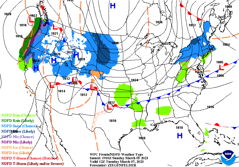
Before we look at raw model output for Wednesday, here is a simplified view of what is going on between Tuesday and Wednesday. You can see the cold front dropping through here down to the Gulf Coast. And then starting to lift northward as a warm front. At the same time, you see that broken beige line out in the Great Plains, that is what we call a shortwave trough (as opposed to a longwave trough), where the lines connecting similar air pressure (in millibars) sort of form a "dip".
If you look closely on the GFS output here you can pick out that trough, that dip in the isobars (lines that connect similar pressure areas). That is why we have moisture returning to the area on Wednesday, looks like enough for rain chances.
And I'm going to keep the rain chances sort of on the lower end at 30% here, that is widely scattered, about a 1-in-3 chance of any one place getting wet. Should see a High in lower 60's, Low in upper 40's. That front on Tuesday is not a strong one, but it should bring a little shot of cooler air.
The main reason I decided to post anything today was noticing in glancing at it on the cell phone that the GFS model has come into pretty good agreement with the pattern the ECMWF was showing yesterday, that I said I agreed more with. It makes for a smoother forecast when the two main global models start to agree somewhat. I'm going to undercut the model guidance just a little bit and only forecast a 40% chance of rain for Thursday. Both models have this system moving slowly on Wednesday and Thursday and increasing our rain chances as it moves along. Should see a High in upper 50's, Low in upper 40's.
Now the GFS agrees with the idea of the front coming through on Friday, where rain chances will go "likely".
The surface Low looks displaced up around the Great Lakes, and model forecasts are showing weak instability around here, so this is looking more like just general rain and thunderstorms. Even though we are in our primary severe weather season, the risk for any stronger storms is looking low with this system now that the models are in decent agreement about what it's going to do.
Looks like we'll have a High in the upper 60's and a Low in the lower 50's.
That front quickly blows through the area with high pressure moving in behind it on Saturday. Skies should be partly to mostly sunny, High in upper 50's, Low dropping to about 40.
Then on Sunday the GFS may be getting carried away again. Brings another system quickly in here.
The ECMWF does not support that scenario and only shows some rain to our South. So for now will mostly ignore that GFS guidance since it did not do well with the overall pattern for this week until today's runs. Yeah, I'm just going to disregard it and forecast a High in lower to mid-50's, Low in mid-30's.
And it looks like this week could bring average rainfall totals of up to about 2 inches for most of us, maybe some locally higher amounts in far Northwest Alabama and up along the Tennessee state border. Even though we have had some rivers at flood stage after Friday's event, the lower-end rain chances this week combined with a swift passage of the cold front on this Friday may prevent any of those problems being aggravated. The threat for any storms becoming severe with Friday's system is looking low. Since we had a rough ride last week, I thought I would bring some better news.


No comments:
Post a Comment