(Forecast)
Sunday (High 70, Low 39): Sunny. Somewhat cold in the morning, mild in the afternoon.
Monday (High 76, Low 49): Mostly sunny. Lightly breezy with increasing clouds at night.
Tuesday (High 75, Low 56): Partly to mostly sunny. An isolated shower or two is possible.
(Extended Outlook)
Wednesday (High 66, Low 47): Partly cloudy with a 30% chance of showers.
Thursday (High 65, Low 51): Mostly cloudy with a 40% chance of showers.
Friday (High 70, Low 54): Thunderstorms likely.
Saturday (High 57, Low 46): Mostly overcast with a 40% chance of lingering showers.
(Notes)
There is a SKYWARN class this Wednesday 6 PM at Trinity Town Hall. And then 6 PM Thursday there is one at Haleyville City Hall. That is the one that had to be rescheduled because of the severe weather potential on February 16.
Two tornadoes were confirmed in Alabama from yesterday, both rated F-1. Nobody got hurt in those, and they only lasted a few minutes. I have not scoured the web for reports, but the only death I heard of from the damaging winds was someone who was in a vehicle when a tree fell on it. That's why I try to emphasize, most of the serious injury or death from storms still happens where it "shouldn't". Like it is easy to prevent most of the time if somebody knows what is going on and has a better plan for how to stay safe. I know there were several injuries yesterday though, some back in Mississippi, remember a tree falling on a home. Seems like there was an injury in Franklin County, Alabama also. Overall I'd say we made it through yesterday's event pretty well. That cap on the atmosphere really helped us out.
(Discussion)
We have had a sunny day in the Tennessee Valley with mild temperatures. It has gotten a little breezy at times, like gusts up to about 15 miles per hour, but obviously very different from yesterday, when a lot of damage occurred from strong gradient winds outside of the actual line of severe thunderstorms. Scott Unger was quite right in calling it a unique event. Today has been very peaceful compared to yesterday, winds generally light and variable. The Low in Cullman was 45. We are at 64 degrees as I write this at about 3:50 PM. That may end up being our High for the day, few hours left to get a degree or two higher if we're going to. The dewpoint is 41, making the relative humidity 43%. Visibility is 10 miles. Winds are from the West at 5 mph currently. And the barometric pressure is 29.99 inches and steady. For some reason they do not include millibars for the Cullman observations, while they do for Huntsville and some other cities. I don't feel like calculating it every time, so I give it in inches of mercury. Plus that's traditional in America. But millibars are what you see on a weather map, and sometimes I wonder if it'd be good to educate the general public about how air pressure is measured and how these conditions at the surface and in the upper atmosphere are used to plot weather maps, and the data is fed into these supercomputer models that predict what the maps will look like in several days, and all that. At times I think maybe it'd be better to quite a blog of weather education (completing the gaps in my own education in the process) than to post forecasts like other people are doing, much less trying to cover severe weather on a more-or-less shoestring budget as far as hardware.
That is a question to be solved in the long-term. For now I'll just tell you about some other conditions around the region. Jasper is at 68 degrees. They had a High of 70 today and a Low of 46. Sunny and 65 in Fort Payne. Also 65 in Huntsville, mostly sunny with North winds of 9 mph. Decatur is sunny and 69. It is sunny and 65 in Muscle Shoals. Gadsden is sunny and 69 degrees. Some of the bigger cities, Nashville is sunny and 62. It is partly cloudy in Memphis and 64 degrees. Birmingham is mostly sunny and 70. Tuscaloosa is sunny and 71. Atlanta is mostly sunny and 69. And Tupelo is sunny and 66. They had a good bit of cloud cover left over earlier in the day.


High pressure is settling over the region now, and it will continue to be a very nice weekend. Unfortunately for some people, they have probably been cleaning up trees today. I heard Brad Travis say yesterday that it is good to pace yourself when doing cleanup work, that some people went at it too hard and suffered heart attacks, especially if they did it the same day, with an adrenaline rush and overworked themselves all at once. That was something I'd not thought about. He served in the military, so has some expertise thinking about factors like that. But on a sunnier note, the next couple days do look nice as well. If you even need to do anything simple like cut the grass, or just play outside with your kids, it is great weather for that, shoot some basketball or whatever.


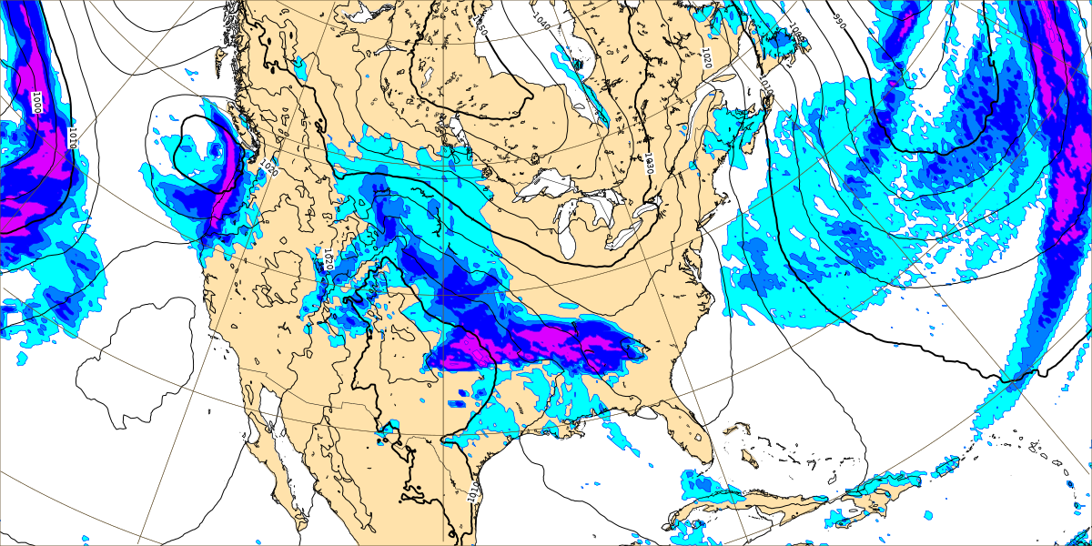
We won't see rain chances until late Monday or after. We'll look at model output in just a moment, but based on what I saw before, I think if we see any rain around here Monday, it will be at night. Even Tuesday the chances were on the low end. But looking at the big picture, more snow in store for the Pacific Northwest, the Rocky Mountains region, up into the Dakotas and parts of Minnesota, also over in New England, places like New York and Maine. As you get into the Great Lakes region, it'll be more of a wintry mix with some ice mixed in. High pressure will dominate our weather until Monday night into Tuesday, and then we get into an unsettled pattern with chances for showers each day.
Tomorrow that high pressure system will continue moving to the East, to the Mid-Atlantic region. We'll see another sunny day, High near 70, Low of about 39-40. So tomorrow morning will be a little nippy compared to what we've had lately.
That high pressure continues to relax its influence on the region and move further up the Eastern seaboard on Monday. Our next system will still be moving into the Midwest. We'll see a little bit of an increase in clouds, but I think the rain will hold off until at least Tuesday morning. Winds will pick up just a little bit.
Not even the NAM is showing any rain around here at midnight between Monday and Tuesday. Will take rain chances Monday night out of the forecast.
That weak front will pass through the region during the day on Tuesday and then more-or-less wash out. We will see a mix of sun and clouds, and any rain we get from it should stay isolated, about a 20% chance or 1-in-5 chance of any one spot getting wet. Should see a High in the mid-70's again, Low in the mid-50's.
Then for the extended period, the weather remains unsettled.
On Wednesday the GFS has quite a bit of moisture moving into the region. This is from a shortwave trough in the Plains sort of riding along the northern side of that stalled, mostly washed-out front down at the Gulf Coast. Eventually another front will push through the region next week or maybe it'll end up even being as late as the week after, depends on which model trends you believe. As usual the GFS is faster, at least as far as Wednesday.
Taking the slower movement from the ECMWF into account (it's often a very accurate model), going to trim back rain chances for Wednesday to 30%. With that front well to our South by then, should see a High in lower to mid-60's and a Low in the upper 40's.
I think the GFS is right in the general idea of keeping the front sort of stalled on Thursday and moisture around here.
But I think the ECMWF has an even better handle on it, moving the system very gradually along Wednesday and Thursday. So for Thursday, will increase rain chance slightly to 40% and forecast a High in mid-60's, Low around 50 or so.


On Friday, that next front really starts to look like it means business out in the Plains/Midwest. This storm system will likely bring some level of severe weather risk to parts of the country. Whether that will end up including the Tennessee Valley is another question. And I'm trending toward no. But I saw where a forecaster from NWS Birmingham wrote that it is too soon to tell, and that is the right answer. The Storm Prediction Center is not issuing any outlooks for any part of the country yet because of how uncertain even the synoptics of this setup are. So it is too early to speculate much on the mesoscale. We do have to watch every system this time of year. Especially as we get into April we'll have to, but sometimes March is pretty nasty too, certainly got a taste of some of that yesterday. And we had quite a few severe weather events early during the Winter months. Which is not unheard of, but it was extra bad this year. It usually slowly tapers off in May, and then we get into Summer.

After looking at this latest run of the ECMWF along with the GFS pattern, I am starting to get a little concerned that Friday or Friday night could end up getting stormy after all. It is too soon to tell if we'll have stronger storms or a severe weather potential, especially with so much uncertainty about the timing of the big picture (synoptic scale - position of fronts, low pressure system, et cetera).
I started to show GFS graphics for Friday and Saturday about a couple of mesoscale parameters like how much unstable air versus wind shear, but that guy from Birmingham was right, it is too soon to be talking about that. For now just need to forecast thunderstorms and admit that we'll fine-tune any severe weather threat (which may not even happen, but it's that time of year, it certainly could) along with adjusting the timing of the forecast when there is not so much model madness going on. Should see a High up near 70 again, Low in the lower 50's. My gut feeling is that we'll see a marginal threat for stronger storms around here. And maybe I should stick with probabilities, but for this forecast, I'm going out on a limb and saying "likely" rain and thunderstorm chances for Friday. The way both models look, I think the front will pass through the region Friday or Friday night. There is uncertainty, but there always is 6-7 days out.


I can see why some other forecasters are going with probabilities though. Maybe I should too. The GFS abruptly slows the system down on Friday.
And the ECMWF blows the system on through here. Since I have to make a temperature shift forecast either way, I am choosing the ECMWF solution for this time period and the forecast period overall. I think the GFS has been smoking too many twinkies for this cycle.
Did decide to show some ECMWF guidance on dewpoints for Friday evening. And it does show values up in the 60's. With a strong cold front, we'll have to watch this period for at least marginal severe storm potential. It is six days away, so really it is too soon to make a call. But for some reason a Saturday afternoon makes me want to be as thorough as possible for the week ahead.
And it looks like between Tuesday and Saturday we could see up to 2-3 inches of total rainfall. This time the higher amounts look likely to happen in places like Cullman, Decatur, Huntsville, North/Central Alabama. We do have some
rivers at flood stage in the region, so if you live in a flood-prone area, you know to keep an eye on that. We are definitely not in a drought at the moment.
Thanks for reading. See you in the funny papers.
6:15 PM - Adding this graphic of highest wind gusts from yesterday, saw it a little late. They only posted it as an image on their webpage, no text product mentioned in their news headlines. Yesterday really was quite a wind event, and I've heard from broadcast media that now the death count is up to at least three from yesterday. Which is too bad. I guess if can find the silver lining, it is a reminder to take a severe thunderstorm warning seriously, or something rare like a high wind warning, even if it is not as exciting (to storm chasers) as a tornado warning. Winds that can damage property can also threaten people's lives. That's just the reality.


No comments:
Post a Comment