(Forecast)
Good Friday (High 60, Low 50): Overcast, cool, and breezy. Periods of rain showers are likely.
Saturday (High 61, Low 51): Overcast, cool, and breezy. Periods of rain showers are likely.
Easter Sunday (High 66, Low 44): Mostly sunny. Staying cool.
(Extended Outlook)
Monday (High 67, Low 45): Mostly sunny.
Tuesday (High 70, Low 47): Sunny.
Wednesday (High 74, Low 49): Mostly sunny.
Thursday (High 76, Low 51): Partly cloudy.
(Notes)
Here is a summary of the April Fools Day Tornado Outbreak. The reason I chose the National Weather Service in Birmingham's page is that they took the time to include links to all the other offices that have done surveys from this event. As you know, the tornadoes and severe thunderstorm damage were widespread that night, March 31 into April 1. So if you would like to read up on the latest surveys, that is a great reference.
I'm going to give these recent events time to cool off before posting more surveys on here. We just had another event in Missouri and Illinois night before last, or some of it happened during the day I believe. There have been several severe weather events that affected our region to some extent lately. And I'd rather wait until the surveys have been completed and everything sorted out to really report on them at length, like I was trying to compile a lot of surveys from different offices before.
If you were not prepared for these severe weather events and would like to be prepared whenever we have the next one, then you might consider putting together a severe weather safety plan. Things look quiet for the next week or so, as far as any risk for severe thunderstorms. But that is the time to make a plan. When it is less stressful to do so. Our severe weather season lasts through the end of May.
The National Weather Service in Nashville is doing Weather101 classes, free to anyone with an interest in weather. The next upcoming class on Monday is about Wind.
(Discussion)
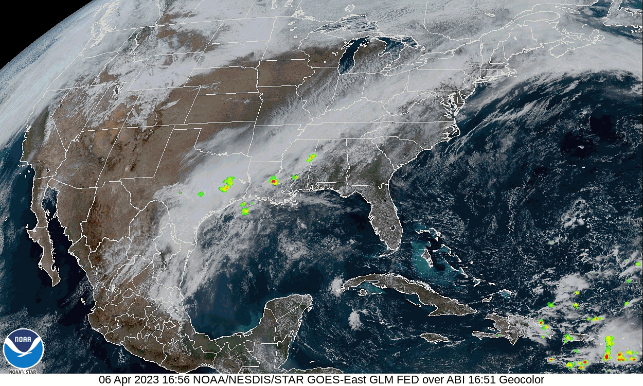
We have some clouds, showers, and thunderstorms moving through the Southeastern United States this afternoon. We are partly cloudy at the 2 PM hour in Cullman with a temperature of 72. The dewpoint is 63, making the relative humidity 73%. Winds are from the North at 7 miles per hour. The pressure is 30.25 inches and steady. Our morning Low was 61.
Elsewhere around the region, Jasper has a thunderstorm, also some fog mixed in with the rain, 66 degrees there, visibility down to 4 miles. Visibility down to 8 miles in Haleyville, where they also have a thunderstorm in progress, a temperature of 67% degrees, also their dewpoint, making the relative humidity 100%.
Fort Payne is mostly cloudy and 79 degrees, Winds from West at 7 mph there. Huntsville is overcast and 72, winds from Northeast at 5. Same for Decatur except their winds are due East.
Winchester is overcast and 64, North winds at 8. Fayetteville is sunny and 64, Northeast winds at 7 mph.
That front is going to stay hung up in our region tomorrow. Periods of rain showers are likely throughout the day with a High near 60 and a Low near 50. May be breezy at times with winds generally from North and East.
The front will start moving slowly through the area on Saturday.
The NAM shows it moving a little quicker than the GFS.
So the rain might be tapering off as we get into Saturday evening and night. But overall it looks like another overcast day with numerous periods of rain showers throughout the day, High near 60, Low near 50 again.
And another breezy day, winds probably shifting more East as the front gets moving.
Then the model guidance shows Easter Sunday being a dry day again, high pressure taking over our weather again even if the center of it is displaced well to our North and East. So any plans you've got for hiding eggs or any other activities outside should be fine for Sunday. We'll see mostly sunny skies and a High in the mid-to-upper-60's. Low should be down in the mid-40's Sunday morning though, so getting up and out early, might be a little nippy, if you've got something like an 8 AM service or thereabouts.
On Monday it looks like that ridge of High pressure settles in strongly over the Southeast. We will remain mostly sunny, temperatures will moderate a little bit, morning Low stays in mid-40's, but the High will get into the upper 60's Monday.
Again on Tuesday it looks like the High and upper-level ridging will keep any disturbances and moisture out of our region. We'll have sunny skies and see a High near 70, Lows edging back toward upper 40's.
There are times when the ECMWF wants to bring some moisture up into at least Southern Alabama, but for now I'm disregarding that. This is a case where I think the American GFS model has a better handle on our weather around here.
And just as soon as I say that, I see the same trend on the GFS for Wednesday. Should not affect us in North Alabama anyway. This has more the look of a pattern you'd see in the summer time.
Should stay mostly sunny around here, Highs getting back up toward mid-70's, Lows rebounding slowly into the upper 40's.
The the GFS as well as the ECMWF want to bring a Low pressure system far enough North to bring us some rain chances for Thursday. I might put in a 20% chance, but may not even do that at this stage. The model guidance has not been particularly consistent with this. And a ridge like this can take a while to break down. So it might end up happening later than Thursday, and models may reflect that on future runs. However the rain chances go, general idea is that we see an increase in clouds on Thursday, High gets well up into the 70's, Low rebounding to about 50.
No signs of any more severe storms any time soon, at least not for the next week or so.
Even the risk for flooding issues looks to stay on the lower end, though we do have a Flash Flood Watch in effect for several counties around here, and some isolated instances of that are possible through Saturday night. If you see water covering the roadway: Turn around, don't drown.


No comments:
Post a Comment