

(Forecast)
Friday (High 82, Low 65): Mostly sunny. An isolated shower or thunderstorm is possible.
Saturday (High 83, Low 64): Mostly sunny. Mild and dry air.
Sunday (High 85, Low 63): Mostly sunny. Mild and dry.
(Extended Outlook)
Labor Day (High 86, Low 63): Mostly sunny.
Tuesday (High 88, Low 65): Mostly sunny.
Wednesday (High 90, Low 67): Mostly sunny.
Thursday (High 92, Low 69): Mostly sunny.
(Tea Leaves Territory)
Friday (High 93, Low 70): Mostly sunny.
Saturday (High 92, Low 69): Mostly sunny.
Sunday (High 93, Low 69): Mostly sunny.
(Beach Forecast)
Friday (High 90, Low 75): Thunderstorms.
Saturday (High 88, Low 76): Thunderstorms.
Sunday (High 89, Low 76): Thunderstorms still likely.
Labor Day (High 90, Low 75): Partly cloudy with a 40% chance of showers/thunderstorms.
Tuesday through Thursday (Highs in lower 90's, Lows in mid-70's): Mostly sunny with a 20% chance of a passing shower or thunderstorm.
(Pronóstico)
Viernes (Máxima 82, Mínima 65): Mayormente soleado. Es posible que se produzcan una lluvia o tormenta aislada.
Sábado (Máxima 83, Mínima 64): Mayormente soleado. Aire templado y seco.
Domingo (Máxima 85, Mínima 63): Mayormente soleado. Suave y seco.
(Perspectiva Extendida)
Día Laboral (Máxima 86, Mínima 63): Mayormente soleado.
Martes (Máxima 88, Mínima 65): Mayormente soleado.
Miércoles (Máxima 90, Mínima 67): Mayormente soleado.
Jueves (Máxima 92, Mínima 69): Mayormente soleado.
(Territorio de las Hojas de Té)
Viernes (Máxima 93, Mínima 70): Mayormente soleado.
Sábado (Máxima 92, Mínima 69): Mayormente soleado.
Domingo (Máxima 93, Mínima 69): Mayormente soleado.
(Pronóstico de la Playa)
Viernes (Máxima 90, Mínima 75): Tormentas eléctricas.
Sábado (Máxima 88, Mínima 76): Tormentas eléctricas.
Domingo (Máxima 89, Mínima 76): Aún es probable que haya tormentas eléctricas.
Día Laboral (Máxima 90, Mínima 75): Parcialmente nublado con un 40% de probabilidad de lluvias/tormentas eléctricas.
De Martes a Jueves (Máximas en los 90 grados inferiores, Mínimas a mediados de los 70 grados): Mayormente soleado con un 20 % de probabilidad de lluvia pasajera o tormenta eléctrica.
(Notes)
If you are headed to the beach any time soon, here are some reminders about how to deal with rip currents safely.
The National Weather Service in Huntsville, along with all the offices that serve Tennessee, have put together a preparedness page in English and in Spanish. Which is why I'm toying around with Spanish forecasts some lately.
Danzig cancelled a show in Houston because of the heat. So we are lucky to be catching a break from it around here.
And while I was reading that story, I also saw that Alice Cooper is catching a lot of flak for some lighthearted criticisms he made about some of the more extreme fringes of the transgender movement. I disagree with Metal Injection jumping on the self-righteous bandwagon to tar and feather him.
Adding this note at the last moment, but the blue moon was lovely last night/this morning. I kind of got sidetracked from mentioning it because of the hurricane. The people I knew of in the path turned out to be safe. And I'm pleasantly surprised at what a low death toll has been reported with this storm so far.


Skies were sunny in the Tennessee Valley today. Had a few fair-weather clouds at times, but mostly sunshine and some pretty dry air compared to what we've had in a while. Winds were generally from the North and light, although we had a little breeze at times during the day. The High in Cullman was 82, and the Low was 61. In Jasper the High was 88 with a Low of 61. Had a High of 82, Low of 61 in Haleyville.
Had a High of 86, Low of 58 in Fort Payne today, with more periods of thicker clouds there at the higher elevation. Decatur saw a High of 85 after a Low of 60. Huntsville saw a High of 85 and a morning Low of 62. Had a few more clouds there than most places today. Muscle Shoals saw a High of 85 and Low of 64.
Elsewhere around the region, Nashville had more periods of clouds and more of a breeze than most. The High there was 81, and the Low was 61. Birmingham was another spot with a fair amount of cloud cover today, compared to most of us. Their High was 87, and the Low was 65. Also a fair amount of clouds in Atlanta today, and winds still variable there, shifting back and forth from Southeast to Northeast. High 86 there, Low 69. Was mostly sunny and breezy at times in Memphis, High of 83 and Low of 63. Sunny skies today in Tupelo with a High of 85 and a Low of 63.
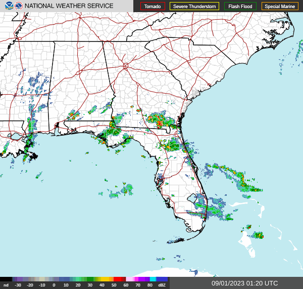
And there sure isn't much rain in the region anymore, not even a whole lot of clouds. What we do have is mainly focused along that weak cold front down near the Gulf Coast. And of course the hurricane is long gone from around these parts. I can think of some places that aren't going to miss Idalia.


Tomorrow a weak inverted trough will bring us some rain chances.

I think the NAM is more realistic than the GFS with this system that will be moving northward into our area from Louisiana tomorrow, keeping the rain chances low.
So only going to forecast a 20% chance of rain, and that means most places stay dry, but isolated showers are possible across the map. We might see enough instability for some thunder and lightning too, but some places probably just get plain old rain. And it's looking pretty mild again, lower 80's, estimating a High about 82 with a few more clouds around, Low of about 64 or 65 tonight.


Given how quickly the GFS (shown here) and the NAM are wanting to bring the next bit of high pressure in here on Saturday, not going to include rain chances then after all. Expecting mostly sunny skies, High of about 82-83 again, Low of about 64-65 again.


Staying mostly sunny on Sunday with a High in the mid-80's, Low in the lower 60's. The air staying mild and dry.


Basically the same thing for Labor Day, though the high pressure system does shift over to the East Coast, and our High may edge into the upper 80's again.


Even though that high pressure system may shift around a little bit from one day to the next, it's not going anywhere fast, staying around here on Tuesday. We should remain mostly sunny, little to no chance of rain, High in the upper 80's, Low in the mid-60's.


Temperatures continue to warm back up on Wednesday of next week, may even make it back to 90 degrees, the Low again in about the mid-60's. Humidity levels staying low.


Then Thursday, looks like a High of 90 or so, Low in the upper 60's.


Several systems in the tropics, so let's take them one at a time.
That low pressure area just West of the Cabo Verde Islands is on the verge of becoming a tropical cyclone, but it's questionable how it will sustain. Current movement is more toward the Northwest at about 10-15 miles per hour.
Then in the Central Atlantic, we have the remnants of Tropical Storm Gert, which might develop into something again, but if so, should be short-lived, this little mess of showers and thunderstorms is drifting Northeast. The upper-level winds will hinder it over the weekend.


Tropical Storm Jose' is not going to last long.


And that's because of the outflow from Hurricane Franklin, which is expected to gradually weaken and then dissipate over this weekend into next week as it moves Northeast over open waters.


The ill-defined remnants of Idalia have prompted a Tropical Storm Watch for Bermuda, which should feel some impacts this weekend. I don't really worry about them too much, because they have far better preparedness than we do over on this side of the pond. But even for a system that has become this weak, tourists that way might want to make a note of that, that tropical storm conditions are possible from this.
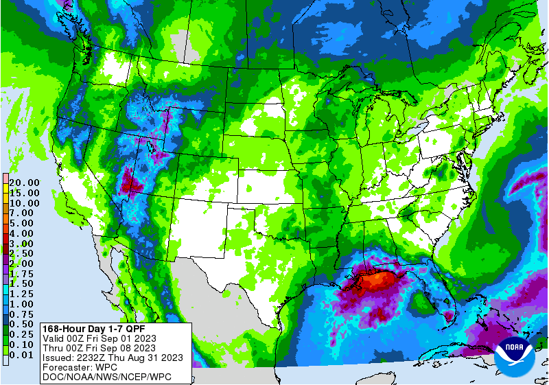
Around here, our rainfall totals should be very light, probably staying at less than a tenth of an inch for this forecast period. Most days we're not going to see any rain.
If you like reading this blog, please feel free to leave a comment or even buy me a coffee. If you don't like reading it, scram.


No comments:
Post a Comment