

(Forecast)
Today (High 60): Sunny. Cool.
Friday (High 60, Low 32): Mostly sunny. Cool.
Saturday (High 59, Low 39): Partly cloudy and breezy. Isolated showers are possible during the day, becoming more numerous at night.
(Extended Outlook)
Sunday (High 56, Low 45): Mostly cloudy with a 40% chance of showers.
Monday (High 52, Low 40): Mostly sunny.
Tuesday (High 53, Low 30): Sunny.
(Notes)
Here is the latest on the Tennessee tornadoes of December 10th. There were also some damaging winds in some severe thunderstorms that spun up a couple tornadoes closer to Birmingham that night.
There was a great discussion of this on the Weatherbrains podcast this week, with Sam Shamburger and Kevin Laws as guests.
Out of all the charitable gestures I saw online for storm victims and survivors, I'll simply link to the one I feel certain is legit.
(Discussion)
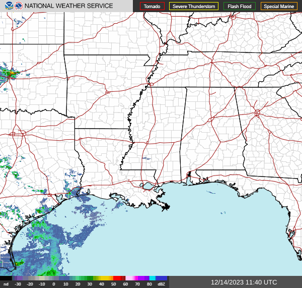


At 6 AM, the latest observations from Cullman show light rain and haze, visibility down to 3 miles. The temperatures is 45 degrees, with a dewpoint of 32, making the relative humidity 61%. Winds are from the Northeast at 7 miles per hour. The pressure is 30.62 inches and rising.
And I think that observation is messed up. There is no indication on radar, satellite, or any of the weather maps to indicate this. I don't see any light rain or haze out the window either.
At any rate, skies are clear in Jasper with perfect visibility. The temperature is 30 degrees, dewpoint is the same, making the relative humidity 100%. Winds are calm. The pressure is 30.61 inches and rising.
Skies are also clear in Haleyville with a temperature of 34. The dewpoint is 32, making the relative humidity 92%. The winds are calm. And the pressure is 30.62 inches/1036.7 millibars and rising.
The high pressure in place over the Ohio Valley will bring us another sunny day today with a High near 60.


That high pressure will continue to push North and East tomorrow, and around here we will stay mostly sunny, a High near 60 again, the morning Low down in the lower 30's, around freezing.


The GFS has gotten back on the idea of bringing a low pressure system up from the Gulf of Mexico this weekend.

The timing is less aggressive on the NAM, which the ECMWF has been showing for days, slower timing.
Still is reasonable to put a minimal 20% chance of rain back in for Saturday. And it'll be a breezy day. Should see a High near 60, Low near 40.


The NAM has it down in Florida.
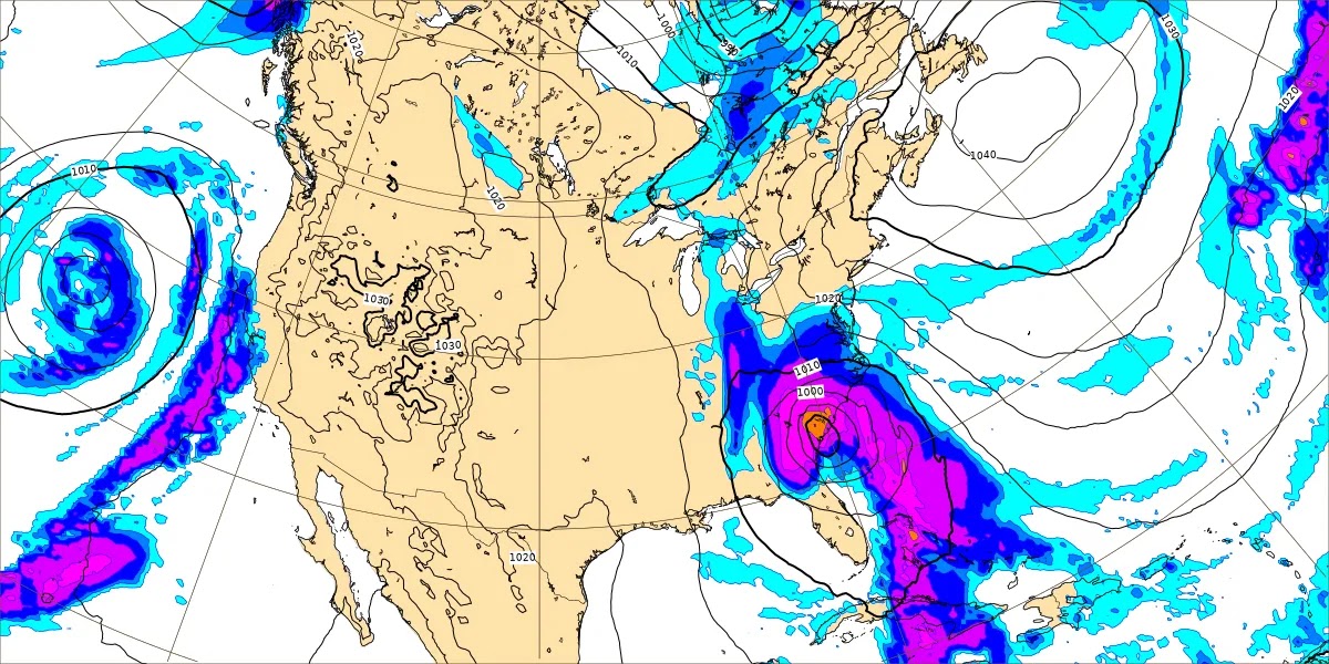
And the ECMWF brings it more through Georgia.
Regardless of the exact track, increase rain chance to 40% for Sunday, High in 50's, Low in 40's. And it looks like another blustery day. As we get into Sunday evening/night, rain should gradually end from West to East.
A lot of the rain will probably come at night, between Saturday and Sunday.


Then on Monday, northwest wind flow aloft sets up, and we have high pressure out in the Plains up through the Dakotas. We'll be mostly sunny here with a High in lower 50's, Low near 40.


That high pressure will be moving through the Ohio Valley on Tuesday. We'll have sunny skies and a High in lower 50's again, but the Low closer to 30 as drier air has had time to set up again.


Then basically the same thing next Wednesday, plenty of sunshine and starting the day around 30 degrees, but then warming to about the mid-50's this time.
Some people are already speculating on Christmas, but this time I think I'll refrain, at least for this morning. Seven day forecasts are challenging enough if you do one right. And I've been really sick lately. Have to use energy wisely.
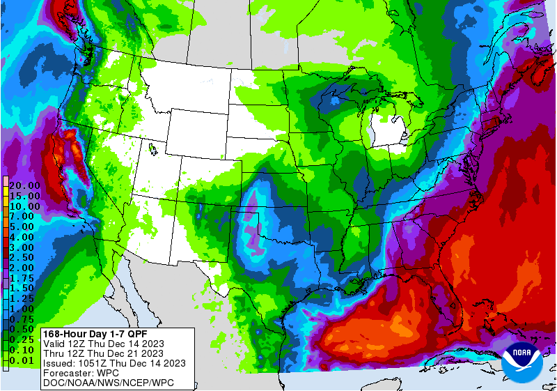
Rainfall totals could be anywhere from a quarter-inch to about two inches for this forecast period, the higher amounts tending to be over far Northeast Alabama, according to the latest WPC guidance. Of course, you saw how the models still can't decide where to move this low pressure system from the Gulf. Its placement will make a big difference in who gets significant rain or not.


No comments:
Post a Comment