Tuesday (High 50, Low 40): Rain showers likely in the morning. Staying mostly cloudy and windy through the evening and night hours.
Wednesday (High 46, Low 30): An isolated, lingering shower is still possible in the early morning. Otherwise mostly sunny with lighter winds and seasonably cold air.
Thursday (High 56, Low 29): Sunny. Seasonably cold.
Friday (High 64, Low 41): Rain likely - storms possible.
Saturday (High 44, Low 25): Sunny.
Sunday (High 45, Low 22): Sunny.
Martin Luther King Jr. Day (High 43, Low 28): Increasing clouds with a 40% chance of showers.
We are under a Wind Advisory tonight and tomorrow.
At 2:15 PM skies are fair with only a few clouds around in Cullman. The temperature is 52 degrees. The dewpoint is 27 degrees, making the relative humidity 38%. Winds are from the Southeast at 14 miles per hour, with higher gusts up to 25 mph. And that is only going to get worse as we get into tonight, with some really strong wind gusts possible, perhaps enough for at least isolated instances of power outages and/or tree damage. The pressure is 30.01 inches and falling.
So this next low pressure system is moving our way out of the Plains, also an occluded front, very strong system. It is bringing a snowstorm well to our North and to our South along the Gulf Coast, bringing potential for severe weather today and tonight.
Around here we just expect some strong winds and heavy rain tonight into tomorrow. Most of the rain probably falling tonight.
Most of the rain tomorrow should be in the morning, then most of us will just have some clouds hanging around and still some strong, gusty winds. These are gradient winds from the strong low pressure system. The High tomorrow should come early in the day, around 50 degrees, and then fall to around 40 degrees before the day is through. So the temperatures are going backwards tomorrow. Happens a lot this time of year.
If we did see any snow flurries tomorrow night, it is not expected to accumulate, with this much rain beforehand, strong winds, borderline temperatures, and a dicey setup. Even in the Northern Cumberland Plateau up to the Kentucky state line, any accumulations are expected to stay under a half-inch.
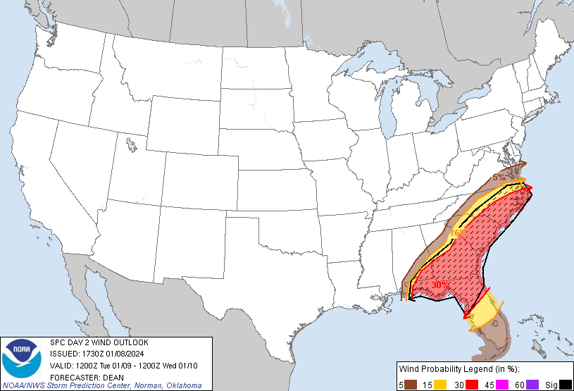
The severe weather threat will stay down near the Gulf Coast, but the threat for damaging winds and some tornadoes down that way is fairly substantial. Someone could get hit hard with damage in a setup like this.
Tomorrow that risk shifts further East, up into the Carolinas even.
The winds will settle down on Wednesday behind this system. We'll see mostly sunny skies around here with a High near 46 and Low near 30.
Then sunshine again on Thursday, high pressure over the region, starting the day around 30 degrees again and this time warming to about the mid-50's or so for the afternoon.
Then another strong system moves in on Friday. Rain is likely with a High in the lower 60's and Low near 40. We'll have to watch the instability to see if the unstable air gets far enough North for us to have much a risk of thunderstorms with this.
The Storm Prediction Center has outlooked a basic 15% risk for severe thunderstorms both Thursday and Friday. Friday is when the risk area clips North Alabama. And we'll have to see where that boundary sets up for the warmer, more unstable air. Looks like we'll have plenty of wind shear and lift with this next system too. With the one tonight/tomorrow, we are fortunate for the unstable air to be staying well to our South, but we might not be as lucky Friday, just something to watch. More likely for Central and South Alabama to have issues, but people in North Alabama or even up along and North of the Tennessee line should keep an eye on this just in case.
Then on Saturday, that front is through the area. And we'll see sunny skies again, a High in the lower 40's and the morning Low plummeting quickly to the mid-20's.
Might have to watch a little more with this one, for any wraparound snow showers Friday night/Saturday morning, at least in Tennessee counties. But even if that happened, nothing looks like we'd have to be concerned with any significant accumulation around here.
Then Sunday is another sunny day with Highs struggling to reach the mid-40's, morning Low down in the upper 20's.
And with that colder air in place, our next system approaching on Monday could get more interesting than these other two. Certainly for Tennessee up into the Ohio Valley and Great Lakes region, the potential for accumulating snowfall will have to be monitored.
Even this far out, on the Alabama side, I have some concern for a wintry mix, and am already wondering if it can accumulate. But there are so many unknowns with two other systems to get out of the way first, two strong storm systems. And the timing is uncertain. Right now the precipitation looks most likely to come in late Monday into Tuesday, but a week in advance, it is hard to nail down the timing when the models are already trying to predict two other systems first. The atmosphere behind either system has an effect on how the rest of the forecast should go. This is a very active pattern we are in with lots of uncertainties. And we have to live with that. It is something to watch in case this trend continues. It certainly has my attention.
For right now, introducing a 40% chance of precipitation for Monday with a High in lower 40's, Low near 30.
Rainfall amounts will probably come out to about 2-3 inches for most of us during this forecast period.
Now tonight, most of us will just get beneficial rain (and the strong, gusty winds), but we do have a low risk of a few places having issues with flash flooding, with so much rain coming in at one time. Just be aware that some potential does exist for that. Never drive into water that covers the road.
The snow accumulations with this first system are expected to stay in the Northern Plains, the Midwest, up through the Great Lakes and into Canada, with even New England, especially Maine, likely to see significant snow accumulation from this. Some of these places could see a foot of snow.
If we see anything like that around here, first of all, the odds are against it being a major snowstorm like they get in the Midwest, but if we see any meaningful snow accumulations around here, it'll be next week, not this week.
By the way, an interesting note about Martin Luther King Day this year: It falls on January 15th, which was the man's birthday.


No comments:
Post a Comment