Wednesday (High 46, Low 30): Mostly sunny. Breezy and seasonably cold.
Thursday (High 57, Low 31): Mostly sunny. Seasonably cold.
Friday (High 63, Low 44): Rainy and windy. Isolated thunderstorms are possible, and where they occur, could become strong.
Saturday (High 44, Low 25): Sunny.
Sunday (High 43, Low 22): Mostly sunny.
MLK Day (High 40, Low 27): Partly to mostly cloudy with a 40% chance of showers.
Tuesday (High 30, Low 15): Mostly sunny with a 20% chance of showers.
It would be a good time to review your Winter Weather Preparedness. Regardless of whether we see any wintry precipitation, next week does look like the coldest air so far this season, and some of the coldest in a few years maybe.
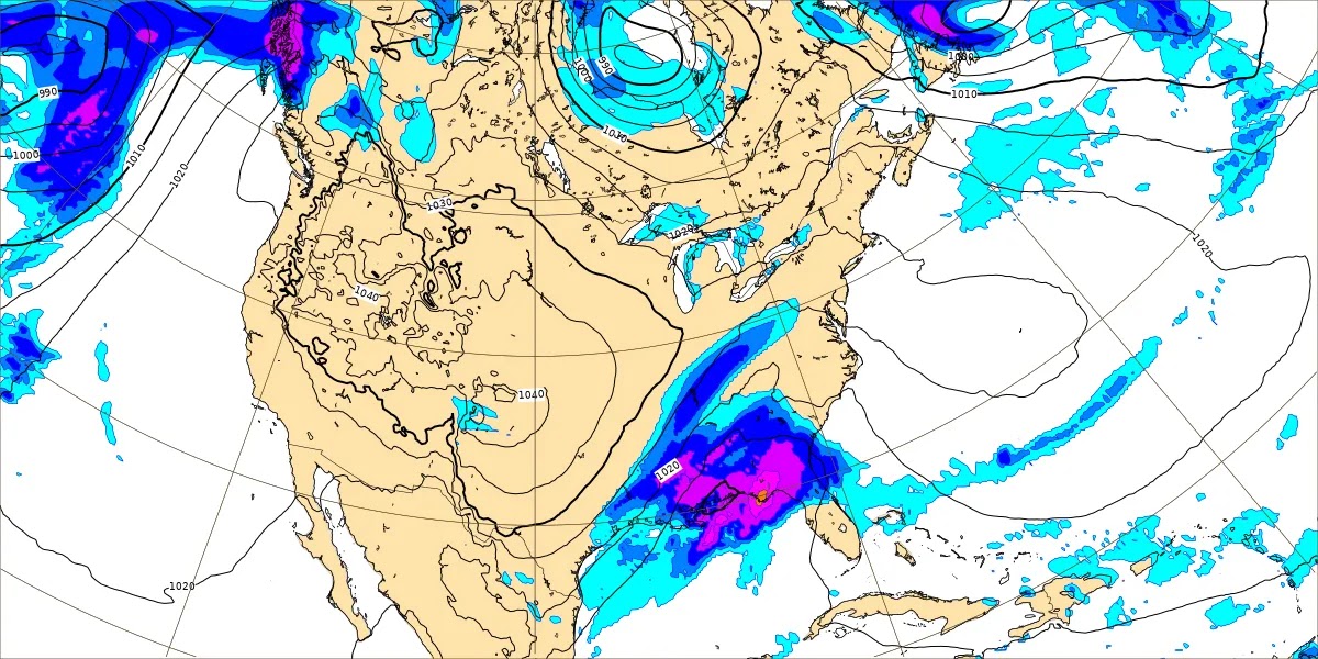
Here at 3:30 PM latest observations show overcast and windy conditions in Cullman, winds sustained from the West/Southwest at 15 miles per hour, with higher gusts to 23 mph still. The temperature is 43 degrees. The dewpoint is 36, the wet-bulb temperature is 40, and the relative humidity is 76%. Visibility hasn't always been the best on a day like today, but at the moment is 10 miles and has been for about the past hour. The pressure is 29.45 inches and rising. If you think that pressure is unusually low, you are right. This was a strong low pressure system, and that's why we've had these kinds of winds. We were fortunate to have stable air, or we would have dealt with similar issues to what South Alabama into Florida did last night into today, severe thunderstorms and tornadoes.
It is 43 degrees in Jasper under overcast skies. The dewpoint is 36, and the wet-bulb temperature is 40. So the relative humidity is 76% there too. Winds are West-Southwest at 14 mph, with higher gusts to 28 mph. The pressure is 29.50 inches and rising. Visibility is 10 miles.
And it is overcast and 39 degrees in Haleyville. The dewpoint is 32 degrees. The wet-bulb temperature is 36. The relative humidity is 75%. Winds are WSW at 16 mph, gusting to 24 mph. Visibility is 10 miles. The pressure is 29.49 inches and rising.
Well this post got majorly delayed. But at least now the rest of the 18Z GFS will be in. So when I was originally writing, you could see that the clouds were hanging around here, but the front and the Low and the storms had moved to the Mid-Atlantic, where they were continuing to have severe weather problems.
And now at 5:30, a few hours later, we still have some wraparound showers going on, more so up in Tennessee.
And some of it on the Tennessee side is falling as snowflakes. Not expecting any accumulations with these winds and the overall conditions, for most places, but parts of the Cumberland Plateau could see light amounts of generally under a half-inch.


And I actually just saw on social media where they've had some sleet in Hamilton, Alabama. But again, conditions are not right for any significant accumulation. Saw a note that the sleet was melting there in a few minutes. Anyway our weather tomorrow will be dominated by some high pressure in the Gulf of Mexico. And we could still be a little breezy tomorrow, winds could get up to about 15 miles per hour, but not windy like today and last night. I forget the exact location, but I saw last night where a tree fell on a mobile home in Cullman County and came close to hitting some people who were in bed, but ended up missing them. And the wind was roaring where I was sometimes. Probably had some gusts in the 40-50 mph range. Should have mostly sunny skies tomorrow, High near 45, Low near 30.
Then on Thursday the high pressure will shift East, and we will still have mostly sunny skies, a High in the mid, maybe upper 50's, so about 56. And the Low in about the 30-32 range.
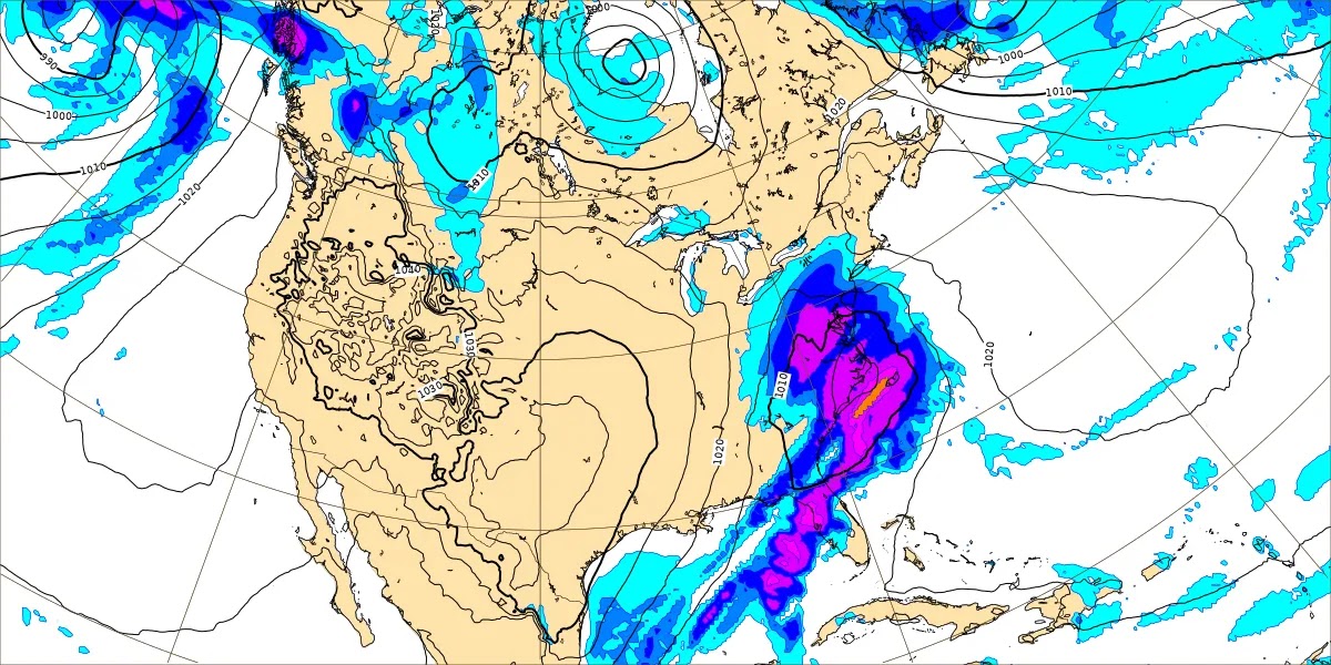
Friday is our next day to really watch. Another strong low pressure system and front is coming into our region, and some of the rain may start Thursday night from it. The upper-level trough is going to be negatively titled, which is something we look for when considering how stormy the weather could get.


Looks like on Thursday the severe weather potential will stay to our South and West. But on Friday, it is a close call, how far North the unstable air can get to support any thunderstorms becoming severe. There is plenty of wind shear and a great source of lift, the other two ingredients we'd need for severe weather. Most of the threat may stay focused on Central and South Alabama, also into Mississippi, Georgia, and up into the Carolinas. But those of us in North Alabama need to keep an eye on how things trend between now and then. We can have severe weather this time of the year and really any time of the year. We had some this past summer that was more organized than usual. This time of year, usually if we see any surface-based instability with a setup like this, there are going to be some problems.


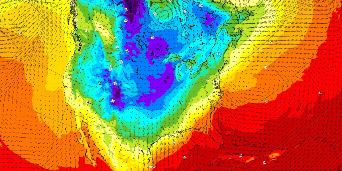
Even during the peak heating hours, the NAM is barely showing any instability around here on Friday, less than 500 j/kg, closer to 200-300 j/kg. And that usually is not going to be enough to work with.
The SREF also is showing CAPE values struggling to reach that baseline of even about 500 joules to work with.
And what really makes me want to lean away from the idea of severe weather up this way is if these dewpoint forecasts verify. If our dewpoints are still going to be down in the 50's, then I'm not going to worry about it at all.
Anyway Friday does look rainy and windy, a High in the lower 60's and Low in the lower-to-mid-40's. Whether or not we see thunderstorms is dicey, and I tend to think the severe weather threat will stay to our South. But let's keep an eye on it anyway to be on the safe side.
Then that system moves on by quickly, with high pressure behind it. Because of how fast it is moving, I don't expect any problems even if we did see some wraparound snow showers on the back side of it. Even far up into Tennessee, I just don't see it being a problem. But the temperatures will plummet quickly, and we'll start Saturday in the mid-20's. Probably still be a breezy day, just not as windy as the night before, sunny skies, but temperatures only warming to the lower 40's by afternoon.
Then Sunday is another mostly sunny day, High in the lower 40's, and with dry air in place, the morning Low should get down into the lower 20's, really cold morning.
Then Monday is the day there's been some buzz about. It looks like the GFS has slowed down the timing as well as the ECMWF has. Here we are at Noon with plenty of cold air in place but no precipitation.
Actually we're just not going to get much good out of that basic graphic showing moisture. About to show another that works better in this scenario.
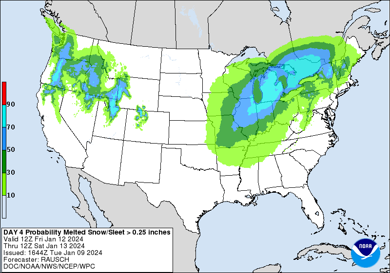
But even with this product showing precipitation rate and type, we see very little chances at snow here, between Noon, 6 PM, and Midnight. Looks like more of a cold rain event.
The ECMWF shows us covered up in precip at Midnight through Daybreak Saturday, then it moving out by Midday.
But the temperatures are looking borderline for wintry precipitation. This looks more like a wintry mix at most.
Anyway it looks like the middle of the month is going to be the influx of Arctic air that a lot of people have been waiting on. Regardless of how much precipitation we see or what kind (right now I'm leaning toward it being a mix of rain, snow, and maybe even some ice), the High will struggle to get up to 40 on Monday. And then on Tuesday, we'll struggle to get up to 30 degrees, with a Low down in the 10's.
Going to forecast a 40% chance of precipitation for Monday and 20% for Tuesday with a note that skies will be clearing and becoming mostly sunny after Tuesday morning, if the timing goes the way the models currently show.
It is more challenging to forecast two systems in a row. But after the Friday system is out of here, we'll be within two days of the Monday event. So have to work with what data is available. Sometimes it isn't nice and neat, one system at a time.
A word to the wise: If you want to stock up on stuff in case of any problems (like power outages and/or roads being closed) for the Monday/maybe Tuesday event, some things that make more sense to stock up on are canned foods or other food that you can open and prepare by hand. Peanut butter and crackers are great. Drinks are good, guess bottles of water are best. Though I guess the thought of snow takes me back to school days, when I loved those YooHoo cartons. I heard a forecaster say he kept cans of that around during snow events, so I tried it one time when it did snow, and hey, it was still great. If you've got a taste for potted meat, vienna sausages, or sardines (and not everybody does), then it's a good time to stock up on that kind of stuff. It's funny to me how many people stock up on milk. Like a dollar store clerk said to me one time, if the power goes out, that's the first thing that's gonna' ruin. Except she said it like "RURN" in a tone of absolute contempt and sarcasm.
To get serious again, if you're concerned about the power going out, it is still nothing to panic over. Just take reasonable precautions. One thing I did over the past couple years was buy a really good sleeping bag that stays warm even if there is no heat. And I had to use it one weekend when I couldn't get the heater fixed and it was brutally cold. Sometimes warming centers open up ahead of time if there is a need for them. But if you're staying home and afraid of losing power during a winter weather event, then you need to focus on the things that will really help you out. Foods that can't spoil, that you can open by hand, easy to fix, bottles of water are good ideas. If you've got a battery radio and/or flashlight, that can come in handy. Some people have those old-fashioned kerosene lamps, but even if you don't, you might have candles in the house. Before a winter weather event or a bad shot of cold air that's going to last a while, it is a good idea to make sure everybody in the house has all the medicines they might need for the next week or two, just to be on the safe side. Double check that you've got first-aid supplies in case you were to need them. A lot of this is common sense, but it gets lost in the hustle and bustle of life.
Hopefully that link I provided above gives better advice than I can rattle off the top of my head.
And maybe we won't have major issues Monday or Tuesday. It's something to watch. It's definitely got everybody's attention. But even during a blast of cold air like we're due for next week, the times we don't see any snow or ice, there are times when people lose power because the grid gets overworked, so many people using juice to heat their homes at the same time. I remember last year around Christmas, a lot of North Alabama did "rolling blackouts" where the company shut off people's power for a brief period, then shut off another area's power briefly . . . just to save the energy. So it is good to be prepared even if a major power outage would be unlikely.
It is too soon to make that call for Monday and Tuesday. It's a week away. If you want to prepare, I think that's great, but it doesn't have to be in a frantic way. And a lot of the stuff people buy doesn't make sense if there was a snow or ice storm coming anyway. So I hope readers here will buy stuff that will actually help if the power goes out and any roads are too slick to drive on. And like I say, we really don't know yet what we're getting Monday into Tuesday. Just know that some seriously cold air is coming in and that at least a mix of wintry precipitation is a real possibility.
This has taken an insane amount of time to finish writing. I can't even remember the last time I've had so many delays, other stuff coming up, while trying to write up a simple weather forecast. Not that this one is all that simple.
We could see about another inch of rain during the rest of this forecast period. Most of it would be on Friday of course.
The Weather Prediction Center does show a slight chance for light snow accumulations Friday night, mainly on the Tennessee side, but also possible around Muscle Shoals. I really doubt this will verify, but am showing it anyway.


However, I do have some concern about Monday into Tuesday. I don't know how much will be snow, freezing rain, sleet, or just plain old rain. But the situation does look somewhat concerning for wintry accumulations, even being still about a week away. I would keep an eye on the latest forecasts, and not go into any sort of a frenzy, but make some reasonable preparations between now and then. If nothing else, make sure everybody around you can stay warm and has a way to get water (or something to drink) and a little food. And of course that includes pets. My cat, Salem, is mad at me lately for not being able to go outside. But then when I open the door and he meets a cold wind, he doesn't want to go out anyway. I guess he thinks I can turn up the thermostat out there.
One good thing if we have any issues with snow Monday is that kids will already be out of school for the holiday. And this year, it actually falls on Martin Luther King's birthday.


No comments:
Post a Comment