

(Forecast)
Friday (High 32, Low 28): Partly to mostly sunny. Breezy and very cold.
Saturday (High 24, Low 10): Sunny. Breezy and bitterly cold.
Sunday (High 40, Low 7): Sunny. Still lightly breezy, very cold in morning, going above freezing in the afternoon.
(Extended Outlook)
Monday (High 51, Low 20): Mostly sunny.
Tuesday (High 56, Low 35): Partly cloudy with a 30% chance of showers.
Wednesday (High 63, Low 42): Partly to mostly cloudy with a 40% chance of showers.
Thursday (High 67, Low 48): Partly to mostly cloudy with a 50% chance of showers/thunderstorms.
(Pronóstico)
Viernes (Máxima 32, Mínima 28): Parcialmente a mayormente soleado. Ventoso y muy frío.
Sábado (Máxima 24, Mínima 10): Soleado. Ventoso y terriblemente frío.
Domingo (Máxima 40, Mínima 7): Soleado. Todavía hay algo de brisa, mucho frío por la mañana y temperaturas por encima del punto de congelación por la tarde.
(Perspectiva Extendida)
Lunes (Máxima 51, Mínima 20): Mayormente soleado.
Martes (Máxima 56, Mínima 35): Parcialmente nublado con un 30 % de probabilidad de lluvias.
Miércoles (Máxima 63, Mínima 42): Parcialmente a mayormente nublado con un 40 % de probabilidad de lluvias.
Jueves (Máxima 67, Mínima 48): Parcialmente a mayormente nublado con un 50% de probabilidad de lluvias/tormentas eléctricas.
(Notes)
There is a Wind Chill Advisory that includes Cullman.
And there is a Winter Weather Advisory that includes places like Decatur, Huntsville, up into Tennessee, for the potential of freezing rain.
(Discussion)


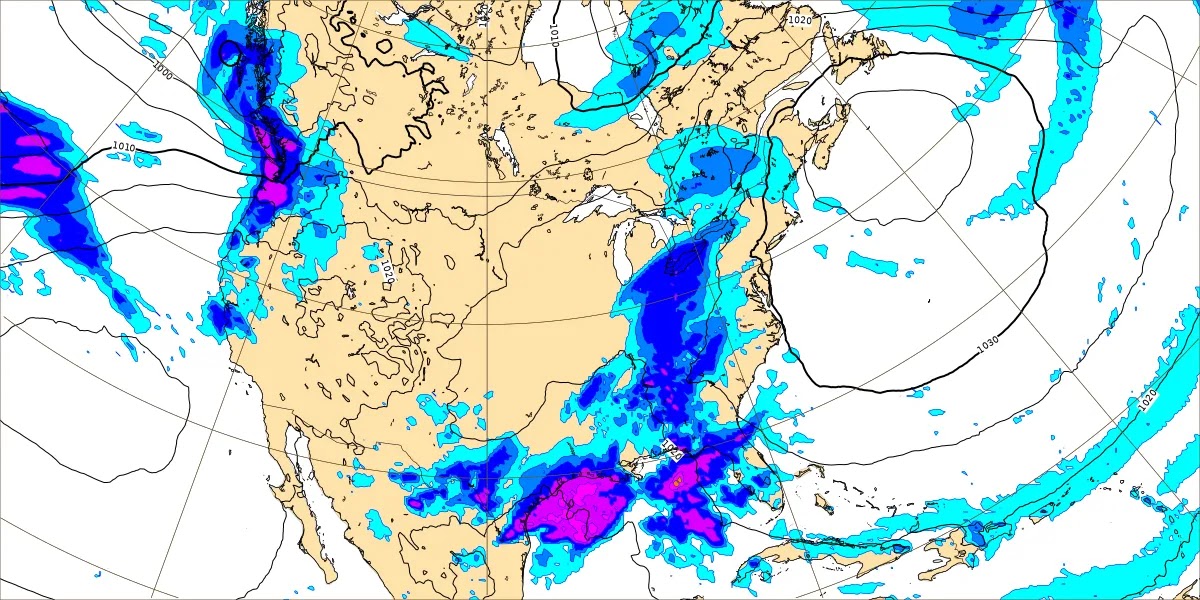
We've got plenty of clouds and some light showers moving through the region with this next cold front. This is a clipper system, and while amounts are expected to remain light, a tenth of an inch of rain or less, the rain could freeze in some places.
We've got fog and mist and some type of rain falling in Cullman this evening, 39 degrees with a South wind at 10 mph. We have had an overcast, breezy day, with a High of 41 and Low of 19. Jasper had a High of 41 and Low of 14 today. They are back down to 39 with light rain and fog there. Also light ran and fog in Haleyville. Their current temperature of 34 is going to be the High, and this morning's Low was 22.
Fort Payne saw a High of 44 and Low of 13. Gadsden had a High of 48 and a Low of 12. Decatur had a High of 40, Low of 22. Huntsville had a High of 40 and Low of 18. Muscle Shoals saw a High of 38 and Low of 17. Tupelo saw a High of 36, Low of 24. Memphis has light freezing drizzle at the 3 PM hour, and the visibility is down to 3 miles there. Their High today was 41, and the Low this morning was 25. And Nashville had a High of 34, a Low of 16.


Cold air will filter in here behind this front tomorrow. Well, we are already in a cold airmass, but air is coming in behind this front that is even colder again. Expecting partly to mostly sunny skies. The Low tonight should get to about 27, and then tomorrow's High should only be at about freezing, around 32 degrees. And we'll have a North/Northwesterly breeze about 10-20 mph that will make it seem colder, less than 20 degrees in many places through much of the day.


On Saturday the center of high pressure will be moving through the Midwest. We will have another very cold day, starting about 10 degrees and only warming to about 25 degrees by afternoon. And it will stay breezy, North breeze. There could be times Friday night that the wind chill value goes below zero.


The center of high pressure moves through the Ohio and Tennessee Valleys on Sunday. While we are under that ridge here in the TN Valley, notice that our upper-level winds turn back to the Southwest. This will allow a little bit of warming. We will still have a little bit of a breeze, not as much as the past couple days, so be aware of that, the wind chill could still be a factor. And the morning will be bitterly cold again, around 10 degrees or maybe even dipping into the single digits. But then in the afternoon, we warm to about 40 degrees. And that should allow a lot of this ice accumulation to finally melt. Something we've been waiting a week on.


Monday looks like still more sun than clouds as the high pressure shifts off toward the Atlantic coast. Notice we have yet another system out to our West, but this one isn't going to produce any winter weather mischief for us. Monday we should get up to about 50 degrees for the High, but the morning will still be cold, about 20 degrees or so for the Low.


This next front will bring some rain in here Tuesday, and for now will keep this in the forecast as just scattered rain, about a 4 in 10 chance of any one spot getting wet. The High should be in the 50's, mid-50's, Low in the mid-30's. Air looks too stable for much thunder but also too warm for any winter weather worries this go-round.


We do see some model disagreement by Wednesday where the GFS wants us to only have scattered rain.
And the ECMWF shows the rain much more widespread.
Will blanket both days with a 40% chance of rain for now. Wednesday the High should climb into the lower 60's and the Low rebound well into the 40's, maybe even upper 40's.


Then that pattern continues for Thursday. Here is the GFS showing limited rain chances.

While the ECMWF has us covered up in rain.

And here is a look at the GEM for Wednesday morning, right in the middle of this unsettled pattern, and it favors the European solution. The Canadian model seems to be more useful in the winter time, but that could only be my imagination.
Looks like upper 60's for Thursday and a Low near 50. With a pattern this unsettled even seven days out, I'm not going to hazard a guess at ten days out this time.


May have to watch for a few stronger storms on Thursday, but Tuesday and Wednesday, the air looks too stable for that. Even Thursday, any threat of stronger storms looks to be on the marginal side, taking a forecast sounding from down in Walker County. As usual this time of year, limited instability is the main factor.

It does look like this round of rain next week will help our drought some more. Rainfall amounts up to 2 inches should be common, and some parts of West Alabama could see closer to 3 inches of rainfall between now and next Thursday.
Be careful if you have to drive while the roads are still slick. Warm wishes, thanks for reading.
Also thanks to all the power companies like Huntsville Utilities, Decatur Utilities, and Cullman Electric Co-Op for working with the TVA to help us all stay warm and have running water during this unusual cold spell and the ice/snow problems we've had. I am pretty sure I saw posts from all three of those local companies talking about restoring power to some customers at times. But most customers kept power the whole time. As a customer, I appreciate all their hard work and their being smart about things.


No comments:
Post a Comment