FORECAST:
Thursday (High 78, Low 50): Partly to mostly sunny. Isolated showers are possible at night.
Friday (High 81, Low 60): Partly to mostly sunny. Warm and breezy.
Saturday (High 81, Low 61): Mostly sunny. Warm.
EXTENDED OUTLOOK:
Sunday (High 82, Low 61): Mostly sunny.
Monday (High 81, Low 62): Partly cloudy with a 20% chance of showers/thunderstorms.
Tuesday (High 80, Low 63): Partly to mostly cloudy with a 30% chance of showers/thunderstorms.
Wednesday (High 83, Low 58): Mostly sunny.
PRONÓSTICO:
Jueves (Máxima 78, Mínima 50): Parcialmente a mayormente soleado. Por la noche son posibles chubascos aislados.
Viernes (Máxima 81, Mínima 60): Parcialmente a mayormente soleado. Cálido y ventoso.
Sábado (Máxima 81, Mínima 61): Mayormente soleado. Cálido.
PERSPECTIVA EXTENDIDA:
Domingo (Máxima 82, Mínima 61): Mayormente soleado.
Lunes (Máxima 81, Mínima 62): Parcialmente nublado con un 20 % de probabilidad de lluvias/tormentas eléctricas.
Martes (Máxima 80, Mínima 63): Parcialmente a mayormente nublado con un 30% de probabilidad de lluvias/tormentas eléctricas.
Miércoles (Máxima 83, Mínima 58): Mayormente soleado.
NOTES:
Here are some reports of damaging winds and hail from a few thunderstorms that became severe, or others that came close, late last week. The severe activity was isolated, but it did happen even around here.
The National Weather Service in Nashville is still doing Weather101 classes, free and enjoyable. Looks like they are doing rip currents, tsunamis, and hurricanes next month.
Meanwhile the Huntsville office has compiled a review of last year's significant weather events.
And the Birmingham NWS offers a look back at the tornado outbreak of April 15, 2011. This actually felt like a big deal until the far worse outbreak that occurred a couple weeks later that year. This one mainly affected Central and South Alabama though.
As usual, if anyone has any feedback on the attempts at Spanish, please feel free to leave a comment or send me an e-mail. I put a lot of effort into that when I do it, but like the meteorology, it is mainly self-taught. So there are going to be gaps in my knowledge. Usually I use Google Translate and then fix all its mistakes. Seems like a natural extension of fixing all the mistakes these computer models make in forecasting the weather and trying to read between the lines, figure out what it's really going to do.
DISCUSSION:
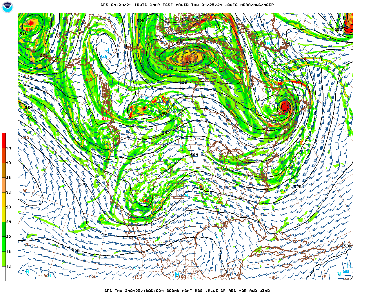
Overall it has been a mostly sunny day in the Tennessee Valley, a light breeze at times as we've had a weak cold front moving through the region. Most of those clouds on the satellite imagery look like cirrocumulus and cirrostratus, if my eye has become trained over the years. If not, feel free to leave a comment and enlighten us as to what kinds of clouds are really showing up there. Any way you slice it, looking out the window even, we've got fair weather clouds today, and not too many of them, mostly the sunshine. The High in Cullman was 75 with a Low of 59. They got up to 79 degrees in Jasper despite more cloud cover throughout the day there, started the day with a Low of 48. In Haleyville the High was 77 after a morning Low of 56.
And let's look at other places around the area. Fort Payne was another place that had more cloud cover today, and their High was 75 after a Low of 45. Gadsden also saw a High of 75, the Low was 46. And it's really a mixed bag as to the warmer spots, because Decatur got all the way up to 79 degrees today after a Low of 56. Huntsville actually saw 80 degrees after a Low of 57. Muscle Shoals also got up to 79 degrees, their morning Low 56. Tupelo topped out at 82, plenty of sunshine there today, after a morning Low of 56. Memphis dealt with a lot of clouds but still got up to 79 today, Low of 63. And then Nashville, the Music City, was mostly sunny, a bit more of a Northwest breeze than many of our other sites in the region today, a High of 77 and Low of 58.
Today has been a quiet day across the country overall, but they do have some low-end severe thunderstorm potential out in Texas up through much of Oklahoma and into Kansas this evening and tonight.
Around here the air will stay dry with the main player in our weather being the high pressure system that has moved off into the Atlantic. We'll have a Low of about 50 tonight and then warm up to about 77-78 tomorrow. Skies should be mostly sunny, and the chance of rain is so low during the day it's not worth putting into the forecast. Will mention a chance of isolated showers at night.
Out in the Plains, a few storm chasers might have some fun, because they do have a risk for organized severe thunderstorms - including some supercell thunderstorms capable of damaging winds, very large hail, and tornadoes.
The GFS wants to bring us some low-end rain chances lingering during the day Friday, but note that upper-level ridge holding pretty strong over the region too.
The NAM keeps us dry, and I think that is more sensible. Forecasting partly mostly sunny skies Friday, any rain probably over in the very early morning (maybe when it's still dark), a High of about 80 or so, the Low near 60.
It will be a breezy day as that warm front finishes moving through the region and our winds turn back to the South/Southeast. It would not be impossible to see a rain shower on Friday or during the day tomorrow, but the most likely timing is tomorrow night/early Friday morning, and even then, rain is expected to stay isolated, about a 20% chance.
It does look like a rough day, stormy weather for places like Omaha to Kansas City back down to Dallas, large swath of mainly the Midwest and Mid-South having potential for organized severe thunderstorms, including supercells.
Again on Saturday, around here I think the ridge of high pressure will still hold strong enough to keep the rain at bay. High should be near 80, Low of 60 or so.
Though it looks like the Plains may have another rough ride of severe weather potential, the bullseye this time being centered on Oklahoma up into mainly Southeastern Kansas. But some potential stretches all the way up to the Great Lakes region in Wisconsin.
As a point of random trivia, I have managed to burn some fish and tater tots while writing this, to the point that my dear cat Salem has no interest in even the salmon patty. I don't mind eating burnt fish every now and then.
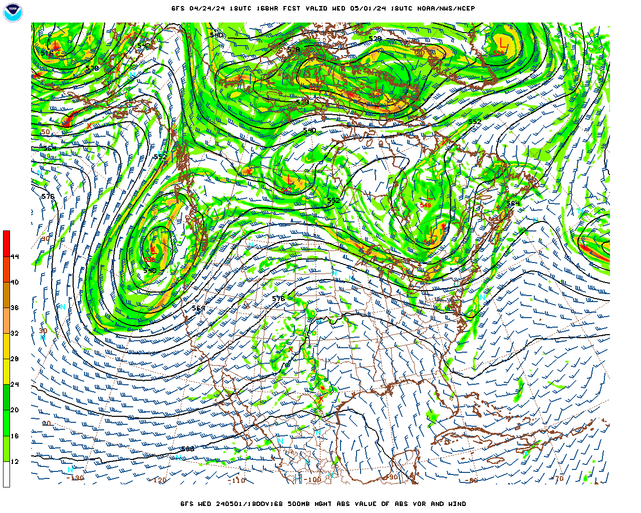
But let's continue the extended outlook.
Sunday looks like another calm day for us. Definitely a great weekend to get stuff done outside if you have even one day off work. Of course it's warming up as we get toward May. It's actually unusual for the weather to stay this dry and quiet this time in late April. This is more like May weather, where this ridge is keeping the storms out West. Basically the same deal, mostly sunny skies, High of 80 or so, Low of 60 or so.
And again on Sunday it looks like severe thunderstorms will be possible across the Midwest and the Mid-South.
On Monday we have the cold front with this system coming at us, with the Low way up in the Great Lakes region. At this point only going to mention an increase in clouds and a 20% chance of rain.
And actually it keeps looking like this front will weaken or even "wash out" as it moves more into our area Monday night and Tuesday. So even for Tuesday, only including a 30% chance of rain/a thunderstorm. That ridge of high pressure off the Atlantic coast sure looks like it is going to help us out, as this is often a stormy time of the year. High staying near 80, Low staying near 60.
Then next Wednesday, the first of May, looks like we can drop the rain chances and go with mostly sunny skies again, High in the lower 80's, Low in the upper 50's.

Average rainfall totals for this forecast period are expected to remain light, less than a quarter-inch even for Northwest Alabama up into Southern Middle Tennessee, and for the rest of us, less than a tenth of an inch as a rule. The major rains will be over the Midwest, Mid-South, and the Eastern Plains, where they'll have to watch for flash flooding issues along with the multiple chances for severe thunderstorms. The risk of flooding is on the low end via WPC guidance, so hopefully a lot of those folks will just get beneficial rain. Does look like a high threat for large hail in the storms, and also some potential for damaging winds and tornadoes. We can still have severe weather in May around here, especially the first couple weeks of May, but as of right now, there are no signs of that in the Southeast/Tennessee Valley any time soon.
And a respectful salute to Bree "Sunshine" Smith for gracefully standing up for herself on social media. That requires a special knack. I still am trying to figure out why nobody harasses or threatens me. I can't even remember the last time somebody demanded to see my tits. And when I'm struggling with my weight, sometimes they can look about like a woman's. I refer you to Rodney Carrington's concerts archived on YouTube for further information.


No comments:
Post a Comment