FORECAST:
Tuesday (High 78, Low 66): Thunderstorms likely - possibly severe. Damaging winds, large hail, and a few tornadoes are all possible across the region - but especially North of the Tennessee River.
Wednesday (High 60, Low 46): Mostly sunny and breezy. An isolated shower or two may linger in the morning, mainly North of the Tennessee state line.
Thursday (High 58, Low 37): Sunny. Much cooler.
EXTENDED OUTLOOK:
Friday (High 60, Low 33): Sunny.
Saturday (High 64, Low 35): Sunny.
Sunday (High 70, Low 38): Sunny.
Monday (High 74, Low 45): Partly to mostly sunny.
* IMPORTANT NOTE: I am not a native Spanish speaker, and there may be mistakes in the translation. *
* NOTA IMPORTANTE: No soy hablante nativo de español y puede haber errores en la traducción. *
PRONÓSTICO:
Martes (Máxima 78, Mínima 66): Es probable que haya tormentas eléctricas, posiblemente graves. Es posible que haya vientos dañinos, granizo de gran tamaño y algunos tornados en toda la región, pero especialmente al norte del río Tennessee.
Miércoles (Máxima 60, Mínima 46): Mayormente soleado y ventoso. Es posible que persistan uno o dos lluvias aislados por la mañana, principalmente al norte de la frontera estatal de Tennessee.
Jueves (Máxima 58, Mínima 37): Soleado. Mucho más fresco.
PERSPECTIVA EXTENDIDA:
Viernes (Máxima 60, Mínima 33): Soleado.
Sábado (Máxima 64, Mínima 35): Soleado.
Domingo (Máxima 70, Mínima 38): Soleado.
Lunes (Máxima 74, Mínima 45): Parcialmente a mayormente soleado.
DISCUSSION:
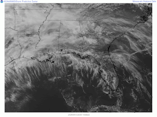
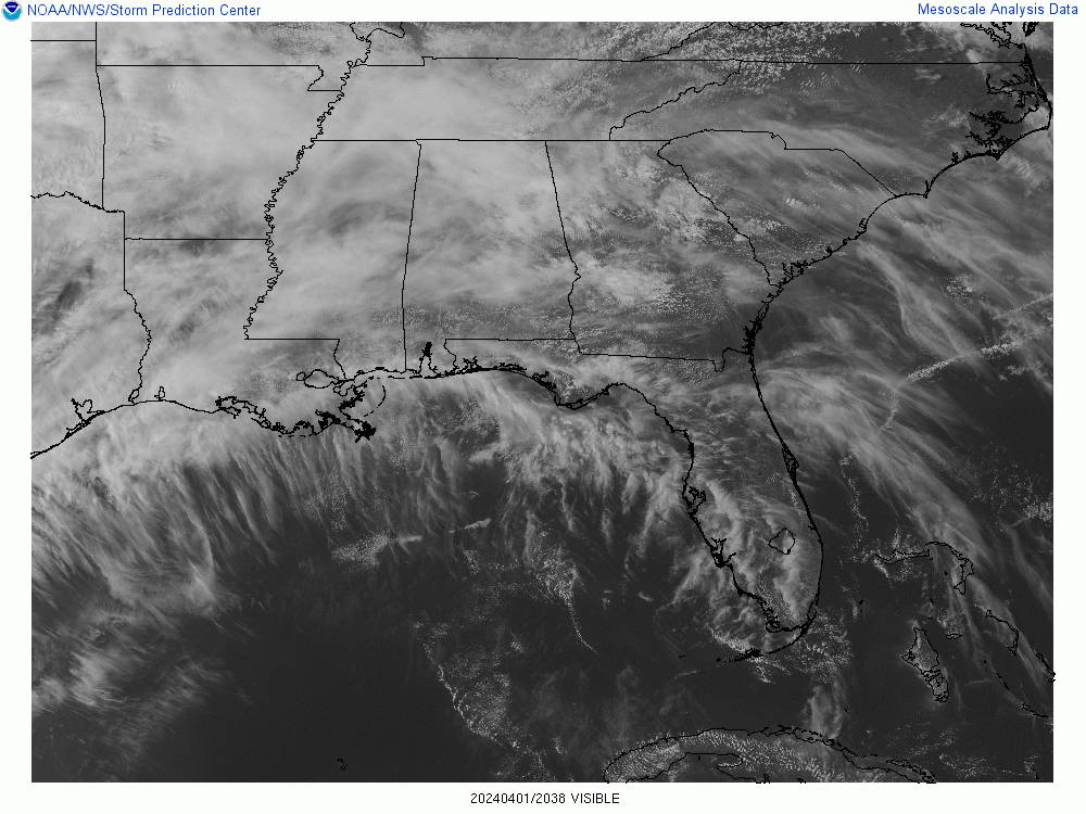
Today has been overcast in the Tennessee Valley, and we have even seen periods of isolated light rain. So Mother Nature continues to throw us a few curves at times in this most active part of the Spring season, as we are now into the month of April.
If the weather was calmer, I'd do an April Fools gag. But now is not the time for that. A severe weather outbreak now looks likely for some of our neighbors up in Ohio, perhaps into Kentucky tomorrow, and we will have some risk for organized severe weather even as you get down into Tennessee and Alabama. So going to focus on that and take this seriously, even though we are not in the hot spot for the worst weather tomorrow. The risk we do have is still plenty worth respecting.
It is currently 72 degrees in Cullman, and it looks like with even more cloud cover than expected, that will be our High. Our Low this morning was 63. Our current dewpoint is 66 degrees, making the relative humidity 83%. Winds are from the South at 8 miles per hour. The pressure is 29.95 inches and falling.
It is 75 degrees in Jasper with a dewpoint of 70, making their relative humidity also 83%. Winds are variable at 7 mph with higher gusts to 13 mph. The pressure is 29.92 inches and falling. The Low in Jasper was 64 this morning.
Haleyville is at 73 degrees with a dewpoint of 65, making the relative humidity 76%. Winds are from the South at 12 mph. The pressure is 29.95 inches/1012.7 millibars and falling. As usual, bravo to their station for using millibars. Their Low this morning was 64.
Elsewhere around the region, Fort Payne is overcast and 73. By the way, those other three sites were overcast too. Or they might have listed it as "mostly cloudy", but we're basically all overcast this evening. Decatur is at 74 degrees. Huntsville is at 72. Muscle Shoals is at 73. Tupelo is mostly cloudy and 77. Memphis is overcast and 72, notice the visibility is down to 9 miles there. Just happened to see that. And Nashville is currently overcast and 78.
Some storms have already become severe out in Oklahoma, now moving into Kansas. And they do have severe weather potential out that way through the Midwest, mainly Missouri, the rest of today into tonight. We're not really going to focus on that, we're going to look at the local stuff here, that we will have to deal with tomorrow, into tomorrow night.
I'm going to run through the basic forecast quickly before looking at the severe weather threat. Because the models are in pretty good agreement now on tomorrow's weather on the synoptic scale. Just going to run through that quickly, maybe showing some WPC graphics, and then analyze our severe weather potential tomorrow, which looks more concerning than it did even this morning, like it may get more organized and carry more of a decent tornado threat as part of the package.
Tomorrow, thunderstorms are likely, starting some time in the afternoon or evening hours. And some may be severe. High is expected to get up to 78-80 range, Low near 65.
Then on Wednesday we will quickly turn mostly sunny and cool down behind that front. Could see isolated lingering showers in the morning, at least up on the Tennessee side. But this system looks like more of a quick hitter to me, so I doubt even that. Wednesday looks breezy, mostly sunny, High near 60, Low in 45-48 range.
Then high pressure will dominate our weather Thursday through at least Sunday. Skies will stay sunny, the only forecast challenge is the temperatures, and even those, confidence is pretty high.
Looks like a sunny day Thursday with a High in upper 50's, Low in upper 30's.
Then Friday, a High near 60, Low in lower 30's, probably not down to freezing for most of us though. Widespread frost is expected that morning.
And we could still have at least patchy frost Saturday morning. We'll start the day in the mid-30's and only warm up to the lower 60's.
Then Sunday we'll still see sunny skies, High temperature rebounding to about 70 degrees and the Low rebounding to the upper 30's.
And for Monday, remains to be seen how fast our next system moves, for now will leave out any rain chances, only mention an increase in clouds and a High in 70's, Low in 40's.

This severe weather event tomorrow has gotten an official upgrade from the Storm Prediction Center. The most noticeable change is for Ohio, where a Level 4/5 Risk has been introduced, and the HRRR model was showing insane Significant Tornado Parameter values for them tomorrow, of 10 units or above. Most of Kentucky and Tennessee are now included in the Level 3/5 Risk. (Sometimes people get confused with these terms like "slight", "enhanced", "moderate", so I'd rather focus on the numbers to get across how much of a risk this is for this particular setup.) The Level 3/5 Risk now includes all of North Alabama and Southern Middle Tennessee. And for much of Central and South Alabama, the risk diminishes to a Level 2/5. Around the fringes of this broad area outlooked for severe weather is a Level 1/5 Marginal Risk. Even people in those areas could see severe weather, it is just where it is least likely. The real hot zone is looking to be Ohio back through Kentucky and parts of West Virginia, down to about Nashville and East of I-65 near there.
But what we have down here is concerning.
Via the NAM, It looks like conditions will become favorable for severe weather around 1 PM for Northwest Alabama into the Tennessee counties and then by 4 PM be spreading into the rest of the area. The actual storms could have a slightly slower timing. But this shows when the unstable air and wind shear are coming together the most strongly.
When it tries to simulate the radar tomorrow, it shows maybe some isolated activity trying to get going around 1 PM, then by 4 PM a broken squall line forming in Northwest Alabama up through Middle Tennessee. Then by 7 PM it looks like two squall lines one behind the other, then by 10 PM they appear to merge into one messy squall line. Keep in mind that these models can't predict exactly what the radar will look like, but the basic idea is often in the right ballpark.
Taking a forecast sounding from where Cullman, Walker, and Winston counties meet, the air looks moderately to strongly unstable, and the wind shear is enough to support tornado development as well as damaging straight-line winds in storms. Of course we could have large hail with this setup too. Oddly the supercell composite is only about 5 and the significant tornado parameter stays about 1-2.
Go up to about Winchester, Tennessee, and it really looks alarming via the NAM. Very strong instability (CAPE at surface over 2,000 j/kg) and more than enough rotation at all levels to support tornadoes. The Supercell Composite is about 15, and the Significant Tornado Parameter is 3-4. And you notice in the brief description box, it flags it as a particularly dangerous situation tornado hazard. This is valid at 4 PM. Keep in mind that the NAM can tend to overdo things sometimes, but this trend is worth noting.
If you look at Hamilton at that time, it looks almost as bad in some ways. Crazy-high instability, plenty of wind shear, enough to support tornadoes as well as severe thunderstorms. The supercell composite is very high, and the significant tornado parameter is definitely respectable, more than the average threat.
And I looked at a forecast sounding around Haleyville at 1 PM tomorrow, already looking like an ideal environment that a tornado could form in, similar to what we saw for up around Winchester at 4 PM.
If anything did form as early as 1 PM in Northwest Alabama (probably wouldn't be in these exact locations, just in the general vicinity), then it could be in the form of an isolated supercell, when things first get going. So this trend is concerning to see. Have to take that into account as a possibility.
Let's look at the SREF to see if it tells us to chill out or looks similarly more concerning.
The SREF shows similar timing with the best chance of severe weather getting started around here being about 4 PM. So we'll compare parameters at that time. The dewpoints are expected to get up to 65 degrees or higher. And the bulk shear up to 6 kilometers is expected to be about 50-60 knots. That is plenty of instability and wind shear to support severe storms.


We have surface CAPE values over 1,000 joules and Lifted Indices of around -5 in parts of the region, similar to what we saw with the NAM. But overall the instability is not quite as much. You don't see as many of those crazy-high pockets of instability that the NAM has advertised. I forget exactly how the SREF is derived from the NAM data, think it is an ensemble approach of some kind, but I know a lot of people think it is outdated. Personally I've often found it to be reliable for mesoscale severe weather details when the other models went on wild goose chases. If something looks really wild on another model, and then the SREF is showing something that would be more in line with what you'd expect with the synoptic setup, then I trend toward believing the SREF.
So let's just say with the SREF we're seeing signs of moderate instability over much of our region but a few pockets of stronger instability.
The limiting factor if the SREF is correct is that the Helicity values struggle to even reach 200 m2/s2, even up at 3 kilometers. And that would greatly mitigate our threat for any tornadoes forming with this system. The NAM had values of 300 units or greater in some spots in our region, combined with much stronger unstable air.
Was going to consider the HRRR, but it is not yet to the time range we need to compare to these other models. I am not a big fan of it anyway. When it gets things right, it can be really great. Sometimes it picks up on things no other models do. I think it is the model that picked up on the Waverly flood a few years ago. But I have also seen it paint a lot of catastrophic scenarios that never play out. It strikes me as very hit-or-miss. So it is interesting to consider as part of a forecast, but I like to keep the baseline with the models that are more consistently reliable.
To look at specific threats, going to focus in on the Tennessee River Valley, because we've got enough potential issues of our own, without worrying about what it does up in Kentucky, Ohio, and West Virginia.
Just to recap, we are all under that Enhanced Level 3/5 Risk.
We do have a 30% chance of damaging thunderstorm winds and large hail over our entire area. Notice in Tennessee, that hatching for the wind damage threat, around Sewanee and points North of there and generally East of Interstate 65, that's where they expect extra-damaging winds to be possible, like maybe hurricane force. Once in a while you hear of structural damage from straight-line thunderstorm winds, instead of just trees and power lines. That hatched area is where that would be most likely to occur.
At this point, the SPC thinks we'll be dealing with coin-sized hail tomorrow. They may adjust this later, and as I'll show below, a couple of the local offices have gone ahead with the idea that we could have some extra-large hail in spots as well.
Our tornado threat has been upgraded to 10% now, and that hatched area actually extends all the way up to the Ohio Valley, for the potential of a tornado staying down on the ground a while and doing significant damage. Around here, that includes areas like Decatur, Athens, Florence, and Huntsville. But all of us have a tornado threat that is well worth respecting. It is just higher in those cities of far North Alabama and points northward into Tennessee and beyond.

Taking the wide view, that is a large area that is outlooked for the potential of fairly substantial tornado damage. Most people don't realize it, but the vast majority of tornadoes end up being rated E/F0-F1. When one does enough damage to be rated E/F-2, that is called a "strong" tornado. (Can easily destroy all of a mobile home and do a fair amount of damage even to site-built homes, at least to the roofing and exterior walls.) And within and near that hatched area, strong tornadoes could occur tomorrow. If you know anybody up in Ohio or nearby parts of Kentucky and West Virginia, I'd make sure they know about this. Up that way, this has the potential to be a tornado outbreak. The farther away you get from that center of Low pressure, the more likely it is to be an isolated tornado threat. But with this setup and its complex variables, I would want to rule any of us out of a tornado threat that needs to be respected along with the damaging wind and large hail threat. The setup for Ohio is looking pretty ominous, like it could be a serious tornado outbreak for some of those people in that vicinity. Down here, it is still looking like the threat could be a little more than average, especially in those places like Huntsville, the Shoals, and up North into the Southern/Middle Tennessee counties.
And you can see that our local offices are on top of this. They give some approximate times that are consistent with what we saw from the NAM and SREF model guidance.
The offices in Nashville and Birmingham are going ahead and mentioning the possibility of hail up to ping-pong-ball size, and I think that's right, even though it is not (yet) in the Storm Prediction Center forecast for us. You have to allow for the possibility of supercells in this setup, even if they happen within a squall line, or are part of a broken squall line. And a few places could get some very large hail like that. The SPC is a national center, and they are very busy with today's and tomorrow's weather. I'd say trust the locals on this one, and be prepared in case we do have some storms that produce hail where the size would have to be described in terms of balls rather than coins. Also remember that these times are approximate. Things might not start to get "real" in our region until around 4 PM. But any time from about Noon on, I would be on the alert, if you really want to play it safe. Some of it could last into the night hours. The Huntsville office even added a note that the timing is not clear-cut with this event, you can see above.
And please remember that any tornado is dangerous. It does not have to get a rating of F-2 (or higher) to be a threat to life, or to cause terrible injuries if people do not take proper shelter. Certainly don't let any of your friends stay in a mobile home tomorrow if there is a tornado coming. In a site-built house, the basic idea is to go to the most central room, hopefully a smaller room or at least a hallway, away from any windows, on the lowest floor. And if you can, shield your body in some way from falling or flying debris, especially your head. If all you have is a pillow, and you've got a bathroom in the middle of your house on the ground floor, then grab that pillow and put it over your head and neck in the bathtub. That's the basic idea.
If you want to go beyond the basic idea, then I'll refer you back to
a post I did a few days ago, that is not as structured or professional as I'd like, but is pretty thorough. You can skim over it and find good information that applies to you, if you need that. These are my opinions on safety from tornadoes and severe thunderstorms.
Better yet, you can get the official government guidelines on tornado safety
here. And for a day like tomorrow, I'm going to advise tornado precautions, even though a lot of us may only see Severe Thunderstorm Warnings, because the chance of a tornado is enough that I think people need to be thinking in those terms. If it's "only" straight-line winds in a severe thunderstorm, and you want to take fewer precautions for that, then that's up to you, but at least have it clear in your mind what tornado-level precautions are. Because you might need those tomorrow. And in case you do, you need to make that plan this evening or tonight.
The
Weatherbrains podcast is going to livestream the second part of their discussion of the April 3-4, 1974 tornado outbreak this evening, I think starting at 7 PM, less than an hour from now. Now if you are extra-nervous about tomorrow's weather, like if you're reading this from that hot zone in or near Ohio, or if you're just somebody whose nerves are jangled here closer to the ranch, then you might want to hold off on listening to this until after we've gotten through tomorrow's event. Because that 1974 event was very unusual and horrible, a lot like the event we had in April 2011. You only see an event like at on an average of every 30-40 years, based on the records we have.
I'll probably listen to the podcast tonight anyway, or watch it. But this event is coming at an inconvenient time for me to say the least. I probably will not be able to post updates through it tomorrow, and I am not looking forward to whatever it does around here. Frankly, I really kind of hope my relatives in Kentucky don't have any problems. Some of them had a close call with that December outbreak a few years ago, believe it was December 10 of either 2021 or 2022. The meteorology of these things is fascinating. And even seeing pictures and video can be really neat, really fun. But these events also have a very real human impact. If you don't believe me, try reading What Stands in a Storm by Kim Cross or James Spann's similar book, All You Can Do Is Pray. I don't think anyone is stoic and logical enough to read through an entire book like that without having a moment where they have to face the tragic side of it. I'm just glad that these days, the science has progressed to the point we can forecast this stuff pretty well, can detect tornadoes very well even when they are not visible to the naked eye (wrapped in rain usually around here), and there's usually somewhere reasonably safe for people to go. Compared to how it used to be, we've got it pretty good.
The only thing I'd prefer about the "good old days" is that a lot of people used more of their common sense and were more neighborly when it came to severe weather. Even if news of tornadoes was mainly going by word of mouth, people did invite each other over to a storm pit, and they might sit and talk and watch the sky for hours, while a tornado was still over in Mississippi. These days even with public shelters, I've seen people come rushing to one during a tornado warning and then leave when it's been downgraded to a severe thunderstorm warning, while the warning still carried a tag saying that a tornado was possible. They got out and drove through that kind of weather, went back home, and ignored my trying to get them to reconsider. And that is just not using common sense. I think the old-timers put us to shame in that way. For science and technology to do us much good, we have to use it wisely.
Hope that helps. Leave me a comment or
send an e-mail if you have any questions or concerns I didn't cover above. Everybody be safe tomorrow. The rest of the forecast looks great . . . a little frost in the morning is nothing compared to a widespread severe weather threat. And I don't mean to make this sound worse than it is. These threats (or some I remember that looked a lot worse for us locally) can bust, or can do a lot less than its potential. The main threat will probably be North of here, but it is a close enough call that I'd play it safe with this event. A few places might get some significant storm damage, whether it comes from straight-line thunderstorm winds, large hail, or a tornado. So let's all have a healthy respect for this and not fool around, even if the main outbreak looks to be the special treat for our neighbors to the North. Our threat down here is nothing to blow off.
The analog events show anything from a really low-end severe weather event with mainly damaging winds and some hail to a pretty organized event around here with numerous severe weather reports, including a few tornadoes. And one of the analog events from
March 2, 2012 did produce a couple of fairly damaging tornadoes in Limestone and Madison counties. The severe weather, including tornadoes, was a lot more widespread up in the Ohio Valley that day, but we still have some problems around here. We had several regular tornadoes besides those two that did more than the average damage that day. Every event is unique. And really, all it takes is one storm, doesn't even have to be a tornado, that hits hard and hurts some people, for it to be a significant event. People tend to complain they had no warning sometimes, or they didn't know what to do. We've known this was coming for several days now, even though it's only started to look more organized and concerning over the course of today. So please let people know what's going on, and take care of yourself until we see how this plays out. I know that's not the most high-tech scientific writeup you've ever read, but those are my thoughts this evening.
9:18 PM - Going to add at least one note to this.
This person's tweet is an excellent example of my criticism of the HRRR. It's sort of like listening to Corey Feldman make a big announcement at a press conference. Sometimes he says something spot on. But a lot of times, it turns out to be hot air. And everyone rolls their eyes, like did we really fall for this again? But hey, in case anyone close to that guy should read this, I'm glad he at least made it out of the Hollywood lifestyle alive. Not everyone does. I am just trying for some humor on a stressful night. It's sort of like if I make a Richard Simmons joke . . . I actually like the guy . . . or Bob Ross, I love his old paintings, but some people just provide a lot of good joke material. I hope I do . . . I try to. Some of my stories about the Salem cat might be "semi-true", as Penn and Teller would call it. But he does bite me a lot. And he does bite inanimate objects a lot. Come to think of it, he is amusing without much embellishment.
And by the way, the HRRR is not the only model that makes it look like a significant severe weather threat is likely for that general area up there, including Ohio. So even if it can't make up its mind, best wishes to those folks tomorrow.
That Weatherbrains show was really good. I still haven't finished the first part of the 1974 discussion from last Monday. But I watched all of this one. They interviewed two survivors of that night. It was in that same event that Xenia, Ohio got hit so hard. So if they do get a tornado outbreak tomorrow, the timing is unfortunate. It's just that time of year though. The atmosphere can get volatile in a hurry in these parts of the country this time of year. At least we understand it better than in 1974 and have more ways to communicate. And I'm not suggesting we'll see anything like 1974, of course not. But Ohio is outlooked for a fairly stout chance of longer-track, damaging tornadoes. Even if they only got one of those, you know, it's rough stuff.
Watched Taylor Sarallo's weather forecast this evening too. She's at Channel 13 now in Birmingham, WVTM. That lady has a mind as sharp as a whip. Watching her, I remember how tough broadcast meteorology is. I used to do YouTube videos when I had a really good computer years ago. Tried to keep them about 5-10 minutes. And I was just winging it. Didn't know how to do the graphics the elegant way. So put a timer on them and tried to finish what I needed to say before it switched to the next graphic. And even that was challenging. But these people have to try to fit even the most complex forecast into 3-5 minute slots and present that several times a day. Some people do it masterfully, and she is one of those. I kind of smiled, the way I do seeing someone like David Copperfield or David Blaine (or even Doug Henning . . . before my time, but all over YouTube now) present a good card trick that I know, but have never seen done that well. The one time I saw David Copperfield live, he did a trick from a book I had called Magic for Dummies. And made it look great. I had seen it in the book but thought it didn't look like it would work. Then when I looked at the book again, I went, "Whoa . . . that's the same trick."
Also found where a former member of my family tree (by marriage) is writing for one of the other local stations and has not lost his obsession with football and wrestling. I did love watching wrestling with him in what feels like another lifetime ago. But I don't see the point in watching it now, when even the Undertaker has retired. I think the really colorful eras are over. It still trips me out that Diamond Dallas Page ended up teaching yoga. Even though I've tried it. And so has Rob Zombie. The original book of that yoga program has a picture of him and Rob Zombie hanging out. And he mentions he got him to try the workout. When I do have the good sense to exercise, my mind goes more back to an Athletic P.E. class where everybody else faked through most of the exercises, but I wanted muscles, so did all of them. So I end up doing more of that old-fashioned stuff like pushups. And when I talked to a couple of women who did yoga, I discovered I was doing it all wrong. Because I was doing all the stretches and things with the same intensity as the pushups.
This has nothing to do with weather.
Let's see if there is any more data that seems meaningful. Be right back.
9:48 PM - So the HRRR, fickle as it may be, shows a broken squall line back in Mississippi about 1 PM tomorrow, with some activity trying to get going ahead of it in far Northwest Alabama up into Tennessee, around Wayne, Lawrence, Hardin Counties.
It is showing CAPE (surface) values over 1,000 j/kg already in Northwest Alabama, also in much of North Alabama into Tennessee, the Helicity at the lowest kilometer of the atmosphere is already up to 150-200 m^2/s^2 range or greater. This is a recipe for rotating updrafts.
And we now see the model trying to estimate where these updrafts will form and track around 1 PM.
It doth foretell a respectable chance for supercell thunderstorms.
On a day like this, such rotating storms could put down some tarrrrrrnaders.
Definitely is a concerning look for Tennessee and also along the state border with Alabama.
Remember that this is the zone that they hatched for a reasonable chance of having a tornado with a longer track or even if the track was shorter, still fairly significant damage.
I forgot to look at the 3 km Helicity above, so here it is, values over 300 units are common around here. And remember the 1 km Helicity was 150-200 or greater for a lot of us. This model is showing a pretty volatile setup even for North Alabama.
Maybe more later, maybe not. Just thought I'd look at a few more things.
10:09 PM - Meanwhile the NAM now just shows a squall line look.
But hey, squall lines are dangerous too. And supercells can be embedded in them, or form in breaks in a line. I'm thinking of that event a year or two ago where an F-3 tornado formed on the edge of a squall line, think it was at Hazel Green, but near the AL/TN border anyway.
Its significant tornado parameter values are a lot more tame. But even a value of 1 deserves some respect, especially with an organized threat like tomorrow's.
The CAPE at 4 PM is still impressive, especially over Southern Middle Tennessee, some of those places showing over 2,000 joules.
Yet it shows the low-level turning of the winds really decreasing between 1-4 PM. Still looks like enough to work with, at least in much of Tennessee. But I can see why it calculates the STP value so much lower than the HRRR.
The SREF calculates the STP values at only 1-2 between 1-4 PM. This lines up well with the current SPC outlook for us. The tornado potential is a little higher than average, but nothing overwhelming around here. And I do like the SREF because of its lack of wild goose chases.
And the NAM has come closer to agreeing with it. The HRRR is the only one making things look extra-bad for tornadoes around here at this point. This is not a simple setup. Even for that hot zone in and around Ohio, it is not a clear-cut forecast. Sometimes even the high-end events are not.
True story: The April 27, 2011 outbreak only had a moderate risk up until 1 AM the day of the event, when they bumped it up to high. They did have a hatched area of 45% chance of severe weather. Back then, they did not outline specific threats a day or two in advance. They only gave the specific threats for Day One. That Tuesday the 26th, they stayed with a Moderate/45% hatched area over the TN Valley because they had some concern that the models were overdoing things and that a morning squall line would stabilize the atmosphere and make the afternoon not quite so bad.
That was such an awful event. Everybody got it wrong, I feel like. Because the people who still thought the afternoon was going to be as bad as the models said, thought the morning squall line would not happen. And what actually happened was a horrible squall line in the morning, that produced plenty of tornado damage all by itself. And then a few hours of a lull (well actually Decatur/Huntsville sort of got a midday intermission), followed by those explosive supercells that produced tornadoes in the afternoon.
But everyone did understand that it was gong to be a bad event. The parameters looked a lot worse than this one, even as bad as some of them have looked for Ohio at times with this one. I remember thinking it was the worst setup I'd ever seen, like it can't get much worse than this, right? And I knew a lot less then. All the parameters were off the charts. So at least we're not seeing that here with this looming event. I sort of hope I live to see another event like that, at least if I get involved in meteorology again (beyond an aimless blog like this). But then I sort of don't. It was horrible.
They were talking on Weatherbrains tonight about how in 1974, a guy had a nervous breakdown from trying to run the teletype machine with all those tornado warnings that night. He started yelling at the top of his lungs. And the boss-man, head meteorologist, came in and said, "Hell! Are you bein' electrocuted?"
They gave a slightly nicer version of it tonight, but I remember the story when it was told uncensored.
The Helicity values continue to look sort of unimpressive with the SREF compared to what you'd usually want to see for an organized, significant tornado threat. I mean it struggles to even get to 200 units up at 3 km.
But we have to keep in mind that the other models did show more than that. And even this one still gives us a 1-2 Significant Tornado Parameter.
The SREF is backing off on CAPE values too.
If you look at Lifted Index, values still show low to moderate instability around here.
So we'll see how it plays out. Some risk will exist for damaging winds, large hail, and at least isolated tornadoes in our region. Pinpointing how much risk and exactly where at what time is challenging with this one. That's why the folks at the SPC make the big bucks.
Actually they probably don't get paid nearly enough. Ditto for the local forecasters in the NWS offices. They make a decent living, but they do it because they love it.
10:47 PM - Every now and then I still wonder why most of the people reading this site are apparently from Hong Kong. Heh . . .
Think I'm going to call it a night.


.png)


No comments:
Post a Comment