

FORECAST:
Friday (High 80, Low 63): Partly cloudy. Scattered showers and thunderstorms are possible.
Saturday (High 70, Low 56): Partly to mostly sunny and cooler. Widely scattered showers are possible.
Sunday (High 57, Low 46): Mostly overcast and cold. Numerous rounds of showers are possible.
EXTENDED OUTLOOK:
Monday (High 66, Low 40): Sunny.
Tuesday (High 75, Low 43): Sunny.
Wednesday (High 77, Low 50): Mostly sunny.
Thursday (High 79, Low 52): Mostly sunny.
READING TEA LEAVES:
Friday April 26th through Sunday April 28th (High ~80, Low ~60): Partly cloudy with a 20% chance of showers/thunderstorms.
PRONÓSTICO:
Viernes (Máxima 80, Mínima 63): Parcialmente nublado. Es posible que se produzcan lluvias y tormentas dispersas.
Sábado (Máxima 70, Mínima 56): Parcialmente a mayormente soleado y más fresco. Es posible que se produzcan lluvias muy dispersos.
Domingo (Máxima 57, Mínima 46): Mayormente nublado y frío. Son posibles numerosas rondas de lluvias.
PERSPECTIVA EXTENDIDA:
Lunes (Máxima 66, Mínima 40): Soleado.
Martes (Máxima 75, Mínima 43): Soleado.
Miércoles (Máxima 77, Mínima 50): Mayormente soleado.
Jueves (Máxima 79, Mínima 52): Mayormente soleado.
LEYENDO LAS HOJAS DE TÉ:
Del Viernes 26 de Abril al Domingo 28 de Abril (Máxima ~80, Mínima ~60): Parcialmente nublado con un 20 % de probabilidad de lluvias/tormentas eléctricas.
NOTES:
Here is a look back at some local weather highlights from last year.
The National Weather Service in Nashville is still doing Weather101 classes, and they are free, by the way. Anyone with an interest in weather and internet access is strongly encouraged to take one. They cover a lot of subjects, even things like the monsoon, that don't really affect us in Tennessee or Alabama, but are interesting phenomena in other parts of the country.
And the Weatherbrains podcast took a trip on the ethereal side this week, interviewing Heather Tesch, a retired meteorologist who now does her own podcast about near-death experiences. I liked how open and respectful the dialogue was. Not even Bill Maher always pulls that off with his chats he has with folks in his bachelor pad. And I heard a local preacher one time say that you can't get people to talk about death anyway, "You'll clean a house out!" So this lady had a special knack that made everyone feel comfortable and interested. They talked about how the science of weather wasn't as different as it might seem, because it explored a lot of unknowns.
I'm not sure to what extent I'm going to keep doing this blog, but I think I've gotten better at the Spanish despite getting no real feedback on it. It's amazing what a guy can learn fixing the mistakes of something like Google Translate. A lot of weather forecasting is fixing the mistakes computer forecast models make, and understanding why they make them. That's why I'm not impressed with "AI" as if it's something totally new.
DISCUSSION:
At 11:30 PM it is overcast in Cullman with a temperature of 66 degrees. That is the same as the dewpoint at the moment, and the relative humidity is 100%. Winds are from the South at 7 miles per hour. The pressure is 30.03 inches and steady. The visibility is 9 miles.
We had a mostly sunny day overall, but then we had an isolated thunderstorm that became severe in the Eastern side of Cullman County, producing some quarter-sized hail and winds strong enough to take out some trees and power lines in Dodge City and up toward Hanceville. This morning and then again tonight, we've had some fog and mist lowering the visibility at times.
Our High today was 81, and the Low was 64.

Most of the severe thunderstorms today were focused in that area that was outlooked for an enhanced severe weather risk up in the Ohio Valley back into parts of the Mid-South, mainly Missouri up into Illinois. They even had a tornado near Athensville, Illinois. We were pretty quiet as far as any severe weather down here except that Cullman County happened to hit the jackpot this time. The large hail and damaging winds seemed to only last a short time, from Dodge City to Hanceville. From what I gathered, I think the storm weakened below severe limits by the time it got about to Holly Pond and then moved through Arab and further into Marshall County.
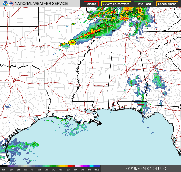


That front is still draped across the Mid-South and Ohio Valley while a high pressure system over Southeast Alabama is limiting its impact on us somewhat.


Then next weekend, the guidance does start to hint at some unsettled pattern, low-end rain chances, Highs near 80, Lows near 60. Rain chances would probably be about 20-30%.
This time of year, a 10-Day-Outlook is more of a guess than it is educated.


As far as the chance of seeing any severe thunderstorms the rest of tonight into tomorrow (technically it is already 12:29 AM as I write this, so we are into Friday now, but I'm still saying "tomorrow" as if Friday is tomorrow), sure, we could have something isolated like we did earlier this evening. But we're not going to have any sort of organized severe weather threat around here. Even the chance of something isolated is very low.

Our rainfall amounts are likely to average about one inch around here, with some slightly higher amounts possible mainly in Northeast Alabama.


No comments:
Post a Comment