

FORECAST:
Sunday (High 55, Low 46): Breezy. Mostly to partly cloudy.
Washington's Birthday (High 46, Low 24): Sunny. Cold.
Tuesday (High 54, Low 27): Mostly sunny.
EXTENDED OUTLOOK:
Wednesday (High 43, Low 33): Rain showers likely - some may change over to snow.
Thursday (High 32, Low 17): Mostly sunny.
Friday (High 40, Low 15): Sunny.
Saturday (High 45, Low 21): Sunny.
PRONÓSTICO:
Domingo (Máxima 55, Mínima 46): Ventoso. Mayormente a parcialmente nublado.
Cumpleaños de Washington (Máxima 46, Mínima 24): Soleado. Frío.
Martes (Máxima 54, Mínima 27): Mayormente soleado.
PERSPECTIVA EXTENDIDA:
Miércoles (Máxima 43, Mínima 33): Probabilidad de lluvias, algunas pueden convertirse en nieve.
Jueves (Máxima 32, Mínima 17): Mayormente soleado.
Viernes (Máxima 40, Mínima 15): Soleado.
Sábado (Máxima 45, Mínima 21): Soleado.
NOTES:
It is a good time to review your severe weather safety plan. We could have some issues tonight.
We're under a Wind Advisory. Go figure.
This Tuesday evening, physical SKYWARN classes are being held in Huntsville and in Cullman. Online classes are on the schedule as well. And Nashville is having Severe Weather Awareness Day at Trevecca University a week from today, Saturday February 22. Anyone who cares about severe weather/public safety and wants to learn more is strongly welcomed to attend any of these events.
On a much lighter note, NOAA has a new animated series that teaches kids about weather and climate.
Which reminds me that James Spann and his kinfolks have a book series for kids about how to be prepared but not overly scared about severe weather.
Tomato sandwiches are still underrated. And they're cheap, especially compared to eggs these days. Although if you thumb your nose at the hype (?) about bird flu, tomatoes also can be good on a chicken sandwich.
At 4:24 PM latest observations show overcast skies in Cullman with a temperature of 64 degrees. The dewpoint is 61, making the relative humidity 88%. Winds are from the South at 10 miles per hour with higher gusts up to 16 mph. The pressure is 29.86 inches and falling. Our current temperature of 64 is our High so far today, and this morning's Low was 52. So the Low temperature was a bit warmer than forecast, and the High so far is six degrees short of what I forecast, about four degrees short of what most other people forecast yesterday. Unless we get a surge of warmer air in here later tonight ahead of the front/squall line, this may inhibit our severe weather potential some.
It is partly cloudy and 70 degrees in Jasper, which is what I forecast for Cullman. The dewpoint is 63, which by the way, is already unstable enough to support a severe weather threat down that way at least. For when the storms come in later. Relative humidity is 78%. Winds are variable at 7 mph with gusts to 13. Pressure is 29.84 and falling. Looks like a High of 70 and Low of 54 there.
It's overcast and 67 degrees in Haleyville. The dewpoint is 62, making the relative humidity 84%. Winds are out of the South at 9 mph. The pressure is 29.84 inches/986.4 millibars and falling. Looks like a High of 67 and Low of 52 there. You know, we've had light rain showers off and on since last night, pretty scattered. So that kept the night from being as cool and today from getting as warm in a lot of places.
Decatur is overcast and 67. Ditto for Huntsville. Muscle Shoals is overcast and 70, dewpoint of 60 there.
Tupelo is 75 degrees with a dewpoint of 64, winds from the South at 20 with gusts to 26. They are in the zone that could see some fairly significant severe weather this evening/tonight. It's overcast with wind gusts up to 35 mph in Memphis, temperature of 73, dewpoint of 64. The pressure is also down to 29.64 inches/1003.4 millibars there. They are in that zone that really needs to look out this evening, and they are already under a Tornado Watch actually. I'll show that in a moment. Nashville is overcast and 64.


That squall line that has formed is expected to produce some severe thunderstorms as it moves to the East, and there is also a low risk of isolated supercells forming out ahead of it or in breaks in the line. Those are the places tornadoes are more likely to form. The chance for tornadoes is great enough that they've issued a Tornado Watch instead of a Severe Thunderstorm Watch. But a lot of places along the line will probably see damaging straight-line winds as well. Either one is really worth taking cover for, especially at night when you can't see storms coming. Sometimes you can't in this part of the world even in the daytime.


So we've basically got a line of storms tonight - some could become severe, then sort of a raw cloudy/breezy tomorrow, then sunshine returning and a very cold President's Day compared to what we're having now. Though it's fairly seasonable. This is February. With days like this, sometimes you can forget what time of year it is. But it's still February. March is about two weeks away.


The specific threat areas have been adjust a little bit for tonight's severe weather risk. But the basic idea is the same: Most of us have a basic threat for damaging thunderstorm winds and isolated tornadoes within a squall line. For Northwest Alabama and maybe places like Waynesboro or Lawrenceburg, TN the chance of severe weather may be a little enhanced, especially if we were to see an isolated supercell or two form just ahead of the main line.


Tomorrow it looks like the rain will end quickly in the morning, then just partly to mostly cloudy and breezy, High in 50's, Low in 40's. Clouds might gradually decrease throughout the day, but with this system, I'm thinking a lot of us won't see the sun peek out at all tomorrow, just one of those dreary days with a cold breeze.


Monday, President's Day, looks sunny with a High near 46, morning Low down near 25. So winter is not over by any means.


Tuesday looks mostly sunny with a High in the lower 50's, Low in the upper 20's.


Wednesday is when it gets interesting, going into the extended period of the forecast. We have a Gulf Low that is going to bring us some moisture to coincide with some freezing or near-freezing temperatures. And we're really going to have to watch this for at least a wintry mix. Much of Tennessee may see some snow from this system.
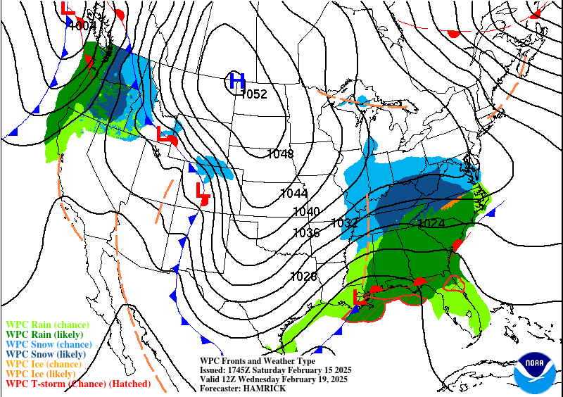
That mix of snow could end up affecting parts of at least Northwest Alabama too, and it's just a close call for the TN Valley in general.
But showers are likely Wednesday, and it's tough to say how much will be a cold rain and how much may change over to snow, or at least mix with snow. Around Cullman, we're probably looking at just a cold rain overall, but even here, looks like a High in the lower 40's and a Low in the lower 30's. So even here, it's a close call. And I think there's a good chance that basically all of Tennessee will see some snow out of this system and that some of that snow may extended into Northwest Alabama. The rest of the Alabama side, I'd say wait and see . . . you might get a mix, or you might get no snow out of this. Let's get tonight's system out of the way before we try to nail down details. But a lot of the Tennessee counties at least are likely to see accumulations.


Then Thursday we have much colder air moving in behind that, mostly sunny skies but starting the day in about the 15-20 degree range and only "warming" to about freezing, 30 degrees or so, lower 30's.
Whether there will be any snow on the ground affecting those temperatures is a good question that as I said, we'll get to AFTER tonight's storm system. It's a possibility, although I'm leaning toward thinking most (or all) of the snow stays North of places like Cullman, Haleyville, or Jasper.


High pressure will be moving through the Midwest on Friday. Got a deep upper Low in Baja California, zonal flow around here. We'll see sunny skies but stay cold, High of about 40, the Low still well down in the 10's.


The High pressure will be centered just West of Memphis on Saturday, which means we stay sunny with a High in the mid-40's and a Low in the lower 20's.


The details of the midweek potential for wintry weather will become clearer tomorrow and Monday, but for now keep in mind that there is a decent chance for Northwest Alabama and especially Tennessee to see some snow from this - accumulations likely in Tennessee, especially as you get up around places like Nashville. The rest of North Alabama is more likely to see either a mix of rain and snow or just a cold rain, and just needs to keep an eye on the trends in case the chance for snow were to increase.

We'll get about another inch of rain from this system. The fast-moving squall line will probably limit too many additional flooding problems beyond what we've already had. What caused the flooding was that front just slowly moving back and forth, North and South through the region for several days.
MESOSCALE DISCUSSION:


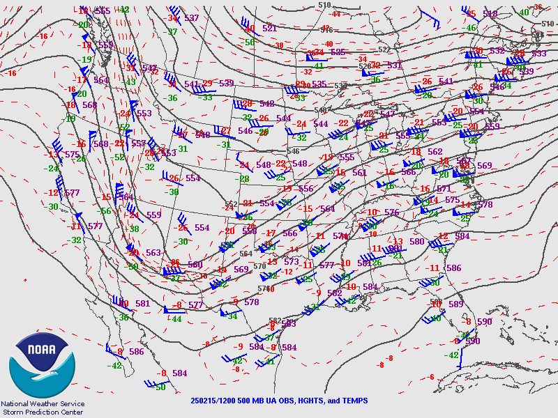
The NAM is now showing more what I thought it should be yesterday. This is the Energy Helicity Index between 6 PM this evening and 3 AM Sunday morning. It shows a decent risk for severe thunderstorms across North Alabama and some of the risk extending up across the Tennessee line at times.

A forecast sounding from Walker County shows about 500 j/kg of CAPE, so marginal instability, but enough to work with, then 300-400 m2/s2 of Helicity, so this supports a damaging wind and tornado threat, definitely.


The HRRR is showing Significant Tornado Parameter values getting up to the baseline of a value of 1 for many of us between 9 PM and Midnight, but the enhanced values are mainly staying back over the MS state line. Some places just East of the line in AL might want to watch the threat of a tornado a little extra closely tonight, as we already talked about.


CAPE values are still struggling to even get up to 500 joules on the SREF, but the Helicity at 1 km is about 400 units, which is really high. This is one of those cold-season squall lines where the wind energy is way more than enough, and we've got the lifting mechanism, but not everywhere is going to get the unstable air needed for severe weather. But wherever we do get even meager instability, a storm could become severe in a hurry and produce a tornado or wind damage.


There is a low risk for an isolated supercell or two to form out ahead of the squall line as it approaches tonight. Best corridor for that, if it happens, is in Northwest, or maybe more so West-Central Alabama. Places along and just East of the MS/AL state line, I'd watch the tornado threat extra carefully as this squall line/QLCS gets close to us tonight.

But really all of us have a standard risk of severe weather tonight. It's just a little enhanced in Northwest Alabama.


Not really seeing much of a large hail threat with this, but we do have a basic risk for damaging winds areawide and a higher potential for them in Northwest/West-Central Alabama. Notice Lamar County is included in that area where they've got about a 50/50 shot at a damaging wind event.

And all of us have a risk for isolated tornadoes. Once again though, things could heat up more for folks along and near the state line. Northwest Alabama is now clipped by that hatched 10% risk area for tornadoes tonight. So while most of the risk is for tornadoes that spin up within the squall line (dangerous enough), we need to watch Northwest Alabama for a chance of a storm trying to become discrete or semi-discrete, a supercell ahead of the squall line that would carry a higher chance of producing tornado damage.
So everybody stay safe tonight. Saturday night in February is not when most people typically think about sheltering from severe thunderstorms or tornadoes. But some of us may have to tonight at some point.
People need not only a reasonably good place to go for shelter but a way to wake them up - NOT an outdoor siren - a weather radio or at least WEA on a cell phone that is going to tone loud enough to wake people up.
This may not be a big outbreak for us, but it doesn't take a big outbreak to cause problems. We had some tornadoes in Eastern Tennessee recently, I think two were rated F-1 and a third was rated F-2 (I don't remember exactly, one or two could have actually been rated a 0, so winds estimated only 60-80 mph if that's the case). And we still had two injuries and two deaths, from the tornado rated E/F-2, sounded like those all happened in the two mobile homes that were destroyed. And if those people could have gotten into a site-built house in something like a bathroom or hallway, away from windows on the ground floor, chances are, they wouldn't have even had a scratch. Most of our tornado deaths or serious injuries are still happening in circumstances that they shouldn't and that we can help without major overhauls like better building codes and all this stuff that would take years to make any headway with. Getting people into the lowest, most central part of a sturdy, site-built house is not exactly moving mountains. But it seems to remain the main challenge about tornado safety around here. Right along with getting people out of this ridiculous idea that they have to hear outdoor sirens before taking cover. That might have been true more than 50 years ago, but to hang on to that idea now is insane. And it has cost a lot of people their lives.
So I managed to get a soapbox in after all. Some of us are just born this way.


No comments:
Post a Comment