So before we get a watch or any warnings in our neck of the woods, might as well take a look at some things.
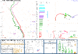
The 6 PM sounding from Birmingham, the temperature is 71, dewpoint of 62. Surface CAPE is 204 j/kg. Storm Relative Helicity is over 300 m2/s2 at 3 km, over 200 units at the lowest kilometer of the atmosphere. This setup supports a marginal threat for tornadoes and damaging winds. The wind shear between 0-6 kilometers is 50 knots, which is also really high.
The wind shear is insanely high in Nashville, Helicity values over 600 units even at the lowest kilometer of the atmosphere, bulk shear up to 6 km at 65 knots.
Their temperature is 62 (Fahrenheit) with a dewpoint of 60. So they'll have a harder time sustaining any rotating storms or severe thunderstorm winds up there, less unstable air likely to be available as we get deeper into the night.
And we just got a new Tornado Watch out ahead of that squall line. Some tornado warnings are in effect along the line as well as a few severe thunderstorm warnings.
Going to make a new post for this watch since it does include some of the bordering counties of Southern Mid TN.


No comments:
Post a Comment