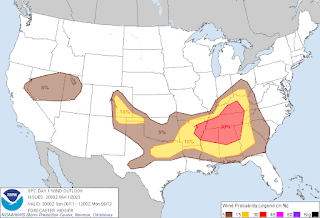
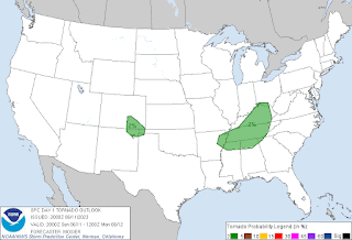
It is clear now that any severe thunderstorm threat for North Alabama into the bordering counties of Southern Middle Tennessee are going to come in the evening or night hours, after dark for most of us. Several storms have become severe today in other states, including Tennessee, and there have even been a few severe thunderstorm warnings in Southeast Alabama.
The Storm Prediction Center did issue an Enhanced Level 3 Risk for severe thunderstorms for today/tonight in our region. Primary threats are large hail and damaging thunderstorm winds.
Much of Tennessee and Northern Mississippi is under a Severe Thunderstorm Watch. Not sure if that will be required later for Alabama, since with loss of daytime heating, the nature of anything severe may become more isolated. We'll see how things trend. But at least isolated severe thunderstorms are possible after dark here.
But the Storm Prediction Center does consider the risk for damaging winds and large hail to be above average for us today, 30% risk, where usually in summer you'd see a 5% or 15% risk at most for storms that cook up in the heat and humidity. This is a little different, as we do have a cold front moving through.
If you live in a mobile home especially, if you've got trees around, some healthy respect for this is wise. It's best if you can shelter in a sturdy house, away from any windows or anything electrical, as any severe storms move through later, and preferably on a lower floor. That way if anything does happen, like a tree falling or a window being knocked out by winds and/or hail, you minimize your chances of sustaining any injury.
Also be careful if you have to drive tonight, because some of these storms could put down a lot of rain in a short period of times and flood some roadways. You never cross water that covers a roadway or a bridge.
For most of us, it will probably be just general rain and thunderstorms with some gusty winds and maybe some smaller hail. But potential for at least some isolated storms making it to severe limits does exist. Some of it could get organized into what's called a mesoscale convective system, and if that develops, those areas will be the ones to watch. I seem to remember a pattern like that several days in the year 2009. The rest of this week does look unsettled, but important to remember that these are summer storms, and even on a day more organized like today, the timing is in question, and a lot of the day will feature sunshine for an awful lot of people. It is just that where the storms do develop and move through, they can pack a decent punch. We have a cold front boundary that's going to move through the area, and you don't see that all the time in summer, kind of an anomaly. So it is best to keep an eye on things and play it safe.


No comments:
Post a Comment