

(Forecast)
Sunday (High 64, Low 49): Partly to mostly cloudy. Cool.
Monday (High 68, Low 43): Mostly sunny and cool during the day. Isolated showers are possible at night.
Tuesday (High 60, Low 50): Partly cloudy with widely scattered showers possible during the day. Rain is likely at night, and becoming breezy.
(Extended Outlook)
Wednesday (High 55, Low 46): Mostly cloudy with a 40% chance of showers.
Thursday (High 63, Low 47): Gradual clearing.
Friday (High 64, Low 51): Partly to mostly cloudy.
Saturday (High 65, Low 49): Mostly sunny.
(Notes)
We are in a Drought Emergency, and no one in Alabama is supposed to be burning things.
While the weather is calm, November is a good month to make sure your severe weather safety plan is in order.
(Discussion)


It was an overcast, lightly breezy day in the Tennessee Valley with periods of light rain and some fog at times. The High in Cullman was 61 with a morning Low of 50. Jasper had a High of 61 and Low of 52. Haleyville saw a High of 61 and Low of 50 also today. Gadsden had a bit more rain today, so less temperature variation, High of 54, Low of 51. Fort Payne had a High of 56 and Low of 50. Not as much rain there, but higher elevation and plenty of clouds through the day. The sun broke out fairly often for Decatur, and they got up to 65 today, Low of 51. Huntsville got up to 66 despite being mostly overcast, Low of 52. And there was variety around the map. Muscle Shoals saw a good bit of sunshine and got up to 65, Low of 52. Memphis got up to 66 after a morning Low of 47. Chattanooga had a High of 61, Low of 52. Nashville was one of the breezier spots today, mostly cloudy day there, High of 65 and Low of 43 there.
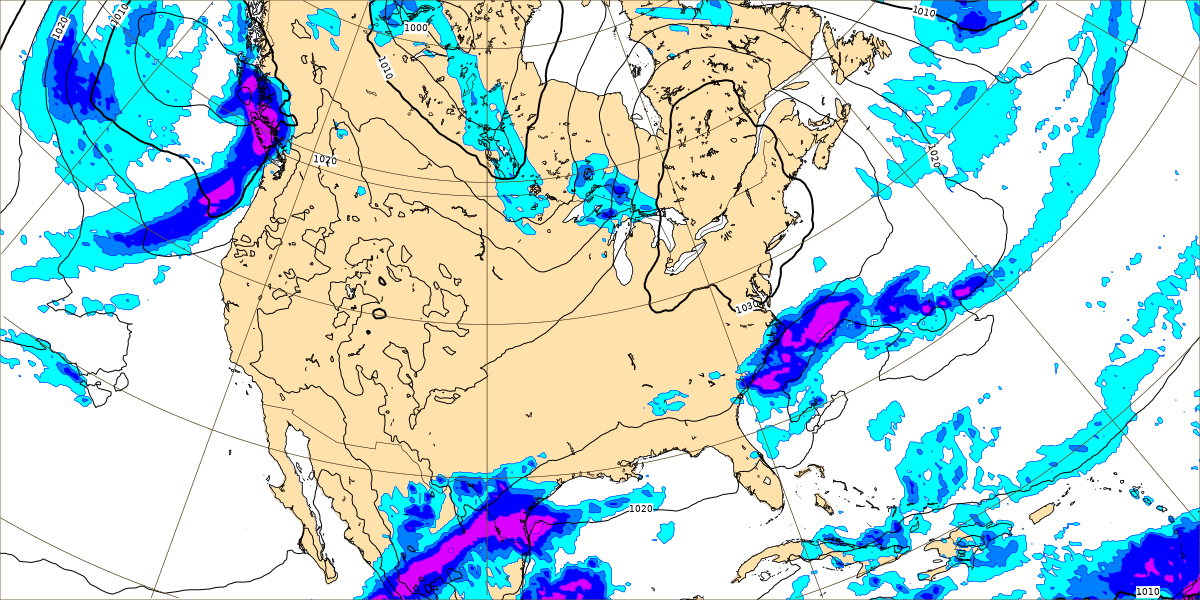
That front that brought us the rain late this week is now parked down in the Gulf of Mexico, moving very slowly when it does move. Sometimes I forget that a lot of readers may not know how to read weather maps, so this is what we call a stationary front. You can see on the radar and satellite imagery how clouds and some rain showers are spreading over our region even though the front has moved well to our South. And on the upper-air map, you can see that our winds are from the Southwest up at 500 millibars (about 18,000 feet). Meanwhile there is high pressure associated with dry weather parked over the Carolinas. And they are in the lower 50's today, you can see since I picked a map that has the official station observations on it. Those red numbers by each station are the temperatures. The green numbers underneath are the dewpoints. Around here you can see the dewpoints are very close to the actual temperature because the air is humid and we're having clouds and rain.
And if all that is obvious to you, that's fine, but we might have a variety of people stopping by here, including kids who want to learn about the weather or remember that their cousin writes a weather blog. And a lot of adults don't understand much meteorology either. My understanding is far below what I'd like for it to be some day, if I live a long life and can try studying it in school again. But I'm sharing some of what I do know.
The direction of the lines at each station show the direction of the wind, and those little notches on the end of those lines tell the wind speed in knots. Some day I guess I'll do a full lesson on that. If you have time to sit and study a weather map, it can be enjoyable. A lot goes into drawing them.
Last time I posted a forecast, I tried a 10-Day-Outlook, and IMHO, it was a big mess. This time I'm going to focus in on a 7 Day Forecast and get it as accurate as possible.


The GFS now shows us drying out tomorrow, which I think is reliable.

Especially since the NAM is on board with it.
Even the ECMWF at Noon tomorrow only shows a little bit of rain in the region. And as great a model as it is, I've seen it make mistakes.
Most of us tomorrow will probably just see a mix of sun and clouds, maybe slightly more clouds, and any rain showers should be really isolated. If I thought it was even a 20% chance of rain I'd include in the forecast above, but I think it's closer to a 10% chance, which means, don't even worry about it. Expecting a High near 64, Low of about 49. Following model output statistics. Those are being phased out in favor of National Blend of Models data, but the transition is sloppy so far, so I tend to use the older products that I'm used to until the newer format is better organized. Winds should be pretty light tomorrow, East/Northeast.


The computer models are in good agreement that we will stay dry on Monday. Skies should be partly to mostly sunny, and the High should get into upper 60's, Low in the lower 40's.


The GFS has finally gotten on board with the idea the ECMWF was advertising for days, of another system coming out the Gulf and bringing more rain chances. The timing has speeded up on both models though, with some rain possible as early as Tuesday. Actually wouldn't be out of the question to see something Monday night. I think during the day Tuesday, showers will be widely scattered, but then at night, rain becomes likely. Should have a High near 60, Low near 50.


Then as the system moves through on Wednesday, this latest run of the GFS shows less of a washout than previous forecasts have.

Even looking at the European model, I'd only want to increase the rain chance to 40% or maybe 50% for Wednesday. As this system moves through late Tuesday into Wednesday, we'll also have breezy conditions because of the tight pressure gradient between this system as it comes up against the Appalachian Mountains. Looks like a High in the 50's and Low in the 40's.


Then Thursday looks like a day of gradual clearing behind this next system. Probably a lot of clouds hanging around, at least early in the day, can't rule out an isolated shower early, but some gradual clearing as the day goes on, and High getting up into the lower 60's again, Low more toward the upper 40's.


Then on Friday we have a cold front dropping into the region, but it looks like we'll be on the southern dry end of it.

Here's a simpler look at it than the raw model data.
For any newcomers, the cold front is the blue line with the spikes on it. The spikes point in the direction it is moving, which is toward us. That L along the Oklahoma/Texas border is for low pressure, associated usually with rain. Though this front looks like a dry one as you go South. The H for the Carolinas is high pressure associated with dry weather, and usually cooler temperatures this time of year. Those red lines with the smoother bumps are warm fronts. A cold front is where cold air is overtaking warm air by lifting it up. And a warm front is where the warmer air is overtaking the colder air.
For Friday I'm thinking High temperature in lower 60's again, Low in lower 50's. Might be just enough moisture around to justify a 20% rain chance, but may take rain out of the forecast here after reviewing the pattern as a whole. Still expecting more clouds than sun overall.


No comments:
Post a Comment