

FORECAST:
Tonight (Low 29): Mostly cloudy. Cold and breezy.
Tomorrow (High 53): Partly sunny. Cold and breezy.
Friday (High 52, Low 40): Showers likely. Staying cold and breezy.
Saturday (High 65, Low 48): Partly cloudy. An isolated shower is still possible.
EXTENDED OUTLOOK:
Sunday (High 72, Low 51): Partly cloudy.
Monday (High 70, Low 55): Partly to mostly cloudy with a 40% chance of showers/thunderstorms.
Tuesday (High 69, Low 57): Mostly cloudy with a 50% chance of showers/thunderstorms.
NOTES:
This is Severe Weather Awareness Week in Tennessee. (Alabama had it earlier in the month, think they used to be coordinated.) Today's subject is tornadoes.
The National Weather Service in Birmingham is holding SKYWARN classes as get get into our primary tornado season. And the National Weather Service in Nashville is doing Weather Safety Basics classes.
Spring Break will be here soon for a lot of people, and if you are headed to the beach, it is a good time to review how to stay safe if you ever get caught in a rip current. It happened to a family I sort of know when they were visiting California; the mother and her daughter were able to get themselves out, and the father of the family needed a lifeguard to fetch him out of there. So it's one of those things you hope you never need, but you'll be glad to know it if you ever do need it.
At 12:30 PM, latest observations from Cullman show overcast skies and a temperature already down to 52 degrees. The dewpoint is 50 degrees, making the relative humidity 94%. Winds have shifted around to the North at 13 miles per hour, with higher gusts to 22 mph. The pressure is 30.04 inches and rising. Our High today was 70, which happened between about 9-10 AM. If we were going to count the overnight/morning temperature as the "Low", then we'd have 66 degrees. But today is a day the temperatures are going backwards. Our Low for the day remains to be seen. Give it another hour or two and we'll be down in the 40's already. Who knows exactly where we'll be before midnight, before this day is officially over. The wind advisory has been allowed to expire, but it is still pretty breezy, making it feel colder.
It is overcast and 54 degrees in Jasper. The dewpoint is 52, making the relative humidity 94%. Winds are from the North at 9 miles per hour, with higher gusts up to 20 mph. The pressure is 30.04 inches and rising.
At Haleyville, it is overcast and 49 degrees. The dewpoint is 44, making the relative humidity 83%. Winds are from the North at 14 mph, with higher gusts up to 17 mph. I know I forgot to mention the wind chill for other sites, but the wind chill in Haleyville is currently 44 degrees, so five degrees colder than the actual temperature. And that is quite a sudden change, to go from springlike warmth straight back to these winter-time temperatures. But it goes that way a lot of times as we get toward March. The pressure is 30.07 inches/1017.3 millibars and rising.
Still got some light rain in Fort Payne, 60 degrees, winds from Northwest at 20, gusting to 35 mph. And you can see the contrast at Gadsden, sunny skies and 72, south of the cold front, they have Southwest winds gusting up to 20 mph. Dccatur, where the front has already passed through, is overcast and 51 degrees, Northwest winds gusting up to 26 mph. Huntsville has light rain and 52 degrees, Northwest winds gusting to 25 mph. Muscle Shoals is overcast and 52 degrees, Northwest winds gusting up to 22 mph. Memphis is mostly cloudy and 50 degrees, Northwest winds gusting up to 29 there. Chattanooga has light rain and fog, which has brought the visibility down to 3 miles, temperature of 63 degrees, Northwest wind gusts up to 35 mph. And Nashville is mostly cloudy and 45 degrees, West winds gusting up to 25 mph there.
I made a mistake with today's forecast, by saying that the idea of severe thunderstorms was off the table. I had a rough few days, as someone I'm kin to by marriage had a stroke this past Sunday, and that situation really ate away at me, even though the person made it through surgery remarkably well. This blog may be an amateur effort, and on a volunteer basis, but when I put stuff out there, I like for it to be accurate. And I made a mistake by completely pooh-pooing the severe thunderstorm potential, and saying that we probably wouldn't even have thunder. Earlier, maybe last week or over the weekend, I actually got it right, at a longer time range, by saying that we did have a potential for isolated severe thunderstorms, but that this potential was low, and that not everybody would even see regular thunderstorms, some would just get rain.
I think it was yesterday that I made the mistake, by just checking other forecasts and forecast discussions and thinking I needed to revise what I'd said earlier. I went along with the general consensus. And I think the forecasts I read, that I played along with instead of double-checking things in detail for myself, were relying too heavily on data from the HRRR computer model. People seem to swear by this model, it's some kind of a fad, and one that I am not a fan of. The HRRR can be amazing sometimes, and pick up on things that other models don't for a really short-term forecast. (I think it is the model that picked up on the severe flooding in Waverly, Tennessee a few years ago, but I'd have to double-check that.) But it can also send people on a lot of wild-goose chases. And I've seen an awful lot of forecasts go wrong simply because people believed this computer model too much. During a lot of severe weather setups, it has tended to make things look a lot more threatening than they really turn out to be. And in this case, it rushed the cold air coming in beyond what was reasonable, keeping us too stable for anything but a cool rain. And that did not quite verify. The cold air did come in during the late morning, but we had enough time to have marginally unstable air and a weak squall line that did produce some wind damage.
I would have posted updates if my NOAA Weather Radio had gone off for the warning that included Cullman County, the storm that mainly was moving through Hartselle up in Morgan County. I don't think I could have slept through it. It was still tuned to the transmitter from Blount County from when the Cullman transmitter was offline, and I had forgotten that it was tuned to a channel that got weaker reception. Another factor, which may tickle some of your funny bones, is that my cat had swatted the antenna from its normal upright position to where it was lying flat on the desk; that probably messed up the reception more.
Still, even if I'm doing more of an armchair meteorology effort than a professional meteorology job, if I'm going to put information out there, I want it to be accurate. And I am not happy with how today's forecast was out of sync with how this low-end severe thunderstorm threat actually played out.


The Storm Prediction Center did extend a marginal risk for severe thunderstorms (the lowest 1 out of 5 threat level they can issue) with the morning update that included much of North Alabama.

Which I slept through, not thinking we were going to have enough unstable air to justify any such a risk. So this is a mistake to be learned from. I am really glad we did not have serious injury in our region.
There were also wind damage reports all the way up through Eastern Kentucky into West Virginia.

And they certainly had a stormy night last night. Numerous reports of wind damage and large hail up in the Ohio River Valley, and they had several tornadoes across Northern Illinois, Michigan, and Ohio.
Now to finally get around to forecasting our local weather.

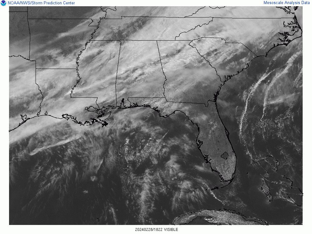


These maps are a little behind schedule, but you get the basic idea, the cold front has passed through the Tennessee Valley now.
The rest of today is going to be raw and breezy, with the temperature down to at least 50 but probably in the 40's for many of us.


Tomorrow high pressure will be moving through the Ohio Valley, and we will be dry again, but with a mix of sun and clouds. We will still be breezy, and winds will be from the North/Northeast, could easily get up to 10-15 mph at many points throughout the day. The High should get up to about 52-54 range, the Low tonight/tomorrow morning actually more like 28-30. Keep in mind that a good northerly breeze with these kinds of temperatures makes it feel even colder.


On Friday some of the moisture will come back northward and bring us some more rain. We'll still be breezy, but this is just cold rain showers, a High near 50 or so, the Low near 40.
And some of the rain could start in the early morning, even if it's still dark out.


The GFS is trending drier for Saturday still.

And the ECMWF has come into pretty good agreement with that.
So only going to keep a 20% chance of rain in there for Saturday, which means really isolated rain showers are possible. I certainly wouldn't cancel any weekend plans based on this. The widespread rain should be on Friday.


And Sunday is now looking so dry on both the American and European computer model that I'm going to take its rain chances out. We should be partly cloudy Sunday, High near 70, Low near 50 or so. And I almost forgot Saturday's temperatures, expecting a High in the 60's, probably lower 60's but maybe mid-60's, the Low for Saturday rebounding quickly to the upper 40's.


Monday we have the next cold front coming at us. Here is the faster GFS solution.


And the GFS shows that front sort of stalling out and running low on fuel on Tuesday.

Meanwhile the ECMWF, which often tends to be more reliable, doesn't have that front approaching us from the West until Tuesday. This graphic is valid at Noon (or 18Z).
So for Monday, going to adjust the forecast for a 40% chance of rain and thunderstorms, High near 70, Low in mid-50's.
And for Tuesday, increase the rain chance to 50%, same basic temperatures, about 69-70 for the High. With a situation like this, you remember why we have probabilities. This is 5-6 days out, and the situation is not clear-cut.


With this much uncertainty in the extended period, a 10-day outlook would be a worthless effort. So I'm not going to bother trying to look beyond Wednesday this time.
We always have to watch things this time of year, as March and April are our two worst months for severe weather just in terms of statistics and climatology. But as of right now, nothing jumps out in the model guidance that makes severe weather appear likely next week. And there are no outlooks from the Storm Prediction Center showing anything like that. They even mention the predictability being low with this setup.

Rainfall totals will probably average up to about an inch for Southern Tennessee and also in Northwest Alabama around the Shoals. For the rest of North Alabama, totals will probably be closer to two inches. This disturbance on Friday is coming from the southern stream. So Alabama is likely to get more rain than Tennessee.
If you want absolute certainty, you should probably follow Dr. Phil McGraw. The only thing that really irked me about his conversation with The View a day or two ago was the part where he said, "That's not an opinion, that's a fact." Though Rick and Bubba certainly enjoyed that "mic drop" moment. They are retiring, as I'm sure you've heard, so if you are already starting to feel old, you can add that to the list of why.
The last time someone made a similar statement to me, that emphatically, was when a guy in the household encouraged me to come out and look at where lightning had just struck nearby. I gave in when he said, "Come on, you're a weatherman!" And I looked through the binoculars out there before coming back inside. I thought he and my uncle (not the one who just had a stroke, I wouldn't trash-talk him at such a time) were being really goofy by gawking and acting like it just made their day.
Later that day I told my grandmother (deceased), with a laugh, that I had been acting like an idiot by joining the other two gawkers. And her partner (not sure if he is still around, but he ran me out of that living situation before running off more than one of their hospice nurses, from what I recall being told, was a real jerk most of the time) managed to hear it even though he had headphones on. He took them off and asked me to repeat it. And told me, "You were not acting like an idiot. You were perfectly safe." I said, "Not so." He said, "I'm sorry, but I'm older and have had more experience . . ." And I said, "I've had storm spotter training . . ." And then he really started going off. Perhaps I could have been nicer about it, but I've seen too much stupid behavior over the years with regard to simple things about storms, and had even back then. Almost all meteorologists are very careful about lightning. And I'd worked with guys at a steel plant who would dance around at the door to outside and giggle when we got a close cloud-to-ground lightning strike. So to hear an intelligent man saying that there was no risk to standing out there gawking with binoculars after a close strike . . . really pushed my buttons that day. I was a few years younger and thought I was taking a necessary stand for the truth. And it sent him into a conniption fit. He started ranting about how I was just like all the other relatives who had tried to tell him he didn't know what he was talking about. I wasn't able to argue with him, because this sparked an argument between him and my grandmother. Unfortunately I was always good at starting such arguments.
These days I try to douse them a little, because I feel like people just argue excessively and are ready to go to war nearly before they even know what they are fighting for. And people have become a lot more easily offended.
But at some point, I just sighed and told this guy, "Well . . . you've got a right to your opinion." And he said, "No, that's not an opinion, that's a FACT!!"
So I find it aggravating when people fail to distinguish between a fact and an opinion. Most of us were supposed to learn that in regular school, elementary school. But we forget a lot of what they tried to teach us in those early years. Sometimes it can be good to remember.
I wasn't offended by the rest of what Dr. Phil said. For one thing, he's always thrived on controversy. My great-grandmother used to call him "that ole' buzzard" and turn him off. She didn't like his attitude or how they had to bleep him out so much. She was sort of known for cussing herself, but she tried to keep it within reasonable limits and was not a fan of what she called "gutter talk." Let's just say that out of the seven words George Carlin put into his classic comedy routine, she would have had a problem with at least four of them, didn't even say them when she was very angry. She was the weather lady in our family. Anyway, I don't like for anything to go unchallenged. And not all of the precautions that were taken against COVID did turn out to be necessary. I don't agree with Phil or the gals on The View completely. I do think there were overreactions to the virus at times. But what I saw a lot more of, my own personal experience, was people going overboard in blowing the threat off. A woman in my neighborhood came over and left a bag of food hanging on my door while still infected, and bragged about her ex-husband going to the store for her and refusing to wear any kind of facial covering while doing that. And I could give many other examples that were basically equivalent to standing outside and daring lightning to strike you. If people have to go the extreme one way or the other, I'd rather them try to look out for each other and make sure everybody's going to be okay.
Maybe the best take I heard on it over the past few years was from Troy Kimmel, a meteorologist who said in his Texas accent, "They don't know what the hell to do! That's why people say all this `social distancing' and everything . . . really nobody knows what the hell to do."
And I think that's the truth. We were all in a situation that was very, very hard to evaluate.
And sometimes the weather is like that. Not going to speak for any other forecasters, but for myself, I think I should have stuck with mentioning a low-end chance for severe thunderstorms today, instead of the devil-may-care attitude I ended up actually posting yesterday. It was kind of an odd situation, one of those reminders not to get overconfident or careless.


No comments:
Post a Comment