


.jpeg)
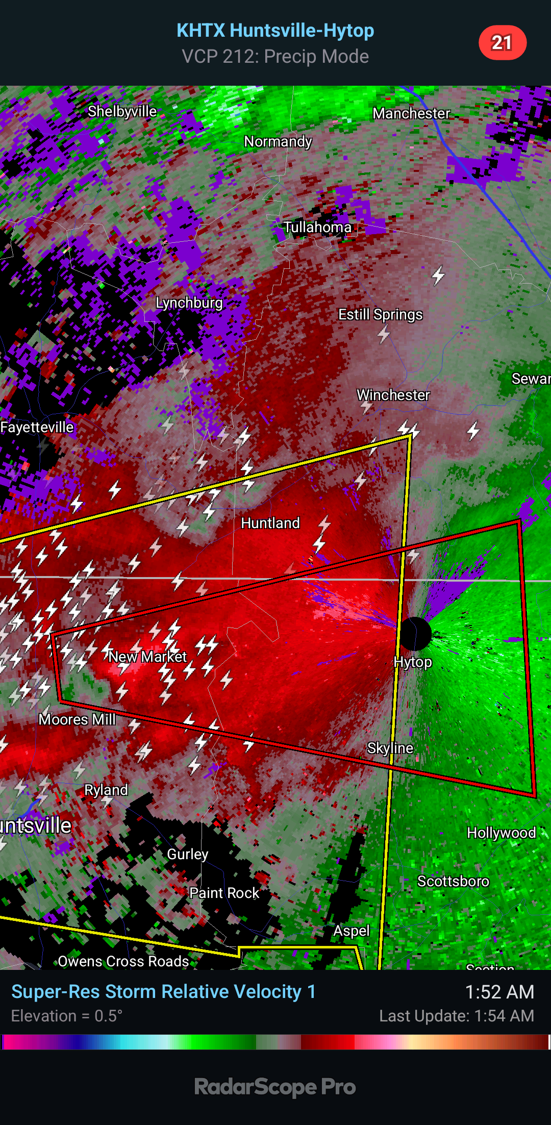
2:03 AM - This storm is currently near New Market.

And will mostly stay over rural areas within this warning polygon. But people still live in these small towns or near them. Anywhere in this polygon, I would stay in your tornado shelter until this warning expires or you are sure the storms have passed you.

2:08 AM - Here is the wide view. We have numerous severe thunderstorm warnings in effect.
The worst one looks like in Wayne and Lawrence County right now. But of course one includes Huntsville. One includes the Shoals. One includes Decatur.
Actually we have two overlapping that include Decatur. So I'll just post an updated radar image.

In any of these polygons, wouldn't be a bad idea to go to a safe place. Certainly take cover if in this Tornado Warning.

2:16 - And now Madison County has been cleared, though they are still under a Severe Thunderstorm Warning. Tornado Warning continues for these parts of Northern Jackson County, mainly around Hytop. Which is where the radar is you're seeing, radar tower is there.

2:22 - From Hartselle to Decatur to Huntsville, damaging wind gusts and severe hail are possible.
Also in Franklin, Colbert, and Lauderdale Counties up into Wayne and Lawrence Counties in Tennessee, stay in a safe place from damaging winds and maybe some large hail.
That storm in Wayne and Lawrence Counties is no longer showing signs of rotation like it was earlier.
2:25 - The tornado warning has been cancelled. We have several severe thunderstorm warnings left, but no tornado warnings at the moment.
781
WFUS54 KHUN 270651
TORHUN
ALC071-089-TNC051-270730-
/O.NEW.KHUN.TO.W.0036.240527T0651Z-240527T0730Z/
BULLETIN - EAS ACTIVATION REQUESTED
Tornado Warning
National Weather Service Huntsville AL
151 AM CDT Mon May 27 2024
The National Weather Service in Huntsville Alabama has issued a
* Tornado Warning for...
Northwestern Jackson County in northeastern Alabama...
Northeastern Madison County in north central Alabama...
South central Franklin County in Middle Tennessee...
* Until 230 AM CDT.
* At 150 AM CDT, a severe thunderstorm capable of producing a tornado
was located over Moores Mill, moving east at 45 mph.
HAZARD...Tornado.
SOURCE...Radar indicated rotation.
IMPACT...Flying debris will be dangerous to those caught without
shelter. Mobile homes will be damaged or destroyed.
Damage to roofs, windows, and vehicles will occur. Tree
damage is likely.
* This dangerous storm will be near...
New Market around 155 AM CDT.
Other locations impacted by this tornadic thunderstorm include
Estillfork, Francisco, Hytop, Princeton, Jericho, and Larkin.
PRECAUTIONARY/PREPAREDNESS ACTIONS...
TAKE COVER NOW! Move to a basement or an interior room on the lowest
floor of a sturdy building. Avoid windows. If you are outdoors, in a
mobile home, or in a vehicle, move to the closest substantial shelter
and protect yourself from flying debris.
&&
LAT...LON 3486 8654 3493 8655 3505 8595 3476 8593
TIME...MOT...LOC 0650Z 258DEG 37KT 3489 8650
TORNADO...RADAR INDICATED
MAX HAIL SIZE...<.75 IN
$$
HC


No comments:
Post a Comment